
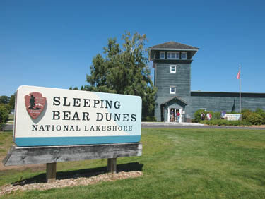
Sleeping Bear Dunes National Lakeshore

Trail Details
Established in 1970, the 72,000-acre park stretches between Frankfort and Leland and includes 35 miles of shoreline on the mainland, two remote islands in Lake Michigan and the largest dunes in Michigan. It is one of Michigan’s best-known destinations, an area that attracts almost 1.2 million visitors a year who come to play in the dunes; to hike, ski, camp, run wildly down the Dune Climb or simply sit on top of a dune and absorb the pastel blues of Lake Michigan.
First surveyed for National Park status in 1958, Sleeping Bear Dunes was pieced together in the 1970s resulting in a bitter controversy. Individuals were forced to sell their property, almost 51,000 acres, to the federal government. In many cases farms and summer homes had been in a family for generations, the reason resentment towards the National Park Service still lingers in the area. But few people who visit the national lakeshore today would argue that its outstanding natural features or its cultural ones, including an 1871 lighthouse, are not worth saving from the development that has ravaged much of the Lake Michigan shoreline.
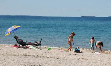
Sleeping Bear Dunes is a long and narrow park, only six miles at its widest point with most of it lying in Leelanau County. The park was created primarily to preserve the fragile dunes along the shoreline but it is still wide enough to contain beech/maple forests as well as meadows of abandoned farm fields, wetlands, cedar swamps, streams and bogs. There are also 26 lakes in the park, which on most of them the use of motorized boats have been banned to preserve the water quality.
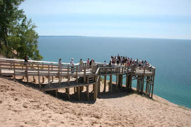
The most noted features of the park, however, are its dunes, high bluffs and dune plateaus. Towering Perched dunes are found on headlands bordering Lake Michigan such as Empire Bluffs, Sleeping Bear Bluffs, Pyramid Point and South Manitou Island. The Sleeping Bear Plateau is a 4 square-mile field of perched dunes, crowned by Sleeping Bear Dune, the highest perched dune in the state rising to more than 440 feet above Lake Michigan.
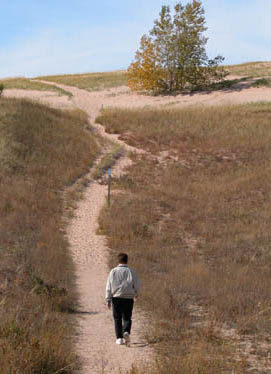
Thanks to the high vistas and open country created by the dunes, the national lakeshore offers the best day hiking south of the Mackinac Bridge through scenery that rivals anything you see north of the bridge. Mixed in with all those fine hikes are a handful of backpacking opportunities, including two island adventures and a beach walk along an undeveloped stretch of Lake Michigan.
The park maintains a dozen trails that total 60 miles on the mainland and extensive trail systems on South and North Manitou Islands. Due to the fragile nature of the dunes, mountain biking is prohibited for the park’s trail system. Backpackers can enjoy easy overnight outings on Platte Plains or Valley View Trails that feature walk-in campsites or an unusual, 36-mile beach hike from near Point Betsie to almost Glen Arbor. For the most remote and wilderness-like adventure, however, backpackers jump on a ferry in Leland and head to North Manitou Island, a wild place without cars or any development other than a ranger station and a campground.
| Camping |
| Difficulty - Easy |
| Difficulty - Challenging |
| Difficulty - Moderate |
| Foot Path |
| Multi-use Trail |
| Paved Trail |
Geo-referenced maps from MichiganTrailMaps.com range from $1.99 to $2.99 each.
Download the Avenza app from the App Store or Google Play


