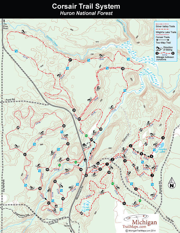
Corsair Trails
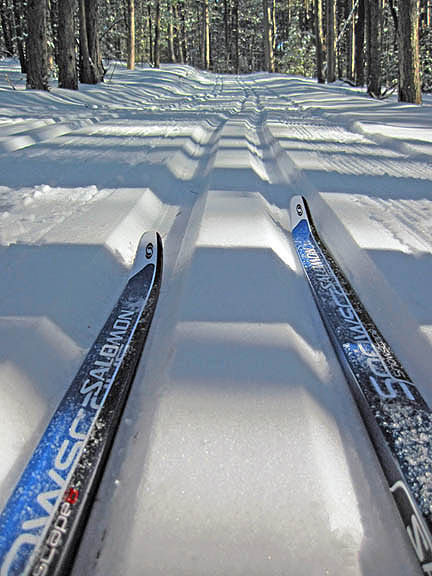
The most popular trails are the original ones, Corsair, now an 8-mile system on the west side of Monument Road. With Silver Creek bisecting the interior, Corsair is also a scenic trail system that is rated intermediate in difficulty and double-tracked for classic skiing.
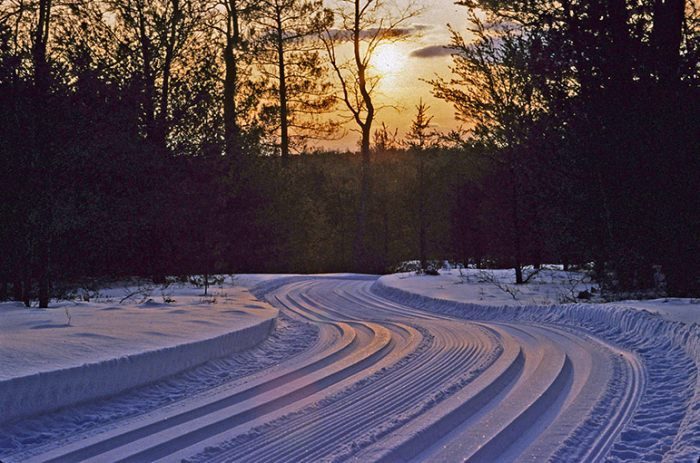
The beauty of the Corsair section are the rolling red and jack pine forests that the trails wind through. The layout were designed as one third uphill, one third level, one third downhill to create a physical balance between exertion and rest. Thus the numerous hills make for almost perfect skiing, when at times it's possible achieve that "perpetual motion." In the world of Nordic skiing, effortless striding is as close to the state of Zen some of us will ever get.
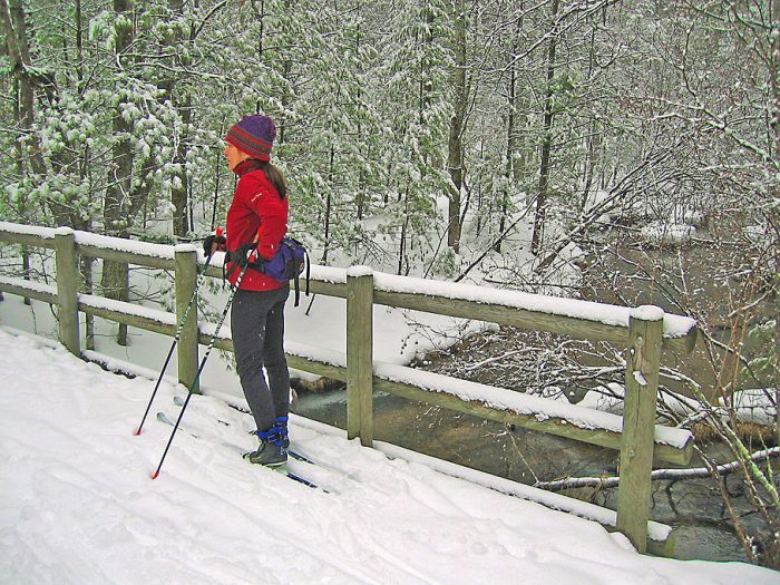
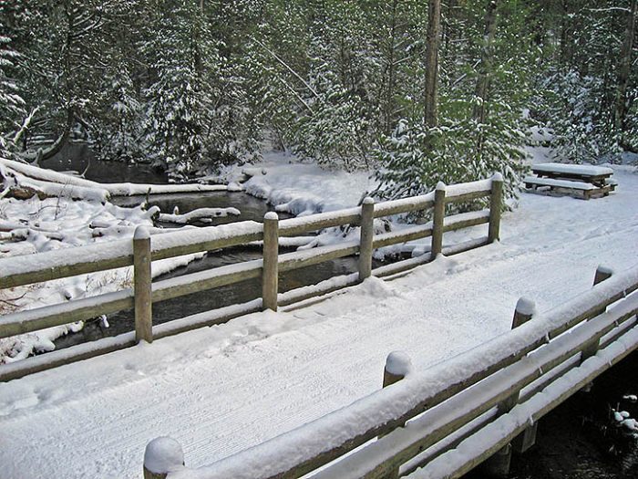
A popular tour is a 5-mile loop that begins from the trailhead by crossing Silver Creek and skiing the gently rolling trail through large pines to post No. 14 and No. 15 and onto post No. 17 reached after a long downhill. You then cross Silver Creek again on log bridge between post No. 17 and No. 18. This is perhaps the most picturesque spot in the entire combined trail system. Silver Creek flows under a canopy of white cedar trees as it gurgles and swirls around snow-covered ice and encrusted fallen trees.
A few notable downhill runs will provide some high speed thrills on the Corsair trail. You climb to post No. 18, reached at Mile 1.4, with more rolling forested terrain encounter to post No. 21. The far outer loop, the 2.2-mile segment from post No. 21 to No. 22, is the only one rated Most Difficult. The black diamond rating is for several downhill runs but all are straight and well-marked. The final downhill is the most exciting run, a straight drop that plummets into a narrow valley and swoops right back up the opposite side to post No. 22, reached at Mile 4.4.
The easy skiing resumes with rolling, wooded terrain through post No. 23 to post No. 20, where you can quickly return to the trailhead parking lot or extend your outing by venturing across Monument Road to the Silver Valley Trails.
Silver Valley
On the east side of Monument Road is Silver Valley, a 9.7-mile, three-loop system designed for beginner skiers and double-tracked for classic skiing. Opened in 1986, this is the newest segment of Corsair Trails but it’s parking lot lies next to the former Silver Valley Winter Sports Park, where some of the earliest skiing in Michigan took place. Buried in the Silver Valley is Frank Eaton, a Civil War veteran in the Michigan Calvary under General George Armstrong Custer and a son-in-law of the Coursers, who homesteaded at the Corsair trailhead in 1860-70s. Eaton’s military tombstone sits on top of a ridge 250 yards from post No. 25.
Bordered by Silver Creek to the east and Gordon Creek to the north, Silver Valley trails meander through a gently rolling, pine forests, offering the easy terrain for beginners, older skiers or those who looking enjoy long peaceful strides and carefree skiing.
The outside perimeter of the system is a 6.1-mile outing that includes a very scenic stretch along the banks of Silver Creek between posts No. 24, No. 25 and No. 26, reached at Mile 1.2. More elevation with climbs and downhill runs is encountered just before post No. 26 and No. 27 but the effort is rewarded with views of Gordan Creek valley below.
Half of the loop is the 3-mile segment between posts No. 27 and No. 28, reached at Mile 5.7. The final leg to the trailhead is a mostly an easy downhill run of less than half mile.
Wright's Lake
Accessed from a trailhead along Tuttle Road is Wright's Lake, an 8.2-mile system with a 6-mile outer loop that winds around two lakes. Groomed with a single track and a skating lane, these trails are laid out in a hilly hardwood forest and are the most lightly used section, due to the area’s most challenging runs and the steepest hills.
The exception is the 1.5-mile inner loop that follows posts No. 10, No. 11, N0. 8 and No. 9 and is rated easy to intermediate. The first mile is essentially level terrain while the last half mile features a succession of long continuous stair-casing downhill runs that cascade back to the trailhead. If you seek black diamond downhill exhilaration, you will find it in the extreme northeast corner, the segments between posts No. 4 and No. 5 and between posts No. 7 and No. 5 and the Lost Lake section on the southern edge of the trail system
The small inland lakes are scenic but because of direction of travel, you have to ski the system in a figure 8 pattern to include both of them. From post No. 1 at the trailhead you can ski to post No. 10 and then around Lost Lake to post No. 11, reached at Mile 2. This is a scenic section rated Most Difficult because it meanders into the ridges that surround the small lake. From post No. 11 you cross Tuttle Road and then continue on to post No. 8, No. 9 and No. 2, reached at Mile 3, to begin the upper half of the figure 8. More elevation is encountered between post No. 3 and No. 4 including a long, fast downhill occasionally referred to as Powerline Hill. You bottom out to a quick right turn and then ski rolling terrain through post No. 4 and past Wright’s Lake to post No. 6.
The outer loop continues to post No. 7 and post No. 8, reached at Mile 5.4, where you backtrack an earlier segment to post No. 9 and No. 2. Here you head left to cross Tuttle Road and quickly reach the trailhead.