Headlands International Dark Sky Park
Buy the $.99 downloadable map!
(This map is not geo-referenced)Trail Details

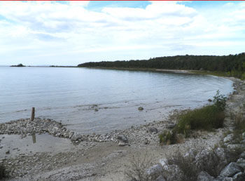
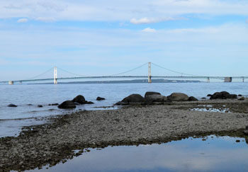

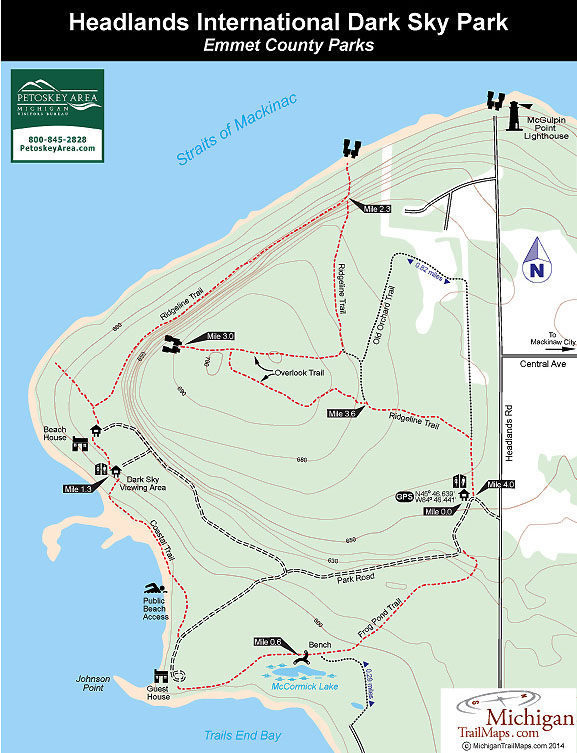
The largest forested tract in the vicinity of Mackinaw City is The Headlands, an Emmet County park that spans over 600 acres and features 2 miles of shoreline on Cecil Bay and the Straits of Mackinac. This unique park includes 4.3 miles trail, two rental houses, outstanding views of the Mackinac Bridge and an interesting history.
The park is the former vacation retreat of the McCormick family, who amassed its fortune by inventing the reaping machine in the 1800s and then creating International Harvester. Roger McCormick established the area in the late 1950s when he hired a helicopter and dropped 50lb. sacks of flour to mark the boundaries of the property he wanted to purchase.
The Headlands remained in the hands of the Chicago industrialist until his death in 1968, when the property was assumed by the McCormick Foundation. In 1966 the Little Traverse Conservancy assisted Emmet County to acquire the tract with the help of a Michigan Natural Resources Trust Fund. County officials then turned the two McCormick vacation homes, including the impressive Beach House designed by Chicago architect Roy Binkley, into rentals and the maze of two-tracks on the property into a trail system.
In 2011, The Headlands was designated an International Dark Sky Park, only the sixth such park in the United States and the ninth in the world. Since then the county has established a 24-hour parking area, trail and stretch of lakeshore for dark sky viewing and monthly programs at the Beach House with a local night-sky expert. Shipwreck enthusiasts will also find The Headlands interesting as several vessels lie just off shore.
The woodlands and undeveloped shoreline are home to 20 species of wildflowers a variety of plants, including endangered Dwarf Lake Iris and the threatened Pitcher’s Thistle. Wildlife that can be spotted includes bald eagles, osprey, white tail deer, wild turkeys, coyotes and occasionally even a black bear.
The two-track trails are short and make the Headlands an easy hike, off-road bike ride or Nordic ski outing that is ideal for families. A number of loops are possible but the entire perimeter of the trail system is only 3.5 miles. What is described below is a 4-mile loop that includes the most interesting and scenic sections of the park.
| Difficulty - Easy |
| Dog Friendly |
| Multi-use Trail |
Geo-referenced maps from MichiganTrailMaps.com range from $1.99 to $2.99 each.
Download the Avenza app from the App Store or Google Play


