320

Trails Reviewed

Find Trails & Maps

Search for Trail
Search by Location
Search by

Back to listing

Isle Royale NP: Greenstone Ridge Trail-Map 5


Buy the Geo-referenced map
for use in the Avenza Maps App

Trail Details

County
Houghton
Regions
Western Upper Peninsula
Latitude
N 48° 00' 5.76"
Longitude
W 088° 54' 0.00"
Distance
8.1 miles
Trail Type
Foot path
Terrain
Greenstone Ridge
Difficulty
Moderate to challenging
Nearest City or Town
Houghton
(map loads here)
view map
Avenza Maps
Geo-referenced maps from MichiganTrailMaps.com are available through Avenza Maps and range from $1.99 to $2.99 each.

Download the Avenza app from the App Store or Google Play

App Store Google Play

The trek from Hatchet Lake to South Lake DeSor via the Greenstone Ridge Trail is a 8.1-mile day that in the first half offer a bit of climbing and some fine views of of Siskiwit Lake, Malone Bay, even deep into Siskiwit Bay. At the halfway point you reach Ishpeming Point (1377 feet), the second highest point on Isle Royale.
Expand All
Photos
Description
The trek from Hatchet Lake to South Lake DeSor via the Greenstone Ridge Trail is a 8.1-mile day that in the first half offer a bit of climbing and some fine views of of Siskiwit Lake, Malone Bay, even deep into Siskiwit Bay. At the halfway point you reach Ishpeming Point (1377 feet), the second highest point on Isle Royale.

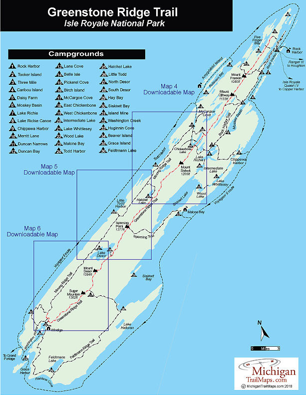
The climb is an easy one to the point marked by a lookout tower, the lowest one on the Island by far. Now used for research by the park staff, the tower was built when Ishpeming Point was bald but now the surrounding trees are taller than the structure so there is no view whatsoever. The Point is also the junction to Malone Bay with Ishpeming Trail departing south and reaching the campground in 7 miles.

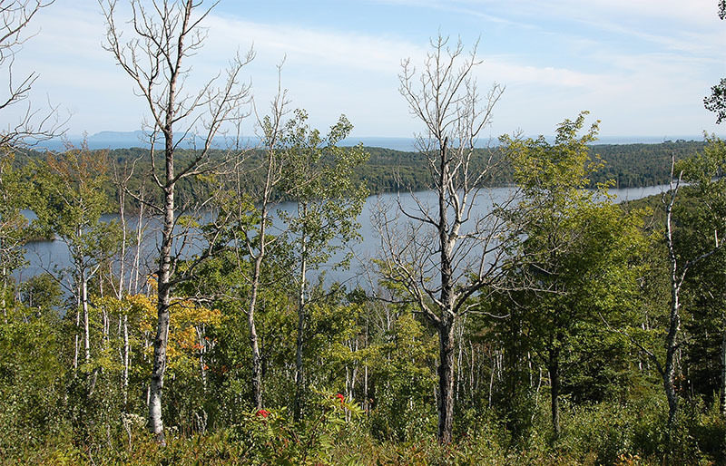
The next segment to Lake Desor is completely different from the trek from Hatchet Lake. The 3.8-mile walk to Lake Desor is shorter and has less up-and-down hiking but provides few views except for the trees next to the path.

 
Amenities & Services
Camping
Difficulty - Moderate
Foot Path
Trail Guide

The Greenstone Ridge Trail is covered in detailed with maps in Isle Royale National Park: Foot Trails & Water Routes by Jim DuFresne. To order the 192-page guide to the Greenstone Ridge Trail and the rest of the wilderness island, Click Here.

Facilities

This stretch of the Greenstone Ridge Trail connects two campgrounds; Hatchet Lake and South Lake Desor, and provides access to Malone Bay Campground via the Ishpeming Trail.  South Lake Desor Campground is a favorite among backpackers. The individual and group campsites are located in a stand of birch and often there is a little breeze to keep the bugs at bay. Near the first group site is a small sandy cove where campers occasionally take a dip or in the evening watch the sunset while listening to the resident loons. Like Hatchet Lake, Desor supposedly has brook trout in it, but it is not heavily fished.

Shower tokens, a clean towel, and a bar of soap can be purchased at the camp store at Rock Harbor or Windigo. Some backpackers like to book a room for their final night at Rock Harbor, either at the lodge or in one of the housekeeping units that can be shared by six people and feature small kitchenettes. For reservations, contact the park concessionaire, Forever Resorts (866-644-2003 or 906-337-4993 in summer; www.isleroyaleresort.com).

Hours & Fees

Isle Royale National Park opens April 16 and closes on Nov. 1 to all visitors for the winter.  The park has an entrance fee of $7 per person per day or an annual pass for $60. You can pay the entrance fee once you arrive at the park or in advance at pay.gov  and avoid congestion and long waits on the island. All park visitors who plan to camp overnight at campgrounds or cross-country sites are required to obtain a camping permit. This permit can be obtained free of charge at the visitor center at Windigo or Rock Harbor when you arrive or onboard Ranger III on the way to the Island.

Directions

To return to Rock Harbor from Windigo after hiking the Greenstone Ridge Trail many backpackers book passage on the Voyageur II. After arriving at Windigo from Minnesota, the ferry circumnavigates the island clockwise and overnights at Rock Harbor Lodge. The following day, it continues with possible stops at Daisy Farm, Chippewa Harbor Campground, Malone Bay Campground, and Windigo before returning to Grand Portage. The trip not only gets you back to Rock Harbor but provides a view of Isle Royale not seen from the crest of the Greenstone Ridge.

Information

For more information on the Voyageur II contact the Grand Portage – Isle Royale Transportation Line (651-653-5872, 888-746-2305; www.isleroyaleboats.com).


Geo-referenced maps from MichiganTrailMaps.com range from $1.99 to $2.99 each.

Download the Avenza app from the App Store or Google Play

App Store Google Play

Michigan TrailMaps.com Michigan's Premier Trail Resource Contact

Trail Mix News

by travel and outdoor writer Jim DuFresne!

Sign Up
Enews Signup
Find a Trail

Find Trails & Maps

Search for Trail
Search by Location
Search by