
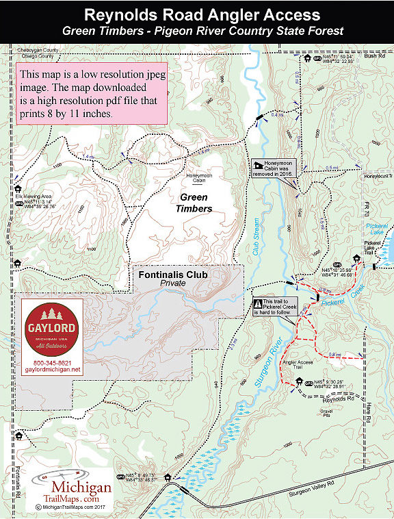
Pigeon River Country SF Green Timbers: Reynolds Road Angler Access
Buy the $.99 downloadable map!
(This map is not geo-referenced)Trail Details

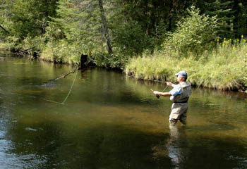
The Reynolds Road Anglers Access, however, is the easiest way to reach a portion of this Blue Ribbon trout stream within this otherwise non-motorized tract. Except for Reynolds Road, no two-track in Green Timbers is open to vehicles.
| Difficulty - Easy |
| Foot Path |
Geo-referenced maps from MichiganTrailMaps.com range from $1.99 to $2.99 each.
Download the Avenza app from the App Store or Google Play


