Trout Lake Pathway
Buy the $.99 downloadable map!
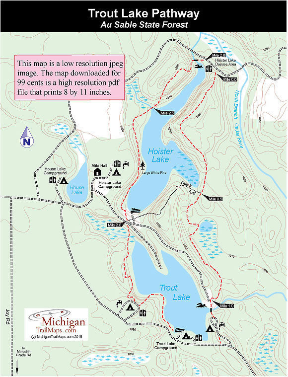
(This map is not geo-referenced)Trail Details


Back in the mid-1980s, Trout Lake Pathway was a war zone. At the time, Michigan was struggling with the explosion of rampant, unregulated off-road vehicle use. ORVers were using this remote recreational area in the northwest corner of Gladwin County and had tore up its sandy slopes, widened the trails into race tracks and were four-wheeling it through delicate cedar swamps and streams.
Beginning in 1987, DNR conservation officers staged a campaign to clean-up the area and crack down on the illegal off-road use. Today the woods are quiet and the land is healing. Left behind are reminders of what it took to win this war — huge cement barriers placed where ORVers were entering Trout Lake, dirt beams blocking the entrance of old two-tracks, rows of wood posts to prevent anything with a motor from using the trails.
The pathway lies in the heart of the Gladwin Field Trial Area, a historic 5,040-acre track within the Au Sable State Forest. The area dates back to 1916 when tax-reverted lands were used to establish “a public grouse field trial area” for hunters and their dogs. By the 1940s the tract was known nationally as the preeminent grouse field trial area and began hosting the Grand National Championships on a rotating basis with New York and Pennsylvania. Today it hosts the national championships every other year.
Because of its legacy with hunting dogs, the Gladwin Field Trial Area has special regulations that include a ban on ORVs and dirt bikes as well as horseback riding and mountain biking. Dispersed camping is not allowed, campers have to stay in one of the three state forest campgrounds: House Lake, Trout Lake and Hoister Lake.
For hikers and campers what has emerged is a quiet area that is the perfect destination for a quick, mid-summer getaway. Trout Lake is only a two-hour drive form Southeast Michigan and half that time for campers looking to escape the heat in Bay City, Saginaw and Midland. Trout Lake Campground alone has 34 rustic sites well spread out along three loops including a handful perched right above the shoreline with a great view of the water. Nearby is a good swimming beach featuring a killer rope swing. All three lakes provide entertaining angling for bluegills and panfish.
And if you want to get away from the handful of others in the campgrounds? Just hit the trail.
| Camping |
| Difficulty - Easy |
| Dog Friendly |
| Multi-use Trail |
Geo-referenced maps from MichiganTrailMaps.com range from $1.99 to $2.99 each.
Download the Avenza app from the App Store or Google Play


