3582 State Park Dr.
Bay City, MI 48706-1356 US
Phone: (989) 667-0717
Region: Lake Huron (Includes the Thumb)
More Info
3582 State Park Drive
Bay City, MI 48706 US
Phone: (989) 667-0717
Region: Lake Huron (Includes the Thumb)
More Info
3582 State Park Drive
Bay City, MI 48706 US
Phone: (989) 667-0717
Region: Lake Huron (Includes the Thumb)
More Info
S. Parker Rd
Ann Arbor, MI 48103 US
Phone: (734) 971-6337
Region: Southeast
Website
More Info
Vienna Corners
Gaylord, MI 49735 US
Phone: (989) 732-3541
Region: Northwest
More Info
1330 E. Greenshield Road
Lake Orion, MI 48360 US
Phone: (248) 693-6767
Region: Southeast
Website
More Info
1330 E. Greenshield Road
Lake Orion, MI 48360 US
Phone: (248) 693-6767
Region: Southeast
Website
More Info
1330 E. Greenshield Road
Lake Orion, MI 48360 US
Phone: (248) 693-6767
Region: Southeast
Website
More Info
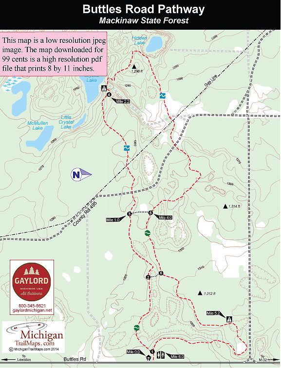
Buttles Road
Lewiston, MI 49756 US
Phone: (989) 732-3541
Region: Lake Huron (Includes the Thumb)
More Info
6360 Chilson Road
Howell, MI 48843 US
Phone: (810) 229-6566
Region: Southeast
Website
More Info
6360 Chilson Road
Howell, MI 48843 US
Phone: (810) 229-6566
Region: Southeast
Website
More Info
6360 Chilson Road
Howell, MI 48843 US
Phone: (810) 229-6566
Region: Southeast
Website
More Info
600 Birchwood Drive
Harbor Springs, MI 49740 US
Phone: (231) 348-2755
Region: Northwest
More Info
Standish Avenue
Petoskey, MI 49770 US
Phone: (231) 347-2500
Region: Northwest
Website
More Info
850 West Osterhout Rd
Portage, MI US
Phone: (269) 329-4522
Region: Heartland
Website
More Info
3351 Mundy Rd
White Lake, MI 49349 US
Phone: (231) 652-9298
Region: Heartland
Website
More Info
Ranch Rudolf Road
Traverse City, MI US
Phone: (231) 941-0960
Region: Northwest
Website
More Info
10th Street & Main Street
Frankfort, MI US
Phone: (800) 882-5801
Region: Northwest
Website
More Info
Industrial Park Drive
Grayling, MI 49738 US
Phone: (800) 937-8837
Region: Northwest
Website
More Info
Grand Lake Road
Alpena, MI US
Region: Lake Huron (Includes the Thumb)
More Info
List of Trails
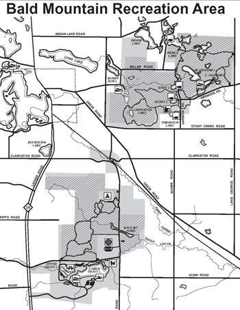
Bald Mountain Recreation Area
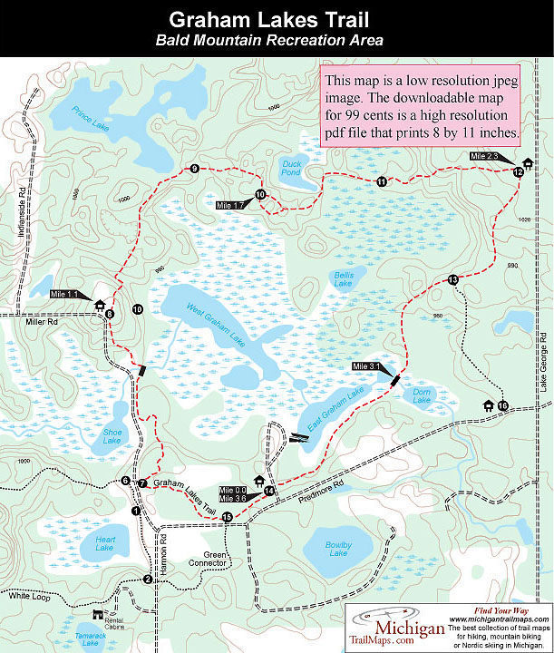
Bald Mountain: Graham Lakes Trail (Orange Loop)
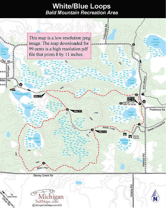
Bald Mountain: White/Blue Loops
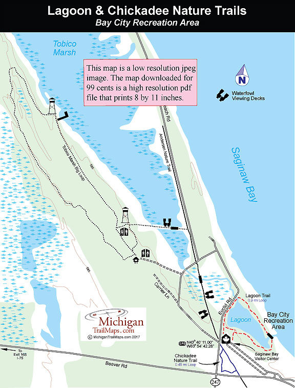
Bay City SP: Lagoon Trail & Chickadee Nature Trail
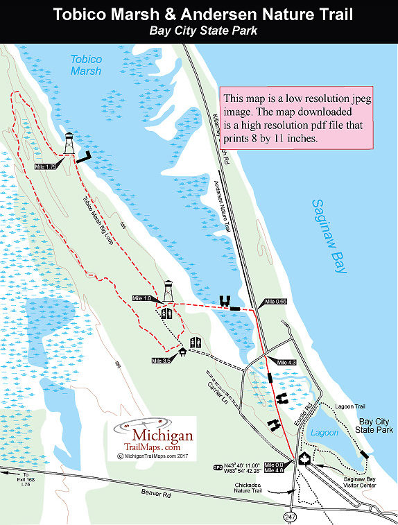
Bay City SP: Tobico Marsh & Frank N. Andersen Nature Trail
Bay City State Park
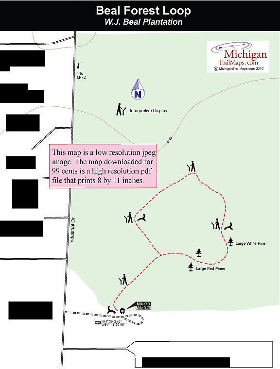
Beal Tree Plantation
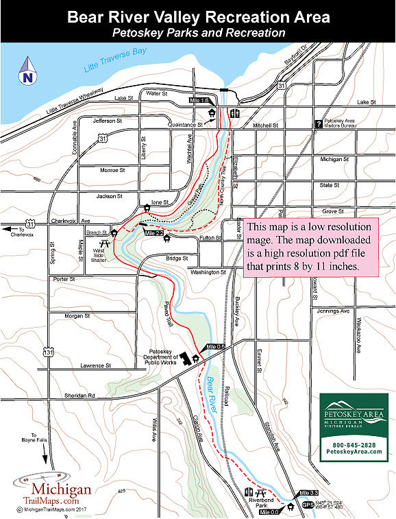
Bear River Valley Recreation Area
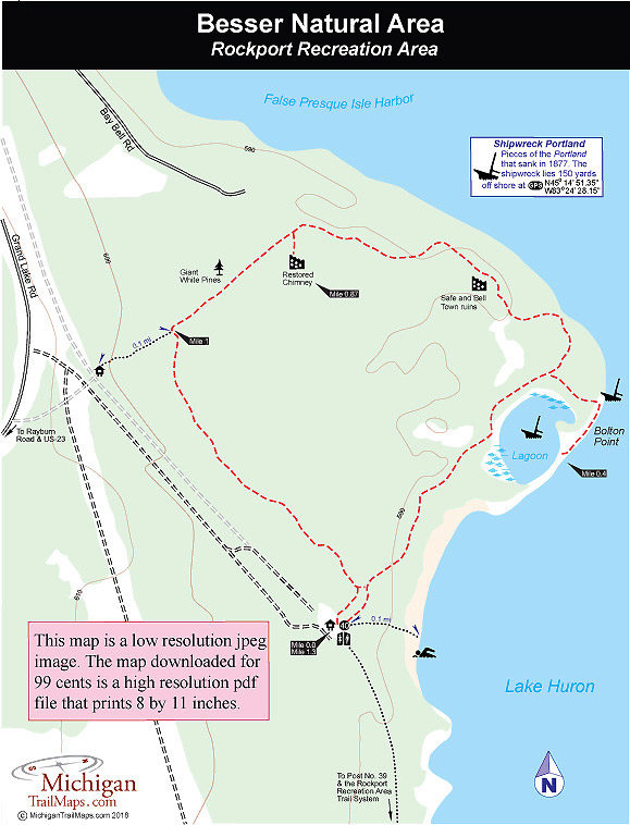
Besser Natural Area
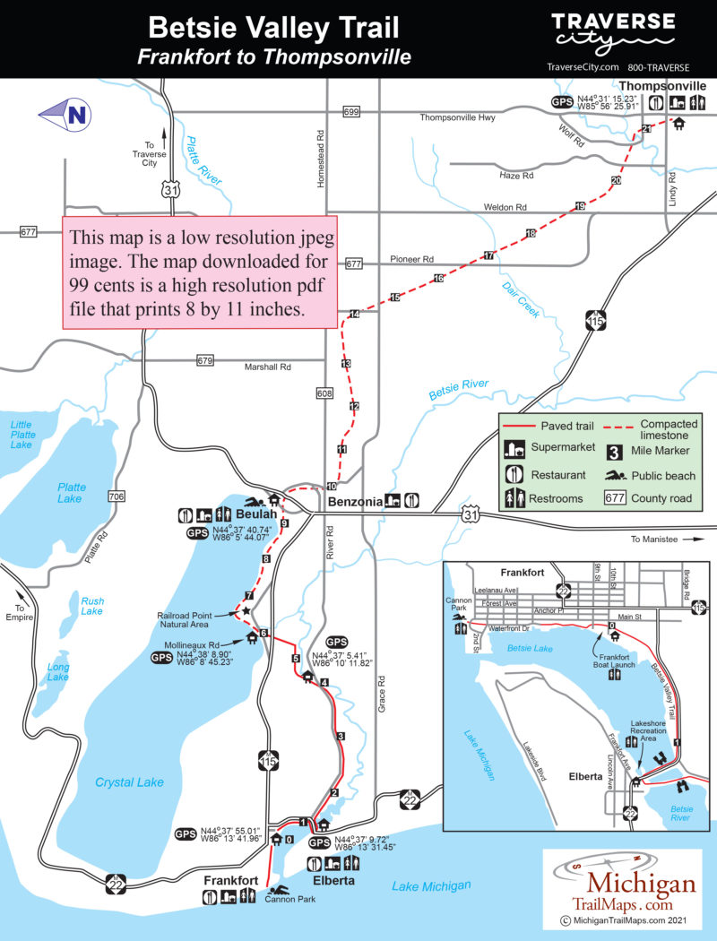
Betsie Valley Trail
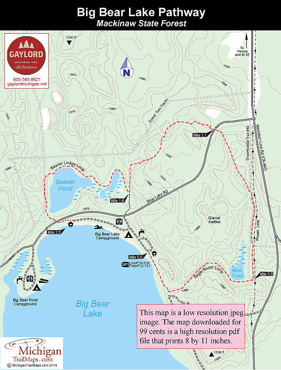
Big Bear Lake Pathway
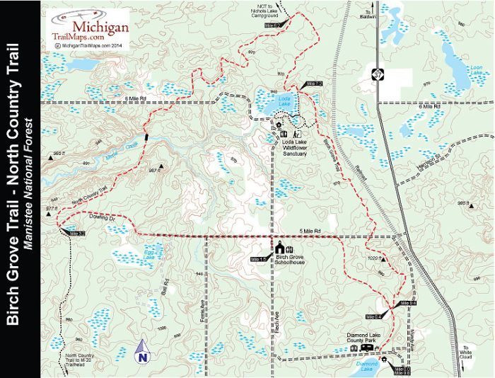
Birch Grove Trail/NCT Loop - Manistee National Forest
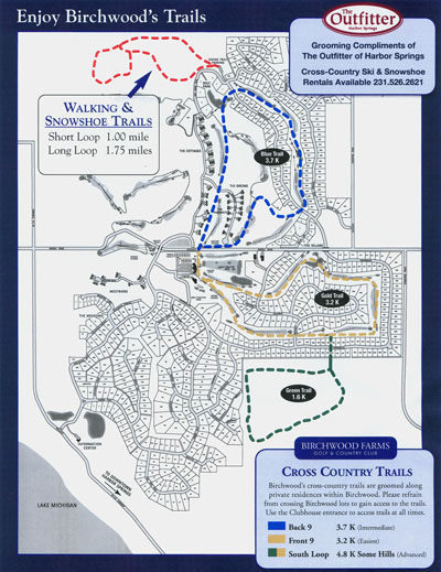
Birchwood Farms
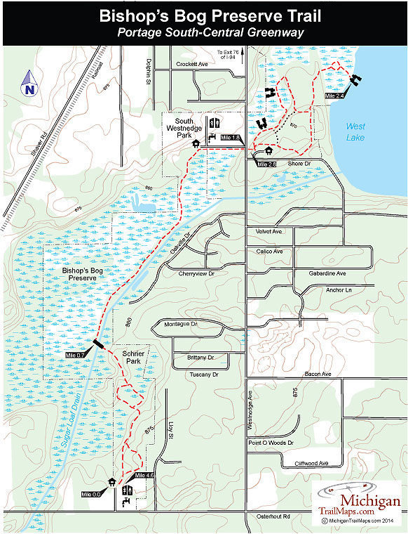
Bishop’s Bog Preserve Trail
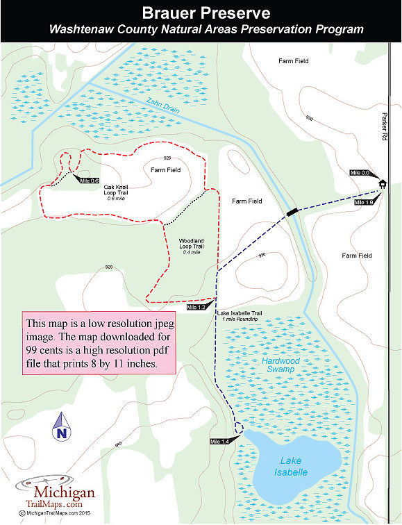
Brauer Preserve
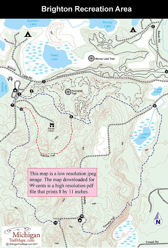
Brighton Recreation Area
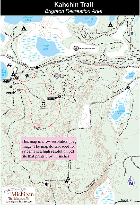
Brighton Recreation Area: Kahchin Trail
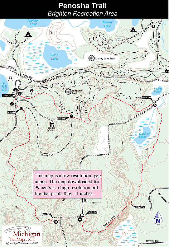
Brighton Recreation Area: Penosha Trail

Brown Bridge Quiet Area