
20379 Marcellus Highway
Decatur, MI 49045 US
Phone: (269) 445-8611
Region: Lake Michigan
Website
More Info
4971 County Road 612
Grayling, MI 49733 US
Phone: (989) 348-5989
Region: Northwest
Website
More Info
4971 County Road 612
Grayling, MI 49733 US
Phone: (989) 348-5989
Region: Northwest
Website
More Info
4971 County Road 612
Grayling, MI 49733 US
Phone: (989) 348-5989
Region: Northwest
Website
More Info
Bell's Bay Road
Charlevoix, MI 49720 US
Phone: (231) 547-6641
Region: Northwest
More Info
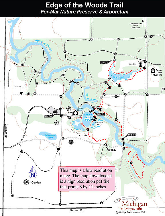
2142 N. Genesee Road
Flint, MI 48509 US
Phone: (810) 789-8567
Region: Southeast
Website
More Info
2142 N. Genesee Road
Flint, MI 48509 US
Phone: (810) 789-8567
Region: Southeast
Website
More Info
133 Fitzgerald Park Drive
Grand Ledge, MI 48837 US
Phone: (517) 627-7351
Region: Heartland
Website
More Info
133 Fitzgerald Park Drive
Grand Ledge, MI 48837 US
Phone: (517) 627-7351
Region: Heartland
Website
More Info
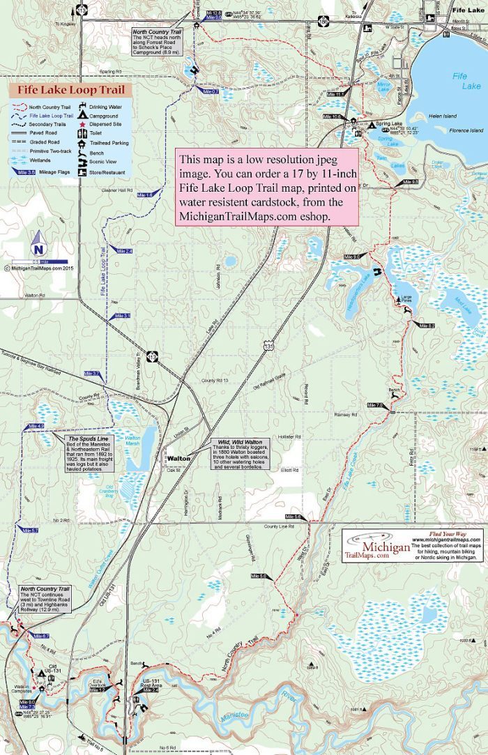
Old US-131 & US-131
Fife Lake, MI US
Phone: (866) 445-3628
Region: Northwest
Website
More Info
Herron Road (County Road 604)
Elberta, MI US
Phone: (231) 929-7911
Region: Northwest
Website
More Info
North Dixboro Road
Ann Arbor, MI 48105 US
Region: Southeast
More Info
4785 II Road
Garden, MI 49835 US
Region: Eastern Upper Peninsula
More Info
List of Trails

Fayette Historic State Park
Fife Lake Loop Trail
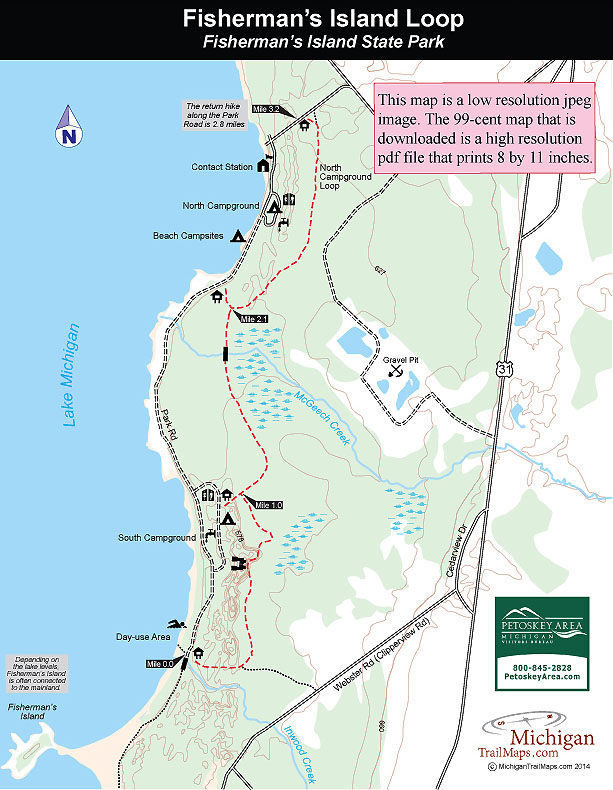
Fisherman's Island State Park

Fitzgerald County Park
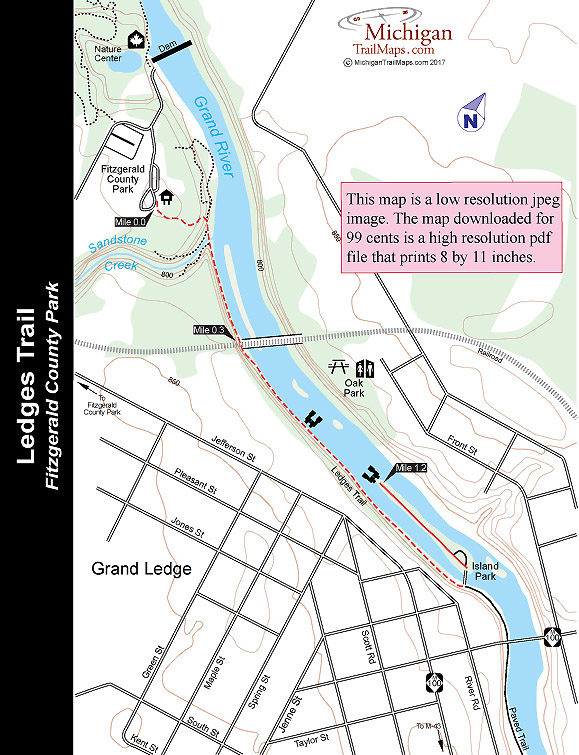
Fitzgerald County Park: Ledges Trail
For-Mar Nature Preserve & Arboretum
For-Mar Nature Preserve: Edge of the Woods Trail
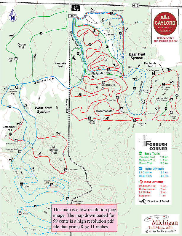
Forbush Corner

Forbush Corner: East Trail System
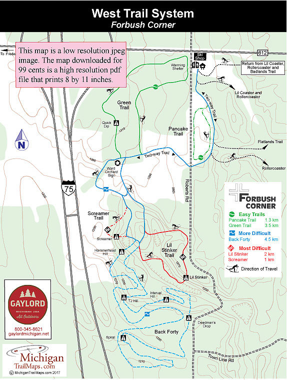
Forbush Corner: West Trail System

Fred Russ Forest Park
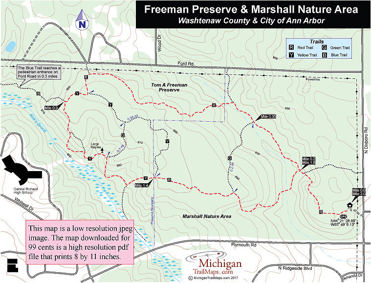
Freeman Preserve/Marshall Nature Area

