320

Trails Reviewed

Find Trails & Maps

Search for Trail
Search by Location
Search by


Search Terms:
Map
FILTERS
Close

Refine Search

By Activities:
By Regions:
By Name:

11000 Camp Pet-O-Se-Ga
Alanson, MI 49706 US

Phone: (231) 347-6536
Region: Northwest
Website

If at Camp Pet-O-Se-Ga you feel like singing Kumbaya around the campfire, go ahead. You wont be the first.The Emmet County park at the west end of Pickerel Lake started out as a summer camp with...
More Info

Leeward Drive
Alanson, MI 49770 US

Phone: (231) 347-0991
Region: Northwest
Website

What was once slated to be a controversial subdivision is now a unique island preserve thanks to the Little Traverse Conservancy. Oden Island, located south of the village of Oden, juts out into...
More Info

Corner of Valley Street and Smalley Street
Alden, MI 49770 US

Phone: (231) 331-4643
Region: Heartland

Tucked away on the east side of Alden, oblivious to most visitors who are mesmerized by Torch Lake to the west of town, is a small mountain with a short but interesting trail system. Coy Mountain...
More Info

M-32
Gaylord, MI US

Phone: (989) 732-3541
Region: Northwest

Located 15 miles west of Gaylord, Warner Creek is a lightly used ski trail in the winter that offers scenery and solitude. It winds through Hardwood Hills, a rugged slice of the Mackinaw State...
More Info

3582 State Park Dr.
Bay City, MI 48706-1356 US

Phone: (989) 667-0717
Region: Lake Huron (Includes the Thumb)

Two short interpretive trails depart from near the Saginaw Bay Visitor Center; Lagoon Trail and Chickadee Nature Trail, both with display signs and built to be handicapped accessible.
More Info

3582 State Park Drive
Bay City, MI 48706 US

Phone: (989) 667-0717
Region: Lake Huron (Includes the Thumb)

Created in 1923, Bay City State Park was the most popular state park in the 1930s when it attracted more than 1.5 million visitors annually. But due to the shallowness of Saginaw Bay, a growth of...
More Info

M-22
Frankfort, MI US

Phone: (231) 929-7911
Region: Lake Michigan
Website

Also known as the C.S. Mott Preserve, Arcadia Dunes is spread across 3,600 acres just north of the Manistee/Benzie County line and is split in half by the state highway. The preserve includes 2...
More Info

Goose Rd
Honor, MI US

Phone: (231) 922-5280
Region: Northwest

Outside of the Porcupine Mountains, there are not too many places in Michigan where you need to ford a stream. But in Benzie County there is Platte River Springs Pathway, a short loop that is...
More Info

1129 Wilson Street
Boyne City, MI 49712 US

Phone: (231) 582-6597
Region: Northwest
Website

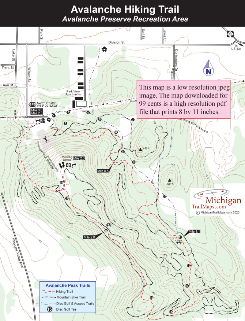
Separate from the mountain bike trail is the Avalanche Hiking Trail, a nearly 3-mile loop that climbs the ridge to the viewing decks and then descends it to return to the warming shelter and...
More Info

1129 Wilson Street
Boyne City, MI 49712 US

Phone: (231) 582-6597
Region: Northwest
Website

Located on the southwest corner of the Boyne City, Avalanche Peak rises to 1023 feet or 439 feet above Lake Charlevoix to provide the most commanding view of any high point south of the Mackinac...
More Info

2280 Boyne City Road
Boyne City, MI 49712 US

Phone: (231) 582-7523
Region: Northwest

Deer Flats Nature Trail is the longest trail at Young State Park, a 3-mile loop that stays predominately in low-lying woods. It shares a segment with White Birch Nature Trail and all of it is...
More Info

6093 E. M-115
Cadillac, MI 49601 US

Phone: (231) 775-7911
Region: Lake Michigan

A hike through the Cadillac Heritage Nature Study Area can be a bit of a surprise for many first-time visitors. Depending on the time of year, the wildlife seen along the trails can surprisingly...
More Info

37205 Mouillee Rd
Rockwood, MI 48173 US

Phone: (734) 379-9692
Region: Southeast

Middle Causeway is a dike that cuts across the heart of Pointe Mouillee and not only allows you to hike a shorter loop than following the perimeter dikes but leads you through the most interesting...
More Info

37205 Mouillee Rd
Rockwood, MI 48173 US

Phone: (734) 379-9692
Region: Southeast

Driving south along Jefferson Road in the Downriver region of Southeast Michigan, you pass a Detroit Edison plant with its towering twin smoke stacks and then the Monsanto chemical company and...
More Info

37205 Mouillee Rd
Rockwood, MI 48173 US

Phone: (734) 379-9692
Region: Southeast

For the most part this 9.8-mile route follows the perimeter control dikes in the Pointe Mouillee State Game Area and for some makes too long of a day on foot. The distance is ideal for a mountain...
More Info

3582 State Park Drive
Bay City, MI 48706 US

Phone: (989) 667-0717
Region: Lake Huron (Includes the Thumb)

Tobico Marsh is a 1,848-acre a wildlife refuge that lies within Bay City State Park and almost within sight of the city itself. The area is steeped in history with Native Americans remaining until...
More Info

12032 Red Arrow Highway
Sawyer, MI 49125 US

Phone: (269) 426-4013
Region: Lake Michigan

Michigan's famous sand dunes begin at Warren Dunes State Park. The 1,952-acre unit is the first unit along Lake Michigan, located just 12 miles north of the state border in Berrien County. It's a...
More Info

12032 Red Arrow Highway
Sawyer, MI 49125 US

Phone: (269) 426-4013
Region: Lake Michigan

The Mt. Randal Loop is a combination of three trails and a shoreline walk that makes for a 4-mile trek and the best hike in this 1,952-acre park. This outing includes a bit of everything: a stroll...
More Info

32911 Willow Road
New Boston, MI 48164 US

Phone: (734) 782-3956
Region: Southeast
Website

Oakwoods Metropark is a 1,700-acre unit of the Huron-Clinton Metropolitan Authority, which oversees a system of thirteen parks along the watersheds of the Huron and Clinton Rivers. Oakwoods...
More Info

M-22
Frankfort, MI US

Phone: (231) 929-7911
Region: Western Upper Peninsula
Website

The favorite destination for most hikers at Arcadia Dunes is Old Baldy, an open dune perched 356 feet above Lake Michigan for sweeping views of the Great Lake. Mountain bikers are allowed on...
More Info

M-22 & Saint Pierre Road
Arcadia, MI US

Phone: (231) 929-7911
Region: Northwest
Website

The bulk of the Arcadia Dunes-C.S. Mott Preserve trail system is Dry Hill Trails, a glacial moraine ridge that runs inland several miles from Lake Michigan. South of the moraine are steep-forested...
More Info

20145 Beck Road
Northville, MI 48167 US

Phone: (248) 349-8390
Region: Southeast
Website

Until 2003, Maybury was the only state park in Wayne County and still the only one with a trail system. A look at its park map clearly shows how Michigans most crowded corner is desperate for...
More Info

M-22
Frankfort, MI US

Phone: (231) 326-5134
Region: Northwest
Website

Anchoring the southern end of Sleeping Bear Dunes National Lakeshore in Benzie County is Old Indian Trail. The path picks up its name from when Native Americans used the route to access their fish...
More Info

20145 Beck Road
Northville, MI 48167 US

Phone: (248) 349-8390
Region: Southeast
Website

The Friends of Maybury State Park spearheaded the development of the History Trail, a self-guided history tour to commemorate Maybury Sanatorium.To help combat the spread of tuberculosis, often...
More Info

20145 Beck Road
Northville, MI 48134 US

Phone: (248) 349-8390
Region: Southeast
Website

The Maybury State Park Hiking Trail is a 4-mile loop that stretches from one side of the park to the other and can easily be adapted to a 3-mile loop, which still contains the best stretches of...
More Info

Haggerty Rd
Sumpter Township, MI 48111 US

Phone: (734) 654-1223
Region: Southeast

While following a boardwalk through the heart of Crosswinds Marsh, we paused to watch an adult eagle leap off the edge of its huge nest and fly overhead. A minute later we were watching a jumbo jet...
More Info

20379 Marcellus Highway
Decatur, MI 49045 US

Phone: (269) 445-8611
Region: Lake Michigan
Website

Located on a rural road between Dowagiac and Marcellus, Fred Russ is a 13-acre Cass County park surrounded by Michigan State University’s 580-acre Russ Forest Research Station. The entire area is...
More Info

Haggerty Rd
Sumpter Township, MI 48111 US

Phone: (734) 654-1223
Region: Southeast

This hike incorporates almost every foot trail in Crosswinds Marsh for a 4.3-mile outing that takes you around the man-made marsh and through the center of it. It begins on the boardwalks, ends on...
More Info

4216 Ranger Road
Grayling, MI 49738 US

Phone: (989) 348-7068
Region: Northwest

Loggers, lumber barons and white pine made Michigan the greatest lumber-producing state in the country between 1869 and 1900. During that era there were an estimated 700 logging camps, and more...
More Info

8555 Silver Hill Road
Pinckney, MI 48169 US

Phone: (734) 426-4913
Region: Southeast
Website

The glaciers that shaped much of southeast Michigan did a wonderful job sculpturing the Pinckney Recreation Area, a 10,201-acre state park that straddles the Livingston/Washtenaw County Line. The...
More Info

8555 Silver Hill Road
Pinckney, MI 48169 US

Phone: (734) 426-4913
Region: Southeast
Website

The main reason Losee Lake Trail was built in 1996 was to give a hikers a quiet place to walk in Pinckney Recreation Area. Designated for "Foot Traffic Only", the 3.5-mile trail system is an area...
More Info

8555 Silver Hill Road
Pinckney, MI 48169 US

Phone: (734) 426-4913
Region: Southeast
Website

The Silver Lake Trail is labeled as a 1.9-mile loop but Ive found it to be much closer to 2.3 miles. Even at this distance the trail is too short for most off-road cyclists so its spared the heavy...
More Info

4216 Ranger Road
Grayling, MI 49738 US

Phone: (989) 348-7068
Region: Northwest

The best escape into the woods at Hartwick Pines is the Au Sable River Trail on the west side of MI-93. The highlight of this 3.1-mile trail is the East Branch of the Au Sable River, which it...
More Info

8555 Silver Hill Road
Pinckney, MI 48169 US

Phone: (734) 426-4913
Region: Southeast
Website

The best hiking in southeastern Michigan is in Pinckney Recreation Area, and the Crooked Lake Trail is another reason why. This 5.1-mile loop is a pleasant walk that traverses hardwood forests,...
More Info

4650 Geddes
Ann Arbor, MI 48105 US

Phone: (734) 971-6337
Region: Southeast
Website

History and nature are well preserved and on display at Parker Mill Park. The Washtenaw County park straddles Fleming Creek just above its confluence with the Huron River west of Ann Arbor and...
More Info

4216 Ranger Road
Grayling, MI 49738 US

Phone: (989) 348-7068
Region: Northwest

Named from an early logging railroad spur, Mertz Grade Trail is a 2-mile plus loop that extends on both sides of M-93. A portion of the trail follows the historic Mertz logging railroad spur and on...
More Info

S. Parker Rd
Ann Arbor, MI 48103 US

Phone: (734) 971-6337
Region: Southeast
Website

In 2003, the Washtenaw County Natural Areas Preservation Program purchased 187 acres west of Ann Arbor from the Brauer family and then seven years later obtained an adjoining 39 acres. The result...
More Info

4216 Ranger Road
Grayling, MI 49738 US

Phone: (989) 348-7068
Region: Northwest
Website

The Old Growth Forest Trail is, without a doubt, the most popular foot trail in Hartwick Pines. The 1.25-mile loop draws more than a quarter million people a year who use it to access the heart of...
More Info

8251 Germania Road
Cass City, MI 48726 US

Phone: (989) 856-4411
Region: Lake Huron (Includes the Thumb)
Website

Woods, a gentle stream, the possibility of encountering wildlife, and easy hiking are reasons why the trail in Sanilac Petroglyphs Historic Site is such a good family outing. But what makes it an...
More Info

4216 Ranger Rd
Grayling, MI 49738 US

Phone: (989) 348-7068
Region: Northwest

Hartwick Pines is not only the largest state park in the Lower Peninsula but it was also one of the first in northern Michigan to welcome mountain bikers when in the late 1980s it opened up its...
More Info

6975 Mower Road
Saginaw, MI 48601 US

Phone: (989) 759-1669
Region: Lake Huron (Includes the Thumb)
Website

In the heart of the Lower Peninsula is an area known as the Shiawassee Flats where three great rivers; the Tittabawassee, the Shiawassee and the Cass, merge to form the Saginaw River. The result of...
More Info

M-72
Roscommon, MI US

Phone: (989) 275-5151
Region: Northwest

What is officially the George Mason River Retreat is to most people who visit this special area simply the Mason Tract. Both titles refer to auto magnate George Mason who loved to fish the South...
More Info

Mt McSauba Road
Charlevoix, MI 49720 US

Phone: (231) 347-0991
Region: Northwest
Website

Charlevoix can be a busy place, especially in the summer. But just north of the city, tucked behind Mount McSauba, is a small preserve where its easy to escape the crowds of tourists. North Point...
More Info

Tin Lizzy Lane
Saginaw, MI 48722 US

Phone: (989) 759-1669
Region: Lake Huron (Includes the Thumb)
Website

The Cass River Unit Trail is located in Bridgeport Township and is so close to I-75 that the interstate traffic is heard in the first half of the loop. The entire loop, including a short cross over...
More Info

Strobelbel Rd
Saginaw, MI 48602 US

Phone: (989) 759-1669
Region: Lake Huron (Includes the Thumb)
Website

Woodland Trail may be part of Shiawassee National Wildlife Refuge but it is literally on the edge of a city and Saginaw is lucky because of that. If there was ever a perfect escape from its urban...
More Info

3010 Maple St
Saginaw, MI 48602 US

Phone: (989) 759-1669
Region: Lake Huron (Includes the Thumb)
Website

The Green Point Environmental Learning Center is a 76-acre natural area located within Saginaw, one of Michigans largest cities, and across the Tittabawassee River from the Shiawassee National...
More Info

6975 Mower Road
Saginaw, MI 48601 US

Phone: (989) 759-1669
Region: Lake Huron (Includes the Thumb)
Website

The Ferguson Bay Trail in the Shiawassee National Wildlife Refuge is an interesting walk almost any time of the year, as it provides dry footing through an area of marshes, ponds, sloughs, flooded...
More Info

6685 Sheridan Rd
Saginaw, MI 48601 US

Phone: (989) 790-5280
Region: Lake Huron (Includes the Thumb)
Website

Located 5 miles south of Saginaw, Price Nature Center is a 186-acre woods surrounded by theagricultural heart of Saginaw County. This park offers a variety of amenities including picnic area,...
More Info

106 State Park Drive
Roscommon, MI 48653 US

Phone: (989) 821-6374
Region: Heartland
Website

Situated on the east side of County Road 100 is an escape from the campers, crowds, and, during the winter, snowmobiles that are the trademark of South Higgins Lake State Park. Marl Lake is the...
More Info

M-33 and Tomahawk Lake Hwy
Onaway, MI 49765 US

Phone: (989) 732-3541
Region: Lake Huron (Includes the Thumb)

Michigan’s karst region is spread across Presque Isle, Alpena and Montmorency counties in the northwest corner of the Lower Peninsula and the heart of it is the Sinkhole Area, a non-motorized,...
More Info

32911 Willow Road
New Boston, MI 48164 US

Phone: (800) 477-3182
Region: Southeast
Website

Besides Long Bark Nature Trail, Oakwoods Metropark has three other short interpretive paths that begin at the nature center; Big Tree Nature Trail (0.75-mile), Sky-Come-Down Nature Trail (1 mile)...
More Info

Ocqueoc Falls Road
Rogers City , MI 49779 US

Phone: (989) 732-3541
Region: Lake Huron (Includes the Thumb)

While the Upper Peninsula has hundreds of waterfalls, the Lower Peninsula has only two, with Ocqueoc Falls being the most popular and accessible one south of the Mackinac Bridge. You can rush from...
More Info

76th or 84th Ave.
Zeeland, MI 49464 US

Phone: (616) 738-4810
Region: Lake Michigan
Website

Located in the southwest corner of Ottawa County, Upper Macatawa Natural Area is an excellent example of what cooperation among agencies and environmental groups can do to save and restore wetlands...
More Info

84th Ave
Zeeland, MI 49464 US

Phone: (616) 738-4810
Region: Lake Michigan
Website

A natural 2.4-mile loop departs from the 84th Avenue trailhead and includes the most interesting terrain at Upper Macatawa Natural Area as well as the barrier-free paved trail and scenic overlook....
More Info

13925 Lakeshore Drive
Grand Haven, MI 49417 US

Phone: (616) 738-4810
Region: Lake Michigan
Website

The most amazing view at Rosy Mound Natural Area is reached after you climb a long set of stairs to an observation deck called Dune Overlook. Below you are open and forested dunes, a small stand of...
More Info

Lone Pine Road
Gaylord, MI 49735 US

Phone: (989) 732-3541
Region: Northwest

Although it is technically a pathway in the Mackinaw State Forest, Pine Baron is more like a city trail on the edge of Gaylord. The pathway is less than 3 miles from the heart of the Ostego County...
More Info

Pickerel Lake Road
Vanderbilt, MI 49795 US

Phone: (989) 983-4101
Region: Northwest

Pickerel Lake Pathway is an easy, 2-mile loop that encircles the lake, staying within sight of the water for much of the hike. Although at times you’re hiking through matchstick forests of aspen...
More Info

Fairview Ave.
Gaylord, MI US

Phone: (800) 345-8621
Region: Northwest
Website

The North Central State Trail is not only one of the newest recreational trails in Michigan but the longest improved rail-trail, stretching 61.9 miles from Gaylord to Mackinaw City. Much of it is...
More Info

Fairview Ave.
Gaylord, MI US

Phone: (800) 345-8621
Region: Northwest
Website

The southern half of the North Central State Trail extends 28.1 miles from Gaylord to Indian River with almost half of it along the Sturgeon River. Gaylord is the southern terminus and also the...
More Info

3435 S. Straits Highway
Indian River, MI 49749 US

Phone: (800) 345-8621
Region: Northwest
Website

The northern half of the North Central State Trail stretches 33.8 miles from Indian River to Mackinaw City, passing through Cheboygan within 16 miles. All three towns have well developed trailheads...
More Info

Sturgeon Valley Rd.
Vanderbilt, MI 49795 US

Phone: (989) 983-4101
Region: Northwest

The lure of Green Timbers is history, trout and, if your timing is right, large elk. This rugged 6,388-acre tract, part of the Pigeon River Country State Forest, not only has wildlife, scenic...
More Info

Sturgeon Valley Rd.
Vanderbilt, MI 49795 US

Phone: (989) 983-4101
Region: Northwest

The Honeymoon Cabin was once the most popular destination in Green Timbers before it was removed in 2016 despite the protests of backpackers, hikers and snowshoers. The cabin was perched on a high...
More Info

Sturgeon Valley Rd.
Vanderbilt, MI 49795 US

Phone: (989) 983-4101
Region: Northwest

As far as anglers are concerned, most of the Sturgeon River in the Green Timbers area is a hike-in adventure. Many who want to fish and then overnight hike to the Green Timbers Cabin, a 2.3-mile...
More Info

Vienna Corners
Gaylord, MI 49735 US

Phone: (989) 732-3541
Region: Northwest

The main campground on Big Bear Lake lacks a boat ramp as well as the privacy usually associated with state forest campgrounds. Butthe Mackinaw State Forest campgrounddoes have one feature most...
More Info

239 Commerce Blvd.
Gaylord, MI 49735 US

Phone: (800) 345-8621
Region: Northwest
Website

There are two places in Michigan where its possible to see an elk while mountain biking, hiking or cross-country skiing; the Shingle Mill Pathway in Pigeon River Country State Forest and Aspen...
More Info

239 Commerce Blvd.
Gaylord, MI 49735 US

Phone: (800) 345-8621
Region: Northwest
Website

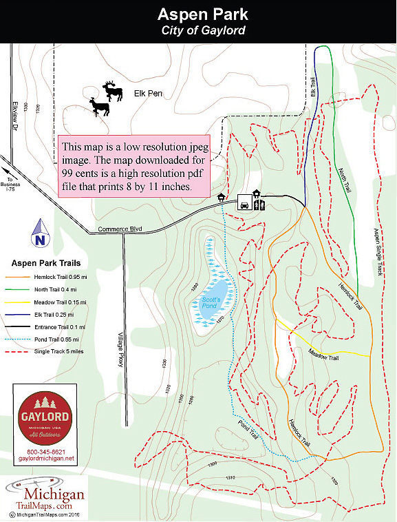
Aspen Park has five short trails that are paved and total 2 miles. The perimeter of the route, Elk Trail, North Trail and Hemlock Trail, form an easy 1.65-mile loop that begins and ends at the...
More Info

239 Commerce Blvd.
Gaylord, MI 49735 US

Phone: (800) 345-8621
Region: Northwest
Website

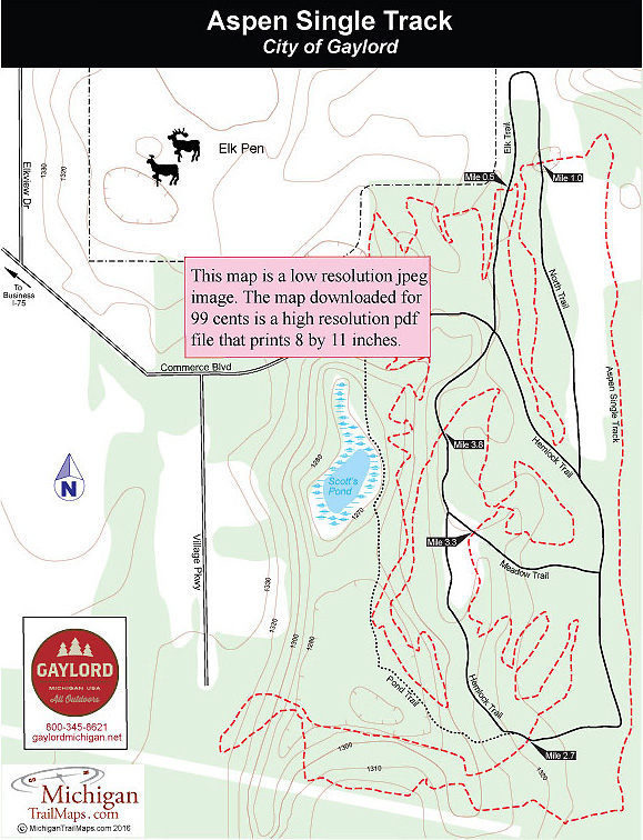
Built by theNorthern Chapter of the Michigan Mountain Bike Association(MMBA), this 5-mile loop has become a favorite with locals looking for a quick workout and vacationing mountain bikers in need...
More Info

9679 State Park Rd
Mears, MI 49436 US

Phone: (231) 873-3083
Region: Lake Michigan
Website

Not all of Michigan’s great hikes are trails. This trek is a journey through Silver Lake State Park's trailless backcountry, a mile-wide strip of dunes between Silver Lake and Lake Michigan....
More Info

8100 Grange Hall Road
Holly, MI 48442 US

Phone: (248) 634-8811
Region: Southeast
Website

Located on the northern edge of Oakland County, Holly Recreation Area is a 7,817-acre state park that offers a wide variety of terrain on both sides of I-75. West side of the interstate Holly...
More Info

8100 Grange Hall Road
Holly, MI 48442 US

Phone: (248) 634-8811
Region: Southeast
Website

Most of McGinnis Lake Campground is grassy sites in a semi-open setting. The exception is the Trillium Loop whose sites are well spread out in a rolling woods, giving you both privacy and that...
More Info

8100 Grange Hall Road
Holly, MI 48442 US

Phone: (248) 634-8811
Region: Southeast
Website

A quick glance at a map and the Lakeshore Trail appears to be a hike through the beaches and day-use areas of the Holly Recreation Area, a walk along the park road where you would be tripping over...
More Info

8100 Grange Hall Road
Holly, MI 48442 US

Phone: (248) 634-8811
Region: Southeast
Website

Calling any trail in Oakland County Wilderness is a little presumptuous. Or a lot. Still this 5.75-mile loop in Holly Recreation Area is a dandy, an oasis in the urban sprawl that someday will turn...
More Info

5142 E Holly Rd.
Holly, MI 48442 US

Phone: (248) 634-1758
Region: Southeast
Website

At the front of Sorensen Park are the usual park amenities; softball fields, a tot lot and a picnic area. In the back is one of the best examples of a warm-water river eco-system in Michigan and a...
More Info

9966 Twin Lakes Road
Vanderbilt, MI 49795 US

Phone: (989) 983-4101
Region: Northwest

The Pigeon River Country State Forest is a rugged 105,049-acre tract located 20 miles north of Gaylord and occupying the high central plateau of the Lower Peninsula. The forest is an outdoor...
More Info

Eaton Road
Springfield Township, MI US

Phone: (248) 846-6558
Region: Southeast

Just a short drive north of the quaint village of Davisburg is the Shiawassee Basin Preserve, Springfield Township’s largest park at 515 acres and home to one of Michigan's largest, most pristine...
More Info

14390 Fish Lake Road
Holly, MI 48442 US

Phone: (248) 634-7271
Region: Southeast
Website

For an area that was originally purchased for development, Seven Lakes State Park has since evolved into a natural retreat with a variety of topography and ecosystems, ranging from mature hardwood...
More Info

14390 Fish Lake Road
Holly, MI 48442 US

Phone: (248) 634-7271
Region: Southeast
Website

The Green Trail Loop is the most interesting route at Seven Lakes State Park as it winds through mature hardwoods forest, skirts the largest lakes in the park and has enough rolling terrain to keep...
More Info

14390 Fish Lake Road
Holly, MI 48442 US

Phone: (248) 634-7271
Region: Southeast

The park considers the Red Trail Loop to be a 1.8-mile, one-way route from Meadow Ridge Shelter on Big Seven Lake to the Dickinson Boat Launch. But a more logical hike would be to continue on the...
More Info

14390 Fish Lake Road
Holly, MI 48442 US

Phone: (248) 634-7271
Region: Southeast
Website

The Nature Trail Loop is misnomer as there are no interpretive plaques along it or a brochure for it. But the trail does provide campers at Sand Lake with a quick escape into the woods and is often...
More Info

10400 Fish Lake Road
Holly, MI 48442 US

Phone: (248) 858-0906
Region: Southeast
Website

The northwest corner of Oakland County is rural horse country, an area of rolling pastures, whitewashed fences, faded red barns and mares and foals trotting through open meadows. In the middle of...
More Info

3500 Wixom Road
Commerce Township, MI 48382 US

Phone: (248) 685-2433
Region: Southeast
Website

Proud Lake is a 4,700-acre state recreation area in the southwest corner of Oakland County whose terrain ranges from rolling dense forests and vast wetlands to a chain of lakes and 3.5 miles of the...
More Info

3500 Wixom Road
Commerce Township, MI 48382 US

Phone: (248) 685-2433
Region: Southeast
Website

The main trailhead in Proud Lake Recreation Area is located in the large day-use parking area just down the road from the park headquarters and near the organization campground. But this loop...
More Info

3500 Wixom Road
Commerce Township, MI 48382 US

Phone: (248) 685-2433
Region: Southeast
Website

This short and easy walk is ideal for children, even those as young as three or four years old. The small lake, technically an impoundment, provides them with something to constantly to look at...
More Info

4480 Orion Road
Rochester, MI 48306 US

Phone: (248) 651-9260
Region: Southeast

Within the mushroom of development that is northern Oakland County is the Paint Creek Trail, an 8.9-mile rail-trail between Rochester and Lake Orion. For the most part, the trail is a wooded path...
More Info

2301 W Clarkston Road
Lake Orion, MI 48360 US

Phone: (248) 625-0877
Region: Southeast
Website

Purchased by Oakland County Parks in 1980, the main feature of Orion Oaks is Lake Sixteen, a 90-acre lake without a single house or condo on it in a corner of the state where everybody wants to...
More Info

2301 W Clarkston Road
Lake Orion, MI 48360 US

Phone: (248) 625-0877
Region: Southeast
Website

Most of the perimeter of the trail system in Orion Oaks County Park was once posted as the Orion Oaks Achievement Trail, a 6.2-mile loop that began at the parking area and trailhead off of Joslyn...
More Info

52221 Pontiac Trail
Wixom, MI 48393 US

Phone: (248) 437-7345
Region: Southeast
Website

Some people think that the naturalists at Lyon Oaks County Park have one of the hardest jobs around. Oakland County’s newest park is bordered on one side by I-96, on another by an industrial park,...
More Info

5200 Indian Trail
White Lake, MI 48386 US

Phone: (800) 477-2757
Region: Southeast
Website

Located 9 miles northwest of Pontiac in Oakland County, Indian Springs was established in 1982 to preserve the last major section of the Huron Swamp and is one of 13 Huron-Clinton Metroparks. Much...
More Info

5200 Indian Trail
White Lake, MI 48386 US

Phone: (800) 477-2757
Region: Southeast
Website

Along with its impressive and awarding winning interpretive building, the Environmental Discovery Center features 60 acres of restored and created native ecosystems including ponds, wetlands and...
More Info

5200 Indian Trail
White Lake, MI 48386 US

Phone: (800) 477-2757
Region: Southeast
Website

This short trail begins on the south side of the park office and skirts a small pond with observation areas. Its surface is asphalt, capable of handling wheelchairs.
More Info

5200 Indian Trail
White Lake, MI 48386 US

Phone: (800) 477-2757
Region: Southeast
Website

The Farmland Trail departs from the nature center and provides a leisurely hike to the east. Through in the beginning it briefly swings through the woods it soon breaks out into a tall grass...
More Info

5200 Indian Trail
White Lake, MI 48386 US

Phone: (800) 477-2757
Region: Southeast
Website

This is Indian Springs best trail for escaping into the natural world and possibly sighting wildlife. Woodland Trail is a 3.5-mile walk but three crossover spurs allow you to shorten it; Crosscut,...
More Info

5200 Indian Trail
White Lake, MI 48386 US

Phone: (800) 477-2757
Region: Southeast
Website

You can view portions of the Huron Swamp and the woods of Indian Springs by hiking, skating or pedaling the parks paved Hike-Bike Trail. The trail is a 5-mile asphalt ribbon that extends from the...
More Info

9501 Sashabaw Road
Clarkston, MI 48348 US

Phone: (248) 625-0877
Region: Southeast
Website

Independence Oaks County Park is the largest unit in the Oakland County Parks system at 1088 acres, and a state-designated Wildlife Viewing Area. The park encompasses rolling hills, wooded ravines,...
More Info

9501 Sashabaw Road
Clarkston, MI 48348 US

Phone: (248) 625-0877
Region: Southeast
Website

River Loop is a 2.2-mile paved loop through the Clinton River Flood Plain Natural Area, a vast, wooded wetland that is the headwaters of the Clinton River. Part of the trail follows the paved lane...
More Info

9501 Sashabaw Road
Clarkston, MI 48348 US

Phone: (248) 625-0877
Region: Southeast
Website

This is Independence Oaks’ best hike, a 3-mile loop in the undeveloped half of the park that includes climbing the tallest ridges and following the shoreline of Crooked Lake. Keep in mind the hike...
More Info

9501 Sashabaw Road
Clarkston, MI 48348 US

Phone: (248) 625-0877
Region: Southeast
Website

Nordic skiers, even those who live in Oakland County, are often pleasantly surprise the first time they ski the trails at Independence Oaks County Park. Not because the trails are so well groomed...
More Info

5200 Highland Road
White Lake, MI 48383 US

Phone: (248) 889-3750
Region: Southeast
Website

Looking to escape the pressures of being Henry Fords only son and thus, sole heir to the Ford Motor Company, Edsel Ford began purchasing the hilly property in northwest Oakland County in 1923 and...
More Info

5200 Highland Road
White Lake, MI 48383 US

Phone: (248) 889-3750
Region: Southeast
Website

Goose Meadow Trail is a 2.5-mile loop lies that wraps around a portion of Haven Hill Lake and lies almost entirely in the Haven Hill Natural Area. It makes for a scenic walk that is easier and...
More Info

5200 Highland Road
White Lake, MI 48383 US

Phone: (248) 889-3750
Region: Southeast
Website

The principal trail in the Haven Hill Natural Area is a loop that encircles Haven Hill Lake with two cutoff spurs that create shorter trails. The entire loop is a 5.2-mile hike marked as the Green...
More Info

5200 Highland Road
White Lake, MI 48383 US

Phone: (248) 889-3750
Region: Southeast
Website

To view the ruins of the Ford estate, follow the former entrance drive up Haven Hill. The road is closed to traffic just beyond the park maintenance buildings and parking is not now allowed at the...
More Info

1330 E. Greenshield Road
Lake Orion, MI 48360 US

Phone: (248) 693-6767
Region: Southeast
Website

There is no longer a Bald Mountain. The highpoint, which at one time was the site of a ski club, eventually became part of a landfill and met its fate at the front end of a bulldozer. But the...
More Info

1330 E. Greenshield Road
Lake Orion, MI 48360 US

Phone: (248) 693-6767
Region: Southeast
Website

When the temperatures finally break 50 degrees or – gosh forbid - hit 60 degrees in late April or early May, the White Loop is a fine choice for your first hike of the spring in Oakland County....
More Info

1330 E. Greenshield Road
Lake Orion, MI 48360 US

Phone: (248) 693-6767
Region: Southeast
Website

Bald Mountain Recreation Area has 15 miles of trails divide between the North Unit and the South Unit and the crown jewel of the system is the 3.6-mile loop around Graham Lakes. Officially its...
More Info

4794 6 Mile Road
White Cloud, MI 49349 US

Phone: (231) 745-4631
Region: Heartland
Website

We stood near the edge of Loda Lake, looking for a splash of pink but finding only brown leaves. We were too early for color. But, though we had never been in the Loda Lake Wildflower Sanctuary...
More Info

Jefferson Rd.
Croton, MI US

Phone: (877) 500-2570
Region: Heartland

Hardy Dam is an interesting contrast. Built in 1931, this huge man-made structure is the largest hydroelectric plant in the Lower Peninsula and produces enough electricity for a city of 24,000...
More Info

Buttles Road
Lewiston, MI 49756 US

Phone: (989) 732-3541
Region: Lake Huron (Includes the Thumb)

Originally set up as a cross country ski trail, Buttles Road Pathway in Mackinaw State Forest now also attracts mountain bikers as well as an occasional hiker interested in the sink hole terrain....
More Info

2800 State Park Road
Monroe, MI 48162 US

Phone: (734) 289-2715
Region: Southeast
Website

William C. Sterling State Park is best known as the only Michigan park on Lake Erie, for its sandy beach and as a popular departure point for walleye anglers. But the park is dedicated to marshland...
More Info

400 S. Badour Rd.
Midland, MI 48640 US

Phone: (989) 631-0830
Region: Lake Huron (Includes the Thumb)
Website

The Chippewa Trail is a paved trail that winds 3.5 miles from downtown Midland to the outstanding Chippewa Nature Center. The scenery is interesting in places but not overly impressive. The trail,...
More Info

8800 W. M-116
Ludington, MI 49431 US

Phone: (231) 843-2423
Region: Lake Michigan
Website

Ludington State Park features more than 20 miles of trails but the most popular path in the park is also the shortest: the Skyline Trail. This half-mile path requires you to climb stairways to the...
More Info

8800 W. M-116
Ludington, MI 49431 US

Phone: (231) 843-2423
Region: Lake Michigan
Website

The largest state park along Lake Michigan and one of the largest in the Lower Peninsula is Ludington. The 5,300-acre state park in Mason County includes 5.5 miles of Great Lake shoreline, 4 miles...
More Info

8800 W. M-116
Ludington, MI 49431 US

Phone: (231) 843-2423
Region: Lake Michigan
Website

The toughest climb for many hiking at Ludington State Park isnt a knee-bending ridge or trudging through the soft sand on a steep dune. Its the 130 steps to the top of the Big Sable Point...
More Info

8800 W. M-116
Ludington, MI 49431 US

Phone: (231) 843-2423
Region: Lake Michigan
Website

Perhaps the most popular hike in Ludington State Park is theLighthouse Trailwhere visitors follow Lighthouse and Logging trails to the Big Sable Point Lighthouse and then loop back along the...
More Info

8800 W. M-116
Ludington, MI 49431 US

Phone: (231) 843-2423
Region: Lake Michigan
Website

The Sable River Trail was originally 1.6 miles in length and formed a semi-loop on both banks of the Big Sable River within Ludington State Park. In the mid-1990s the park turned a good portion of...
More Info

9922 Front Street
Empire, MI 49630 US

Phone: (231) 326-5134
Region: Northwest
Website

The 200 miles of sand dunes fronting Lake Michigans east shore is the largest collection of freshwater coastal dunes in the world and Sleeping Bear Dunes National Lakeshore, the only National Park...
More Info

Stocking Road
Glen Arbor, MI US

Phone: (231) 326-5134
Region: Northwest
Website

The best cross-country ski area in Sleeping Bear Dunes National Lakeshore is Alligator Hill, whose 8.3-mile trail system offers skiers three loops that range from easy to advance and feature plenty...
More Info

Forest Road 5993
Cadillac, MI 49601 US

Phone: (231) 723-2211
Region: Lake Michigan
Website

From Hodenpyl Dam Pond the Manistee River winds south uninhibited and free in the Manistee National Forest for 13 miles before a road crosses it. Unmolested by bridges, cottages and dams, this wild...
More Info

6360 Chilson Road
Howell, MI 48843 US

Phone: (810) 229-6566
Region: Southeast
Website

The glacial activity that blessed several southeast Michigan counties with a rolling terrain and numerous lakes can easily be seen at Brighton Recreation Area, 50 miles northwest of Detroit in...
More Info

M-109
Empire, MI US

Phone: (231) 326-5134
Region: Northwest
Website

The Dune Climb is undoubtedly the most popular spot in Sleeping Bear Dunes with more than 300,000 people climbing it annually. This open dune forms the eastern edge of the Sleeping Bear Plateau, a...
More Info

M-209
Glen Arbor, MI US

Phone: (231) 326-5134
Region: Northwest
Website

There are two interesting trails in this incredible corner of Sleeping Bear Dunes National Lakeshore and most visitors head to just one of them - the park's popular Dune Climb and its 4-mile...
More Info

6360 Chilson Road
Howell, MI 48843 US

Phone: (810) 229-6566
Region: Southeast
Website

This trail is listed as a 2-mile loop but is actually closer to 1.7 miles from start to finish at the trailhead in the Bishop Lake day-use area. If you need a little more mileage on your hike, it’s...
More Info

6360 Chilson Road
Howell, MI 48843 US

Phone: (810) 229-6566
Region: Southeast
Website

An ice age 25,000 years ago and some unsuccessful farmers in the 1930s resulted in an undeveloped tract in Livingston County where today you can go for a 5-mile walk in the woods to escape the...
More Info

Deadman’s Hill Road
Alba, MI US

Phone: (989) 732-3541
Region: Northwest

Deadmans Hill is a beautiful vista with a sad story. One of the most beloved viewing points for leaf peppers in the Lower Peninsula is something of a memorial to a young logger named Stanley...
More Info

Deadman’s Hill Road
Mancelona, MI US

Phone: (800) 345-8621
Region: Northwest

Note: The Jordan Valley Pathway has been re-routed around a wetland area. A map of the new trail can be downloaded from this page. You can read about the re-route in a Trail Talk blog by Jim...
More Info

Wilco Road
Empire, MI US

Phone: (231) 326-5134
Region: Northwest
Website

Few trails in Sleeping Bear Dunes National Lakeshore lead to a more spectacular view at the end as does this short path to the edge of Empire Bluff. The bluff rises more than 400 feet above the...
More Info

Lake Michigan Road
Glen Arbor, MI US

Phone: (231) 326-5134
Region: Northwest
Website

Within Sleeping Bear Dunes, a park of towering dunes and rolling ridges, Good Harbor Bay Trail is the rare exception. This 2.8-mile loop is almost entirely flat, a trail where a change in elevation...
More Info

15310 N. Lighthouse Point Road
Northport, MI 49670 US

Phone: (231) 386-5422
Region: Northwest

Crowning the tip of Michigan's little finger like a diamond ring is Leelanau State Park, a 1,350-acre unit of spectacular views that are seen along miles of lakeshore, from platforms on top of...
More Info

Densmore Road
Northport, MI US

Phone: (231) 386-5422
Region: Northwest

Although there are five named trails in the undeveloped Cathead Bay area of Leelanau State Park, the system basically forms a 4-mile loop using the Lake Michigan Trail and Mud Lake Trail, with...
More Info

207 W. River Street
Leland, MI 49654 US

Phone: (231) 326-5134
Region: Northwest
Website

More than just transportation, the 11-mile ferry ride from Leland sets the mood for visitors arriving at the North Manitou Island. Located in Lake Michigan, North Manitou is wild, isolated, and...
More Info

207 W. River Street
Leland, MI 49654 US

Phone: (231) 326-5134
Region: Northwest
Website

Click hereto order a detailed map and a guide toSouth Manitou Island.Part of Sleeping Bear Dunes National Lakeshore, South Manitou Island is located 18 miles west of Leland and is the southernmost...
More Info

Basch Road
Glen Arbor, MI US

Phone: (231) 326-5134
Region: Northwest
Website

In an area of the state known for its stunning views of sand dunes, islands and the pastel blues of Lake Michigan, Pyramid Point is one of the best. Part of the Sleeping Bear Dunes National...
More Info

Pierce Stocking Scenic Drive
Empire, MI US

Phone: (231) 326-5134
Region: Northwest
Website

Shauger Hill Trail is a wooded 2.1-mile loop with a trailhead and parking area near the contact station at the beginning of Scenic Drive. The hilly trail passes through a climax beech-maple forest,...
More Info

Welch Road
Empire, MI US

Phone: (231) 326-5134
Region: Northwest
Website

After a stunning trek like the Empire Bluff Trail or the Dunes Trail, the scenery along the Windy Moraine Trail in Sleeping Bear Dunes National Lakeshore may seem, well, ho-hum at best. But arrive...
More Info

M-32
Gaylord, MI US

Phone: (989) 732-3541
Region: Northwest

This is an easy mountain bike ride through two of Northern Michigan's most scenic river valleys. The route is almost entirely forest roads and old two-tracks and crosses through two distinctly...
More Info

4971 County Road 612
Grayling, MI 49733 US

Phone: (989) 348-5989
Region: Northwest
Website

In 1981, Dave Forbush turned the 80-acre family farm into a Nordic ski center by leasing the rolling, forested state land that surrounds much of it. This allowed him to design and build 40...
More Info

4971 County Road 612
Grayling, MI 49733 US

Phone: (989) 348-5989
Region: Northwest
Website

The heart of the trail system at Forbush Corner lies on the east side of Roberts Road and is occasionally referred to as the East Trail System. Roberts Road is a dirt road that is not plowed during...
More Info

4971 County Road 612
Grayling, MI 49733 US

Phone: (989) 348-5989
Region: Northwest
Website

The West Trail System at Forbush Corner lies on the west side of unplowed Roberts Road and is 11.5 kilometers of groomed track divided among five loops ranging from Easy to Most Difficult. The...
More Info

Bell's Bay Road
Charlevoix, MI 49720 US

Phone: (231) 547-6641
Region: Northwest

Two things to know before visiting Fishermans Island State Park; Michigans state stone is not really a stone and Fishermans Island isnt really an island.Petoskey stones, Michigans state stone, are...
More Info

3871 Hurd Rd.
Metamora, MI 48455 US

Phone: (810) 797-4439
Region: Southeast

Metamora-Hadley Recreation Area is a 723-acre state park in the southwest corner of Lapeer County whose main feature is Lake Minnawanna, an 80-acre impoundment. Surrounding the lake and developed...
More Info

State Road
Luther, MI US

Phone: (231) 775-9727
Region: Heartland

Silver Creek Pathway has been a gradual work in progress, an evolving trail that is now considered well worth the wait by visitors to this corner of Lake County. What began as a short path for...
More Info

7 Mile Road
Baldwin, MI US

Phone: (231) 775-9727
Region: Heartland

Before even hoisting their packs for an overnight trek to Lost Lake, some hikers think their already lost. At the Pine Valleys Pathway parking lot there are signs and directional arrows for...
More Info

County Road 597
Kalkaska, MI US

Phone: (231) 258-2711
Region: Northwest

What did we expect? Hike in a swamp in the middle of the summer, and there’s going to be something trying to land on us. In this case, deerflies in Skegemog Swamp. My family was hustling down the...
More Info

Yuba Road
Elk Rapids, MI US

Phone: (231) 938-1350
Region: Northwest
Website

Hidden in a valley between two ridges, relatively close to US-31 but oblivious to those zipping along the state highway, is a wonderful, nature reserve with a mile of designated trout stream,...
More Info

4167 M-137
Interlochen, MI 49643 US

Phone: (231) 276-9511
Region: Northwest

One of the first things most visitors notice in Interlochen State Park is the well-preserved Big Wheel, the device the loggers used to haul timber out of the woods at the turn of the century. Its a...
More Info

US-27
Ithaca, MI US

Phone: (517) 641-4903
Region: Heartland

The Maple River State Game Area is mid-Michigan’s largest contiguous wetland complex, an extensive area of floodplains, lowlands, and marshes along the Maple River that begins in Gratiot County and...
More Info

Wildwood Road
Interlochen, MI US

Phone: (231) 922-5280
Region: Northwest

Located just inside the Grand Traverse/Benzie county line, not far from the Lake Ann Pathway, Lost Lake is another pathway connected to a state forest campground, providing campers with a place to...
More Info

Meredith Grade Road
Meredith, MI US

Phone: (989) 426-9205
Region: Lake Huron (Includes the Thumb)

Back in the mid-1980s, Trout Lake Pathway was a war zone. At the time, Michigan was struggling with the explosion of rampant, unregulated off-road vehicle use. ORVers were using this remote...
More Info

2142 N. Genesee Road
Flint, MI 48509 US

Phone: (810) 789-8567
Region: Southeast
Website

In the 1960s Forbes and Martha Merkley operated a dairy farm just outside the city limits of Flint. Here the urbanization of Buick City was held in check by a farm and the Merkleys love for their...
More Info

2142 N. Genesee Road
Flint, MI 48509 US

Phone: (810) 789-8567
Region: Southeast
Website

Adjacent to the DeWaters Education Center, between posts No. 47 and No. 48, is a sign announcing you are on the “Edge of the Woods Trail.” It’s unclear what route the sign is actually marking but...
More Info

686 Tawas Beach Road
East Tawas, MI 48730 US

Phone: (989) 362-5041
Region: Lake Huron (Includes the Thumb)

Tawas Point State Park in Iosco County is a small unit at only 183 acres and it contains a big campground, a modern facility with 193 sites and four cabins spread across three loops. That doesn’t...
More Info

6260 East Lake Drive
Haslett, MI 48840 US

Phone: (517) 676-2233
Region: Heartland
Website

There are Ingham County Parks on Lake Lansing but Lake Lansing-North isnt one of them. The 410-acre preserve is across the street from the popular lake and features the usual day-use facilities...
More Info

6260 East Lake Drive
Haslett, MI 48840 US

Phone: (517) 676-2233
Region: Heartland
Website

Lake Lansing North is an amazing park because of the extensive wetlands scattered through it and the Green Trail is by far the most interesting way to explore. It is a 3.3-mile loop that includes...
More Info

6260 East Lake Drive
Haslett, MI 48840 US

Phone: (517) 676-2233
Region: Heartland
Website

The Blue Trail is the longest loop in Lake Lansing – North County Park at 3.8 miles and also the newest. It was completed in the early 1990s after a development company granted the Ingham County...
More Info

Loosemore Road
Port Austin, MI 48467 US

Region: Lake Huron (Includes the Thumb)
Website

Located at the tip of the Thumb, less than a mile from the sandy beaches of Saginaw Bay, Huron Nature Center Wilderness Arboretum is a 280-acre oasis of woods and wetlands in an area of the state...
More Info

15675 Headlands Rd
Mackinaw City, MI 49701 US

Phone: (231) 348-1704
Region: Northwest
Website

The largest forested tract in the vicinity of Mackinaw City is The Headlands, an Emmet County park that spans over 600 acres and features 2 miles of shoreline on Cecil Bay and the Straits of...
More Info

Krause Road
Petoskey, MI US

Phone: (231) 347-0991
Region: Northwest
Website

Located just southeast of Petoskey, the Skyline Trail is a short hike to an observation deck with a view of the rolling country of Bear River Valley in Emmet County and Lake Michigan. At 1,200 feet...
More Info

903 Wilderness Park Drive
Mackinaw City, MI 49718 US

Phone: (231) 436-5381
Region: Northwest

Wilderness State Park in Emmet County may have cabins for rent, a boat launch, two campgrounds and a day-use area on Lake Michigan, but for most visitors the outstanding feature is its undeveloped...
More Info

903 Wilderness Park Drive
Mackinaw City, MI 49718 US

Phone: (231) 436-5381
Region: Northwest

The largest piece of contiguous, undeveloped land in the Lower Peninsula is Wilderness State Park, a 10,500-acre tract that includes a rugged interior ranging from mature hardwood forests and vast...
More Info

903 Wilderness Park Drive
Mackinaw City, MI 49718 US

Phone: (231) 436-5381
Region: Northwest

One of the most interesting day hikes in Wilderness State Park and certainly the driest is this loop that combines Nebo Trail, Old South Boundary Trail and the trail known as Swamp Line Road with...
More Info

903 Wilderness Park Drive
Mackinaw City, MI 49718 US

Phone: (231) 436-5381
Region: Northwest

Three short trails can be linked together at Wilderness State Park to make for a delightful day hike of 4 miles though a variety of terrain and natural features. The trek includes following a...
More Info

903 Wilderness Park Drive
Mackinaw City, MI 49718 US

Phone: (231) 436-5381
Region: Northwest

Pondside Trail is a 0.25-mile loop around Goose Pond, with interpretive posts numbered clockwise. It also provides access to three other trails; Red Pine Trail, Big Stone Creek and Wilkenhs Trail....
More Info

2475 M-119 Hwy
Petoskey, MI 49770 US

Phone: (231) 347-2311
Region: Northwest

In the middle of the resorts, summer cottages, shopping areas and marinas that line Little Traverse Bay from Petoskey to Harbor Springs is Petoskey State Park. This 303-acre sanctuary may not be...
More Info

2475 M-119 Hwy
Petoskey, MI 49770 US

Phone: (231) 347-2311
Region: Northwest

One of the most popular names for a trail along Lake Michigan is Old Baldy, a dune that everybody climbs for the view of the Great Lake below. Petoskey State Park is no exception.Its Old Baldy...
More Info

2475 M-119 Hwy
Petoskey, MI 49770 US

Phone: (231) 347-2311
Region: Northwest

Portage Trail is the longest path in Petoskey at a mile from one end to the other. Older park maps show it as a partial loop but the actual marked trail extends from Dunes Campground to Tannery...
More Info

2475 M-119 Hwy
Petoskey, MI 49770 US

Phone: (231) 347-2311
Region: Northwest

Petoskey State Park has a limited ski trail system that often serves as a place where locals go for a quick outing. Everybody else who has driven this far north usually searches for something more...
More Info

8258 South Ayr Road
Alanson, MI 49706 US

Phone: (231) 348-0998
Region: Northwest
Website

Oden State Fish Hatchery was built in 1921 and from the beginning was a popular stop for people traveling US-31 to view trout in the raceways and pools. In 2002 the state built a new hatchery a...
More Info

Maxwell Road
Petoskey, MI US

Phone: (231) 347-0991
Region: Northwest
Website

McCune Nature Preserve is a beautiful 168-acre tract located east of Petoskey in Emmet County. Originally homesteaded by Allan Purchis, the property was donated to the Little Traverse Conservancy...
More Info

Robinson Road
Harbor Springs, MI US

Phone: (231) 347-0991
Region: Northwest
Website

First impressions can often be misleading and cross-country skiing at Goodhart Farms is a case in point. From the winter trailhead you begin in an open and very flat field where often the groomed...
More Info

600 Birchwood Drive
Harbor Springs, MI 49740 US

Phone: (231) 348-2755
Region: Northwest

Birchwood Farms is a large country club and resort community located 3.6 miles north of Harbor Springs off of M-119. Spread across the 1,600-acre development are 27 holes of golf, heated pools,...
More Info

Standish Avenue
Petoskey, MI 49770 US

Phone: (231) 347-2500
Region: Northwest
Website

Flowing for more than 15 miles from Walloon Lake to Little Traverse Bay and splitting Petoskey in half is Bear River, boosting some of the finest whitewater in the Lower Peninsula. Within its final...
More Info

l3991 Tallman Road
Grand Ledge, MI 48837 US

Phone: (517) 627-7351
Region: Heartland
Website

Lincoln Brick Park may contain only 90 acres and less than 3 miles of trails, but acre for acre its as scenic and historically interesting as any park in central Michigan. The parks name comes from...
More Info

13991 Tallman Road
Grand Ledge, MI 48837 US

Phone: (517) 627-7351
Region: Heartland
Website

The best, and longest, hike in Lincoln Brick County Park is this 2.2-mile walk that combines Beechnut, Cherry Ridge, Deer Run, and Tallman Trails. There is a little climbing towards the end of Deer...
More Info

245 S. Williams Street
Bellevue, MI 49021 US

Phone: (517) 627-7351
Region: Heartland
Website

Located in the quaint village of Bellevue is Dyer Kiln Historic Site, where you can see the remains of the first limestone kiln in Eaton County. In the 1800s the kiln was used to burn the rock for...
More Info

133 Fitzgerald Park Drive
Grand Ledge, MI 48837 US

Phone: (517) 627-7351
Region: Heartland
Website

Blended together on 78 acres bordering Michigans longest river is a bit of nature, a lot of history and a riverbank lined by 270 million-year-old sedimentary rocks that are the most impressive...
More Info

133 Fitzgerald Park Drive
Grand Ledge, MI 48837 US

Phone: (517) 627-7351
Region: Heartland
Website

The ancient sedimentary outcroppings that tower above the Grand River is the only place in the Lower Peninsula - other than climbing walls - where somebody can lace up a pair of rock shoes and dip...
More Info

2280 Boyne City Road
Boyne City, MI 49712 US

Phone: (231) 582-7523
Region: Northwest

Young State Park surrounds Horse Point at the east end of beautiful Lake Charlevoix, also known at one time as Pine Lake, Long Lake and a place frequently fished by a youthful Ernest Hemingway. The...
More Info

2280 Boyne City Road
Boyne City, MI 49712 US

Phone: (231) 582-7523
Region: Northwest

Young State Parks shortest trail, the White Birch Nature Trail, is its most popular during the summer and for good reason. The first half of the 1.5-mile loop skirts Lake Charlevoix, providing easy...
More Info

2280 Boyne City Road
Boyne City, MI 49712 US

Phone: (231) 582-7523
Region: Northwest

During the winter Nordic skiing is the most popular activity in Young State Park. The trails are not groomed but due to its close proximity to Boyne City they are usually skier-set and more than...
More Info

Old Horton Bay Road
Boyne City, MI 49712 US

Phone: (231) 347-0991
Region: Northwest
Website

Lucky Boyne City. It lies at the east end of beautiful Lake Charlevoix and is guarded on by scenic high hills. On the south side of town is Avalanche Peak, a nearly 1,000-foot high point that...
More Info

US-31
Charlevoix, MI US

Phone: (231) 347-0991
Region: Northwest
Website

Lying adjacent to US-31, one of the busiest roads in Charlevoix County, yet relatively obscured is Susan Creek Nature Preserve, the perfect escape. The 223-acre preserve consists of three separate...
More Info

Chandler Road
Boyne Falls, MI US

Phone: (989) 732-3541
Region: Northwest

Spring Brook Pathway is a somewhat obscured trail, hidden among the heavily wooded Chandler Hills near the Charlevoix/Otsego/Cheboygan County border. Often overlooked except by locals, the pathway...
More Info

Maple Grove Road
Charlevoix, MI US

Phone: (231) 347-0991
Region: Northwest
Website

The best views at Charles A. Ransom Nature Preserve in Charlevoix County arent along its trails but in the parking area, standing on your bumper if you can. The trailhead is located on the top of a...
More Info

1129 Wilson Street
Boyne City, MI 49712 US

Phone: (231) 582-6597
Region: Northwest
Website

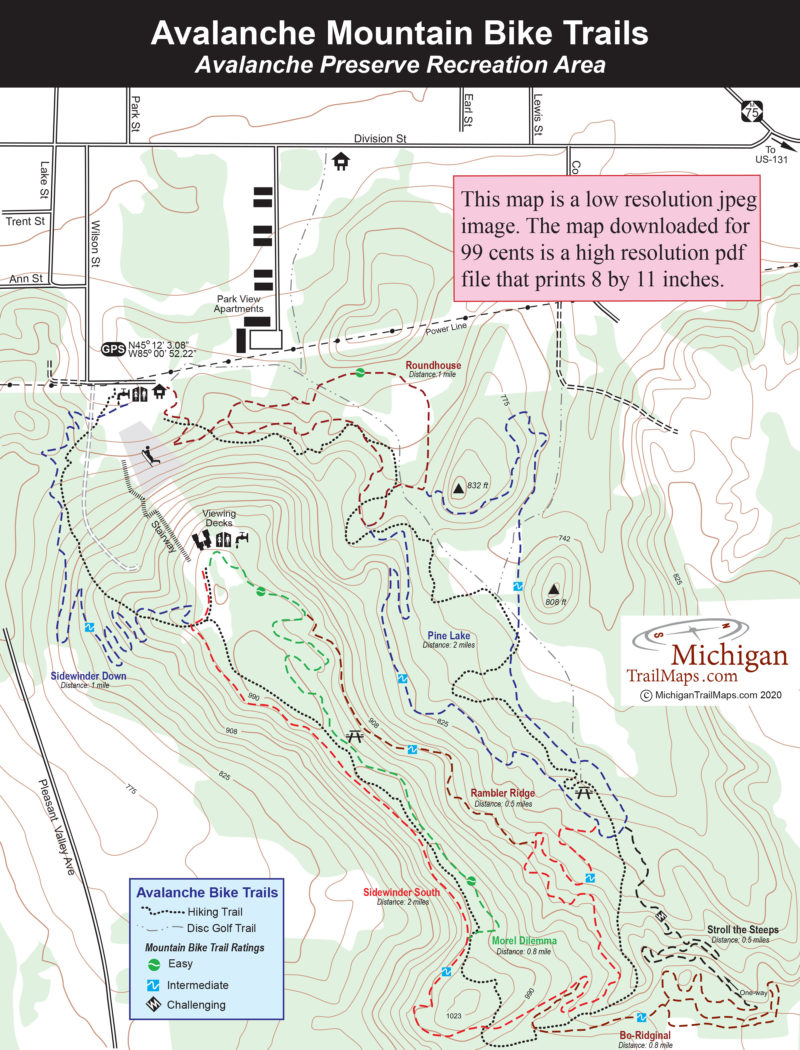
The mountain bike trails at Avalanche Preserve Recreation Area were totally redesigned by the Top of Michigan Mountain Bike Association who transformed a 4.2-mile loop into a series of eight...
More Info

32911 Willow Road
New Boston, MI 48164 US

Phone: (800) 477-3182
Region: Southeast
Website

Of the four interpretive trails Long Bark is the longest at 2 miles and the most interesting walk, as a portion of it follows the Huron River. The theme of the trail is forest ecology, and its 15...
More Info

Forest Highway 9300
Marenisco, MI US

Phone: (906) 358-4724
Region: Western Upper Peninsula

Even in Michigan mountaintop camping is possible. There are many places scattered across the Upper Peninsula where you can pitch a small tent on knobs and open ridges and then spend an evening...
More Info

800 East Lakeshore Drive
Houghton, MI 49931 US

Phone: (906) 482-0984
Region: Western Upper Peninsula
Website

Isle Royale is one of the most unusual national parks, not just in Michigan or the Midwest but in the country. It is one of the smallest at only 210 square miles and has one of the lowest numbers...
More Info

800 East Lakeshore Drive
Houghton, MI 49931 US

Phone: (906) 482-0984
Region: Western Upper Peninsula
Website

The Greenstone Ridge, the backbone to Michigan’s unique island national park, is also responsible for the state’s best long distance hike; the 42.5-mile Greenstone Ridge Trail. This is the trail...
More Info

800 East Lakeshore Drive
Houghton, MI 49931 US

Phone: (906) 482-0984
Region: Western Upper Peninsula
Website

Few backpackers who have walked the Minong Ridge Trail will argue that this 29-mile route is one tough trek. Minong Ridge is not only the most challenging stretch of the Isle Royale’s 161-mile...
More Info

800 East Lakeshore Drive
Houghton, MI 49931 US

Phone: (906) 482-0984
Region: Western Upper Peninsula
Website

The Feldtmann Ridge Trail is another one of Isle Royales great walks, a 10.3-mile trek across the high ridge from Feldtmann Lake to Siskiwit Bay. Because of a major forest fire in the 1930s,...
More Info

800 East Lakeshore Drive
Houghton, MI 49931 US

Phone: (906) 482-0984
Region: Western Upper Peninsula
Website

The Rock Harbor Trail is probably the busiest trail in the park. In midsummer, when the Ranger III pulls in, a stampede often results as hikers scurry down the trail to secure a shelter or campsite...
More Info

800 East Lakeshore Drive
Houghton, MI 49931 US

Phone: (906) 482-0984
Region: Western Upper Peninsula
Website

Originally Native Americans used this route to portage their birchbark canoes across the Island, from Chippewa Harbor to McCargoe Cove. The Civilian Conservation Corps built this trail in the...
More Info

800 East Lakeshore Drive
Houghton, MI 49931 US

Phone: (906) 482-0984
Region: Western Upper Peninsula
Website

Mount Franklin Trail is often the entry ramp for hikers tackling the Greenstone Ridge Trail. From a junction with the Rock Harbor Trail, it runs 2 miles to the ridge, passing the Tobin Harbor Trail...
More Info

800 East Lakeshore Drive
Houghton, MI 49931 US

Phone: (906) 482-0984
Region: Western Upper Peninsula
Website

The trails in and around Rock Harbor and the eastern end of the park offer the most variety of any on Isle Royale. For an afternoon of craggy coastline and pounding Lake Superior surf, the Albert...
More Info

M-109
Glen Arbor, MI US

Phone: (231) 326-5134
Region: Northwest
Website

The first section of the Sleeping Bear Dunes Heritage opened in 2012 to rave reviews. This 4.3-mile segment is anchored at one end by charming Glen Arbor and at the other end by the popular Dune...
More Info

6585 Lake Harbor Rd
Muskegon, MI 49441 US

Phone: (231) 798-3711
Region: Lake Michigan

The "Dune Climb Stairway" at P. J. Hoffmaster State Park is no easy climb. It's 193 steps to the end, a viewing platform on top of a dune, 190 feet above the lake. So tiring is the climb for some...
More Info

6585 Lake Harbor Rd
Muskegon, MI 49441 US

Phone: (231) 798-3711
Region: Lake Michigan

The best place to learn and study about Michigan's amazing sand dunes is at P. J. Hoffmaster State Park, where you can combine a visit to the Gillette Visitor Center, Michigan’s Sand Dune...
More Info

Thornton Road
Stevensville, MI 49127 US

Phone: (269) 426-4013
Region: Lake Michigan

Grand Mere State Park is a 985-acre unit in Berrien County that lacks the amenities found in most other state parks along Lake Michigan, including a campground and even direct access to its mile of...
More Info

239 Commerce Blvd.
Gaylord, MI 49735 US

Phone: (800) 345-8621
Region: Northwest

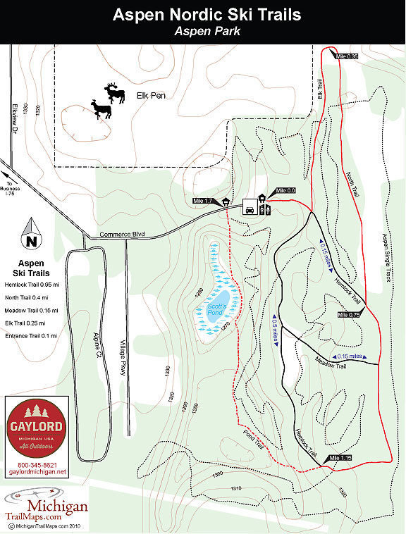
There is great cross-country skiing all around the city of Gaylord and right in the middle of it as well. Aspen Park is a 100-acre city of Gaylord park whose rolling terrain of hardwoods and...
More Info

Wildwood Road
Indian River, MI US

Phone: (989) 732-3541
Region: Northwest

Located in the upland forests along the hilly border of Cheboygan and Emmet Counties, Wildwood Hills Pathway is an 11-mile trail system of three loops that is true to its name. The pathway winds...
More Info

Boyne City-Charlevoix Road
Boyne City, MI US

Phone: (231) 347-0991
Region: Northwest
Website

Tucked away in the ridges above Lake Charlevoix is Nathan Barry Driggers Memorial Preserve, a 75-acre tract with a colorful history that is now owned and managed by the Little Traverse...
More Info

09223 McSauba Rd
Charlevoix, MI 49720 US

Phone: (231) 547-3267
Region: Northwest
Website

Named after a local Indian chief, who probably never downhilled in his life, Mt. McSauba Recreation Area dates back to 1956 when 10 fathers approached city officials about starting a ski club to...
More Info

Sand Hill Trail
Black River, MI US

Phone: (989) 724-5126
Region: Lake Huron (Includes the Thumb)
Website

What visitors see first at Negwegon State Park is only 50 yards from the parking area; a crescent-moon bay framed in by a sandy shoreline and the turquoise waters of Lake Huron and unmarred by...
More Info

17030 Bush Rd.
Chelsea, MI 48118 US

Phone: (734) 475-3170
Region: Heartland
Website

Located among the rolling hills of Waterloo Recreation Area, between Jackson and Ann Arbor, is the Gerald E. Eddy Discovery Center. Originally a nature center that was closed due to state budget...
More Info

1775 Port Austin Road
Port Austin, MI 48467 US

Phone: (989) 738-8663
Region: Lake Huron (Includes the Thumb)

The Campers Trail is the most scenic path in Port Crescent State Park. The trail, a 2.3-mile loop with a 0.3-mile cutoff spur, lies in an area of the park completely surrounded by water, with the...
More Info

River Road
Oscoda, MI US

Phone: (989) 362-8961
Region: Lake Huron (Includes the Thumb)
Website

Strung along the towering bluffs above the Au Sable River is the Highbanks Trail, a skiing and hiking route that was developed through the Corsair Ski Council and the Huron National Forest. This is...
More Info

Monument Road
Tawas City, MI US

Phone: (989) 362-2001
Region: Lake Huron (Includes the Thumb)
Website

The first hill was a gentle slope, the second hill long and twisty. Before we had a chance to catch our breath we were speeding down a third hill, a short but steep run. Wham! Bam! Thank you...
More Info

850 West Osterhout Rd
Portage, MI US

Phone: (269) 329-4522
Region: Heartland
Website

Bishops Bog Preserve Trail, a 1.2-mile, point-to-point trail with much of it a floating trail, is part of the Portage South-Central Greenway, a series of five parks that total 483 acres and are...
More Info

2104 S. Briggs Rd
Middleville, MI 49333 US

Phone: (269) 795-9081
Region: Heartland

The rugged terrain, inland lakes, interesting bogs, and unusual depressions known as Devil’s Soup Bowls provide Yankee Springs Recreation Area with ideal hiking qualities. Its location, almost...
More Info

Reserve Road
Houghton Lake, MI US

Phone: (989) 275-5151
Region: Heartland

Lost Twin Lakes is a 3.4-mile loop that was built in the mid-1980s. It remained a soggy, lightly-used pathway until 1999 when members of Boy Scout Troop 944 turned the trail into an Eagle Scout...
More Info

3351 Mundy Rd
White Lake, MI 49349 US

Phone: (231) 652-9298
Region: Heartland
Website

The Birch Grove Schoolhouse wasbuilt in the late 1870s for students buttodayserves as a pleasant place to stay for hikers and backpackers walking the Birch Grove Trail - North Country Trail (NCT)...
More Info

Elm Valley Road
Sawyer, MI 49125 US

Phone: (269) 426-4013
Region: Lake Michigan

In1879 and only seven years after the countrys first national park, Yellowstone, was established, Edward K. Warrenwaspurchased Warren Woods. Warrenat the time was apartner of a general store in...
More Info

138th Avenue
Saugatuck, MI 49453 US

Phone: (269) 637-2788
Region: Lake Michigan

Saugatuck Dunes State Park’s 14-mile network of footpaths is divided into three basic loops referred to on park maps as North Trail, Beach Trail, and South Trail. All are wide paths and well marked...
More Info

3560 Memorial Dr.
Muskegon, MI 49445 US

Phone: (231) 744-3480
Region: Lake Michigan

Often overshadowed by the hiking at P. J. Hoffmaster State Park,Muskegon State Parks 12-mile trail system isno less impressive than its better known sisterparkjust to the south of it.This hike is a...
More Info

1687 M-119
Petoskey, MI 49770 US

Phone: (231) 348-8280
Region: Northwest
Website

One of the most beautiful paved paths in Michigan, the 23-mile Little Traverse Wheelway provides cyclists, inline skaters, walkers and joggers with a smoothpath, incredible scenery and a...
More Info

Reynolds Road
Lake Ann, MI US

Phone: (231) 922-5280
Region: Northwest

Lake Ann Pathway lies in the Pere Marquette State Forest and is known primarily as an excellent Nordic ski trail, featuring many loops and a rolling terrian. What started out as an interpretive...
More Info

M-72
Grayling, MI US

Phone: (989) 826-3252
Region: Northwest

Most of the people who know and visit Wakeley Lake are anglers looking for a quality fishing experience. Because of special regulations such as walk-in access, the lake has developed a loyal...
More Info

M-37
Traverse City, MI US

Phone: (231) 223-7322
Region: Northwest
Website

Old Mission Peninsula is20-mile long finger that splits Grand Traverse Bay in half and is best known for its cherry orchards and vineyards. But at the tip of it are a pair of parks that combine for...
More Info

M-23
Rogers City , MI 49779 US

Phone: (989) 734-2543
Region: Lake Huron (Includes the Thumb)
Website

Conveniently located right on US-23, the main route up the sunrise side of Michigan, Thompson’s Harbor is an undeveloped and lightly used state park that contains miles of spectacular Lake Huron...
More Info

N8391 Sand Point Rd
Munising, MI 49862 US

Phone: (906) 387-3700
Region: Eastern Upper Peninsula
Website

The towering sandstone cliffs known as the Pictured Rocks rarely fails to impress whoever passes through this far north. First it was Ojibway tribes who would honor the spirits of such a grand...
More Info

1505 Sand Point Rd
Munising, MI 49862 US

Phone: (906) 387-3700
Region: Eastern Upper Peninsula
Website

In one of the most spectacular regions of the state, Pictured Rocks National Lakeshore, you have one of the most spectacular paths to hike, the Lakeshore Trail. The 42.4-mile trail, part of the...
More Info

4490 Beach Rd.
Cheboygan, MI 49721 US

Phone: (231) 627-2811
Region: Lake Huron (Includes the Thumb)
Website

Acre for acre, Cheboygan State Park might be one of most underused units in the Lower Peninsula, a park that contains almost 5 miles of Great Lakes shoreline yet attracts less than 50,000 visitors...
More Info

M-22
Empire, MI US

Phone: (231) 326-5134
Region: Northwest
Website

Platte Plains Trail isa 15-mile network of trails with four trailheads and a walk-in campground. The shortest route to White Pine Campground is a 1.2-mile walk that begins at the end of Peterson...
More Info

Lake Michigan Road
Manistee, MI US

Phone: (231) 723-2211
Region: Lake Michigan
Website

With the Michigan Wilderness Act of 1987, the federal government declared the Nordhouse Dunes area of the Manistee National Forest a wilderness, the only area designated as such in the Lower...
More Info

Thoreson Road
Glen Arbor, MI US

Phone: (231) 326-5134
Region: Northwest
Website

Bay View Trail in Sleeping Bear Dunes National Lakeshore is better known as a destination for cross-country skiers than hikers, primarily because of its link to Homestead Resort. During the summer,...
More Info

Traverse Bay Road
Torch Lake, MI US

Phone: (231) 599-2036
Region: Northwest
Website

Torch Bay Nature Preserve is a leg stretcher. Located just off US-31 between Elk Rapids and Charlevoix, the 40-acre preserve is overlooked by most speeding their way north despite its brown sign...
More Info

Old Dixie Highway
Atwood, MI US

Phone: (231) 533-6265
Region: Northwest
Website

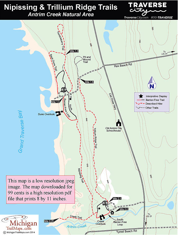
Antrim Creek Natural Area is a 156-acre tract that lies just south of the Charlevoix/Antrim County Line and only 1.5 miles from US-31. Its most notable feature is the nearly one mile of Grand...
More Info

1031 W. Dexter Trail
Mason, MI 48854 US

Phone: (517) 676-2290
Region: Heartland
Website

Kitty corner to the Ingram Conservation Center is a working farm called Rolling View. How appropriate.In the agricultural heart of Ingham County, the Ingram Conservation District property is a...
More Info

Sturgeon Valley Road
Vanderbilt, MI 49795 US

Phone: (989) 983-4101
Region: Northwest

Pigeon Bridge Campground in the Pigeon River Country State Forest is frequented by hikers as it serves as the trailhead for the Shingle Mill Pathway, a system of five loops that passes through some...
More Info

16th Avenue
Sault Ste. Marie, MI 49799 US

Phone: (906) 635-5281
Region: Eastern Upper Peninsula
Website

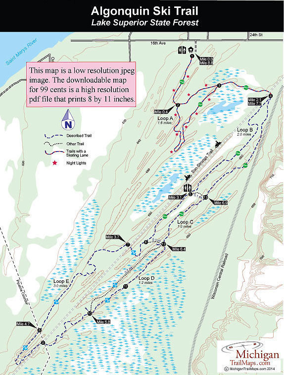
Although located in Lake Superior State Forest and groomed by the Michigan DNR, the Alognquin Cross County Ski Trail is a community trail. After the DNR built the 9-mile pathway in 1987, a surge of...
More Info

8765 Hammel Rd.
Brighton, MI 48116 US

Phone: (734) 426-8211
Region: Southeast
Website

When it is cold in Southeast Michigan but theres no snow serious Nordic skiers head to Huron Meadows Metropark for a workout on Bucks Run.In 2012 the Huron-Clinton Metropark in Livingston County...
More Info

Guernsey Lake Road
Traverse City, MI US

Phone: (231) 922-5280
Region: Northwest

You dont have to go far to replace the traffic, summer crowds, or the relentless commercialization of Traverse City with woods and a bit of quiet. A short drive but a world away - from northwest...
More Info

Broomhead Road
Traverse City, MI US

Phone: (231) 922-5280
Region: Northwest

In the summer there are eight ways to access the 12.3 miles of trails in the Sand Lakes Quiet Area. But what are forest roads in July are snowmobile trails in January or two-tracks covered with so...
More Info

M-37
Traverse City, MI US

Phone: (231) 223-7322
Region: Northwest
Website

The 62-acre Pelizzari Natural Area is a mix of woodlands, meadows, wetlands and shoreline in the southern end of Peninsula Township.  Remnants of the farm fields and orchards are still evident, but...
More Info

6500 Alden Hyw
Bellaire, MI 49615 US

Phone: (231) 533-8314
Region: Northwest
Website

Grass River has nine trails that total 7.5 miles including a Rail-Trail bisecting the natural area. Most of the paths are classified as Upland Trails and wind through forests that range from pines...
More Info

Ranch Rudolf Road
Traverse City, MI US

Phone: (231) 922-5280
Region: Northwest

In 1990s Muncie Lakes Pathway was a battlefield over trail use conflicts, with equestrians and mountain bikers and Nordic skiers and snowmobilers waging war. Today the 9.8-mile trail system is one...
More Info

1785 N. East Silver Lake Rd
Traverse City, MI 49684 US

Phone: (231) 941-1620
Region: Northwest
Website

The Silver Lake Recreation Area is a 84-acre park in Garfield Township with a split personality. The east half of the recreation area has the usual park-like amenities; tennis and basketball...
More Info

Old US-131 & US-131
Fife Lake, MI US

Phone: (866) 445-3628
Region: Northwest
Website

To order the new17- by 11-inch trail mapto the Fife Lake Loop Trail click onthe MichiganTrailMaps.coms eshop.Michigans newest backpacking adventure is the result of the Grand Traverse Hiking Club...
More Info

Mayfield and Wadsworth Roads
Mayfield, MI US

Phone: (231) 941-0960
Region: Northwest
Website

Half hidden in a rugged woods east of Mayfield is East Creek Reserve, a lightly used park that includes ridges that rise almost 140 feet above the scenic Boardman River tributary. The 560-acre...
More Info

1450 Cass Rd.
Traverse City, MI 49685 US

Phone: (231) 941-0960
Region: Northwest
Website

The northern half of the 525-acre Natural Education Reserve includes the short Fox Den Trail, and Sabin Pond and Beaver Pond Trails which merge into each other and are anchored by the Boardman...
More Info

Beitner Road
Traverse City, MI US

Phone: (231) 941-0960
Region: Northwest
Website

The 525-acre Natural Education Reserve is a long, narrow preserve that includes more than 5 miles of the Boardman River. North of Cass Road is the Boardman Valley and the Sabin Pond Trails and the...
More Info

Pyatt Road
Traverse City, MI US

Phone: (231) 929-7911
Region: Northwest
Website

Located just off Bowers Harbor in the heart of Old Mission Peninsula, Pyatt Lake represented one of the most botanically diversed, privately-owned properties in the region. At times locals referred...
More Info

M-22
Leland, MI US

Phone: (231) 256-9669
Region: Northwest
Website

The views are what attract most hikers to this 40-ace preserve but the flora can be fascinating. In the spring, the forest is covered by vast swaths of wildflowers such as trillium and columbine....
More Info

Ranch Rudolf Road
Traverse City, MI US

Phone: (231) 941-0960
Region: Northwest
Website

Brown Bridge Quiet Area is a 1,310-acre preserve located 11 miles southeast of Traverse City and is the result of two monumental events; the year they built the Brown Bridge Dam and the year they...
More Info

M-22
Leland, MI US

Phone: (231) 256-9665
Region: Northwest
Website

Clay Cliffs Natural Area is another one of those wonderful Leelanau Conservancy preserves that is small, easy to hike and has a trail system that leads to a stunning view of Lake Michigan. Wedged...
More Info

M-22
Leland, MI US

Phone: (231) 256-9665
Region: Northwest
Website

At 342 acres, Houdek Dunes is Leelanau Conservancy’s second largest and most diverse preserve. The landscape ranges from hardwood forests featuring some of the largest white birch trees in northern...
More Info

Kehl Lake Road
Northport, MI US

Phone: (231) 256-9665
Region: Northwest
Website

The 279-acre Kehl Lake Natural Area north of Northport features 2,500 feet of undeveloped shoreline along the 74-acre lake, paths that wander through an extensive hardwood-conifer swamps and...
More Info

Green Point Road
Frankfort, MI US

Phone: (231) 929-7911
Region: Northwest
Website

Sand dunes, a shipwreck and, if the evening is clear, a sunset over Lake Michigan; Green Point Nature Preserve is one of Grand Traverse Regional Land Conservancy’s most impressive efforts. The...
More Info

Pierce Stocking Drive & M-109
Empire, MI US

Phone: (231) 326-5134
Region: Northwest
Website

Cottonwood Trail is worthy of having a trailhead along framed Pierce Stocking Drive, featuring several scenic viewing points of its own. The 1.7-mile loop winds through the perched dunes above the...
More Info

Stover Road
Bellaire, MI US

Phone: (231) 533-8363
Region: Northwest
Website

Since the late 1990s, Cedar River Natural Area has been a protected and quiet place to soak in the natural world, from wildlife to wildflowers. Some of its trails have been there even longer but...
More Info

Swamp Road
Elberta, MI US

Phone: (231) 929-7911
Region: Northwest
Website

Anchoring the northeast corner of Arcadia Dunes-C.F. Mott Nature Preserve, more than 4 miles from Lake Michigan, Petes Woods lacks the impressive dunes or views of Baldy Trails or the miles of...
More Info

Esch Road
Empire, MI US

Phone: (231) 326-5134
Region: Northwest
Website

Officially, Otter Creek is a 4.6-mile loop and part of the Platte Plains Trail, a nearly 15-mile network that stretches from the Platte River Campground to Esch Road and includes four trailheads....
More Info

M-22
Arcadia, MI US

Phone: (231) 929-7911
Region: Northwest
Website

Located in Manistee County, the 400-acre Arcadia marsh borders Arcadia Lake and is fed by Bowens Creek. Restoration began in 2010 after Grand Traverse Regional Land Conservancy acquired 155 acres...
More Info

M-22 & Norman Road
Arcadia, MI US

Phone: (231) 929-7911
Region: Northwest
Website

Complementing Dry Hill Trails in Arcadia Dunes-C.S. Mott Nature Preserve and integrated with Abbey’s Woods is Camp Arcadia Trail. Originally Camp Trail was laid out along fairly level terrain,...
More Info

M-22
Elberta, MI US

Phone: (231) 929-7911
Region: Northwest
Website

Established in 1991 by the Grand Traverse Regional Land Conservancy, Upper Herring Lake Nature Preserve is a180-acre tract featuringa nearly mile-long trail that winds through five habitats: old...
More Info

Herron Road (County Road 604)
Elberta, MI US

Phone: (231) 929-7911
Region: Northwest
Website

Fruithaven is linked with GTRLC’s Upper Herring Lake Nature Preserve — together they protect 256 acres of the Herring Lakes Watershed. Other than an old farm field and the hardwood wetlands in the...
More Info

10th Street & Main Street
Frankfort, MI US

Phone: (800) 882-5801
Region: Northwest
Website

Built after the Michigan DNR purchased the abandoned rail corridor in 1998, the Betsie Valley Trail extends 22 miles from Frankfort to Thompsonville, passing through Beulah and Elberta and near...
More Info

Mollineaux Road
Elberta, MI US

Phone: (231) 929-7911
Region: Northwest
Website

In 1998, with the help of the Grand Traverse Regional Land Conservancy, Benzie County purchased 66 acres on Railroad Point, the largest undeveloped parcel remaining on Crystal Lake. Railroad Point...
More Info

M-22
Elberta, MI US

Phone: (231) 929-7911
Region: Northwest
Website

Tiny Elberta, population 372, is located on a small peninsula, surrounded by Lake Michigan to the west, Betsie Lake to the north and Betsie River to the east. Anchoring the village to the south is...
More Info

Boon and Seeley Roads
Cadillac, MI US

Phone: (231) 775-9727
Region: Northwest
Website

Sometimes you have to drive five or six hours to the Upper Peninsula to find enough snow to justify stepping into your Nordic skis. And sometimes Heikki Lunta is smiling down on you and all you...
More Info

Forest Haven Drive & M-22
Glen Arbor, MI US

Phone: (231) 326-5134
Region: Northwest
Website

In a region that already boasts some of the states most scenic paths, Sleeping Bear Heritage Trail is destined to be the crowning jewel when its finished. The proposed 27-mile trail through the...
More Info

Cherry Bend Road
Traverse City, MI US

Phone: (231) 941-4300
Region: Northwest
Website

The Leelanau Trail officially extends from Carter Road in the Greilickville area of Traverse City to Dumas Road on the north side of Suttons Bay. For many, the trail is a 14-mile ride from the...
More Info

M-22
Empire, MI US

Phone: (231) 256-9665
Region: Northwest
Website

The 110-acre Chippewa Run Natural Area doesn't have sand dunes or long stretches of Lake Michigan shoreline but does feature an interesting history and a variety of habitats that make for excellent...
More Info

County Road 629 and Cathead Bay Drive
Northport, MI US

Phone: (231) 256-9665
Region: Northwest
Website

Leelanau State Park and Lighthouse West Natural Area preserve 230 acres of the tip of the Leelanau Peninsula, which includes the historic Grand Traverse Lighthouse.  But the bulk of that, along...
More Info

Cherry Bend Road (County Road 633)
Traverse City, MI US

Phone: (231) 256-9665
Region: Northwest
Website

DeYoung Natural Area is a work in progress but hikers already have more than 2 miles of trail to explore. On the east side of Cherry Bend Road is the Cedar Forest Trail that makes for a loop of...
More Info

Point Betsie Road
Frankfort, MI US

Phone: (517) 316-0300
Region: Northwest
Website

Point Betsie is more than a picturesque lighthouse or a place to watch sunsets. It is also a natural wonder, a dynamic mosaic of shifting sand dunes and Lake Michigan shoreline. The Michigan...
More Info

M-22
Leland, MI US

Phone: (231) 256-9665
Region: Northwest
Website

Swanson Preserve covers 83 acres and includes more than 2,000 feet of natural wooded shoreline near the east end of Little Traverse Lake, the fragile wetlands that are critical to the lake’s high...
More Info

Lime Lake Road
Leland, MI US

Phone: (231) 256-9669
Region: Northwest
Website

Teichner Preserve has 41 acres, includes 200 feet of undeveloped shoreline on Lime Lake and forested wetlands that contain giant elms and chestnuts, rare trees most likely planted by early...
More Info

1687 M-119
Petoskey, MI 49770 US

Phone: (231) 348-8280
Region: Northwest
Website

Formed in 1854, the Grand Rapids and Indiana Railroad began in Richmond, Indiana and reached the Straits of Mackinac in 1882 when the segment known as the Fishing Line was opened from Petoskey to...
More Info

M-119
Petoskey, MI US

Phone: (231) 348-8280
Region: Northwest
Website

The North Western State Trail the Fishing Line portion of the Grand Rapids Indiana Railroad from the 1880s extends 32 miles from near Petoskey to Mackinaw City. But the crowning jewel of the...
More Info

Wheeler Road
Glen Arbor, MI US

Phone: (231) 256-9665
Region: Northwest
Website

Located almost due east of Glen Arbor and within a mile of Sleeping Bear Dunes National Lakeshore in three different directions, Krumwiede is Leelanau Conservancy’s first forest reserve. Winding...
More Info

534 W. Grand River Ave
Okemos, MI US

Phone: (517) 853-4608
Region: Heartland
Website

This 74-acre woodlot was originally called Van Atta Woods Park when the initial 62 acres were purchased by Meridian Township in 1973 followed by additional enlargements over the years. In 2009 when...
More Info

Frost Street
Dowagiac, MI US

Phone: (517) 655-5655
Region: Lake Michigan
Website

Often referred to by the Michigan Nature Association as its jewel in the crown, Dowagiac Woods is the largest MNA sanctuary in the Lower Peninsula. The 384-acre wooded preserve is located just west...
More Info

M-97 & Sunset Drive
Roscommon, MI US

Phone: (989) 275-5151
Region: Northwest

The Red Pine Natural Area covers 164 acres, but it is the 34-acre grove of virgin pines in the middle, most of them red pine, that makes the preserve so unusual. Thestand of old-growth pine is...
More Info

Industrial Park Drive
Grayling, MI 49738 US

Phone: (800) 937-8837
Region: Northwest
Website

To reach Beal Plantation you head east on M-72 and just beyond the I-75 overpass turn into the Grayling Industrial Park.Within this cluster of warehouses, offices and manufacturing plants, across...
More Info

33303 Headquarters Rd
Ontonagon, MI 49953 US

Phone: (906) 885-5275
Region: Western Upper Peninsula

Most people follow the Big Carp River Trail in Porcupine Mountains Wilderness State Park from east to west. Theybegin the day on a high rocky bluff overlooking the rugged landscape of an ancient...
More Info

County Road F-32
Harrisville, MI US

Phone: (989) 362-8961
Region: Lake Huron (Includes the Thumb)
Website

True to its name, Hoist Lakes Foot Travel Area is indeed a place for foot travel whether your feet are strapped to snowshoes or cross-country skis in the winter or are in hiking boots the rest of...
More Info

33303 Headquarters Rd
Ontonagon, MI 49953 US

Phone: (906) 885-5275
Region: Western Upper Peninsula

This is the crowning jewel of trails not only in the Porkies but in all of Michigan and possibly in the Midwest. The Escarpment combines a high rocky bluff and alpine-like vistas with views of the...
More Info

33303 Headquarters Rd
Ontonagon, MI 49953 US

Phone: (906) 885-5275
Region: Western Upper Peninsula

The Overlook Trail offers one of the few loops into the rugged interior of the park that is under 10 miles in length, making it an ideal dayhike for those with only a few hours left on their...
More Info

County Road 519
Wakefield, MI US

Phone: (906) 885-5275
Region: Western Upper Peninsula

The East River Trail and the West River Trail are actually two separate paths but when combined, as they usually are, they form another scenic loop in the Porkies and the best trek for families...
More Info

M-72
Mio, MI US

Phone: (989) 826-3252
Region: Lake Huron (Includes the Thumb)
Website

Wolf Creek is described by the National Forest Service as a semi-primitive experience. Yet its main trailhead is located right in the heart of Mio, Michigan. This is an unusual trail to say the...
More Info

33303 Headquarters Rd
Ontonagon, MI 49953 US

Phone: (906) 885-5275
Region: Western Upper Peninsula
Website

Porcupine Mountains Wilderness State Park, the beloved Porkies to many backpackers, is not only Michigan’s largest state park at 59,020 acres but it’s also the most rugged and the wildest. The...
More Info

Cauchy Road
Mio, MI US

Phone: (989) 826-3252
Region: Lake Huron (Includes the Thumb)

A hidden gem in the woods. Loud Creek Cross-Country Ski Trail dates back to 1984 when a group of locals approached the Huron National Forest rangers in Mio about building a trail system for their...
More Info

South Boundary Road
Ontonagon, MI US

Phone: (906) 885-5275
Region: Western Upper Peninsula

Lost Lake Trail extends from South Boundary Road to Government Peak Trail and along the way passes a yurt, a backcountry campsite and, of course, its namesake lake; a small, remote, and beautiful...
More Info

Summit Peak Road
Ontonagon, MI US

Phone: (906) 885-5275
Region: Western Upper Peninsula

These two trails plus a portion of Little Carp River Trail form a pleasant half-day hike along a route that is scenic but not nearly as heavily traveled during the summer as the Escarpment or the...
More Info

M-72
Curran, MI US

Phone: (989) 739-0728
Region: Lake Huron (Includes the Thumb)

To order a Reid Lake Foot Travel Area trail mapclick here.Reid Lake is a lovely little body of water that was privately owned until 1966 with some of the surrounding land still being farmed in the...
More Info

Summit Peak Road
Ontonagon, MI US

Phone: (906) 885-5275
Region: Western Upper Peninsula

The North and South Mirror Lake Trails provide a route that crosses the heart of the Porkies, beginning from Summit Peak Road and ending at the Lake of the Clouds Overlook. The highest point is...
More Info

South Boundary Road
Wakefield, MI US

Phone: (906) 885-5275
Region: Western Upper Peninsula

Pinkerton Trail is the shortest route to the cabins and campsites near the mouth of the Big Carp River, a popular destination for many hikers. Others choose Pinkerton Trail to bypass the rugged...
More Info

33303 Headquarters Rd
Ontonagon, MI US

Phone: (906) 885-5275
Region: Western Upper Peninsula

Cross Trail is probably the least traveled route in the park. It connects the Lake Superior Trail at the mouth of the Big Carp River with the Little Carp River Trail near Greenstone Falls. It is a...
More Info

South Boundary Road
Ontonagon, MI US

Phone: (906) 885-5275
Region: Western Upper Peninsula

When the water is up or during spring runoff, there is no finer trail for waterfall lovers than the Union Mine Trail. But its a great walk any time of the year for those intrigued by the copper...
More Info

South Boundary Road
Ontonagon, MI US

Phone: (906) 885-5275
Region: Western Upper Peninsula

The Nonesuch Mine site includes an abandoned copper mine and the remains of a small ghost town in the southeast corner of the Porcupine Mountains State Park, just off South Boundary Road. The mine...
More Info

M-107
Ontonagon, MI US

Phone: (906) 885-5275
Region: Western Upper Peninsula

Correction Line Trail is a well-traveled route that connects Big Carp River Trail, 4 miles from Lake Superior or 5 miles from the Lake of the clouds Overlook, to Mirror Lake. Its commonly used to...
More Info

M-107
Ontonagon, MI US

Phone: (906) 885-5275
Region: Western Upper Peninsula

Deer Yard and Superior loops can be combined for a 3.5-mile ride that will be gentle on the mind and easy on the cardiovascular system. The loop may be limited in mileage but features two of the...
More Info

Chapel Rd
Shingleton, MI 49884 US

Region: Eastern Upper Peninsula

The Lakeshore Trail is one of Michigan's classic backpacking treks, a 42.4-mile walk from Grand Marais to Munising. But if you don't have four to five days to spare or the desire to haul a backpack...
More Info

9791 N Lakeshore Dr
MI 49460 US

Region: Lake Michigan

There is a tendency to visit Kirk Park in the summer and head straight to the beach. You park in the picnic area, jump out of the car and hightail it down a paved path to Lake Michigan where you...
More Info

Eagle Harbor Shortcut Road
Eagle Harbor, MI US

Region: Western Upper Peninsula

In 2001-02 the Nature Conservancy purchased 1,531 acres southeast of Eagle Harbor that included a half mile of shoreline on Lake Bailey, steep wooded slopes and rare plant communities. But the...
More Info

North Union Street
Manchester, MI 48158 US

Region: Southeast

The Leonard Preserve is the largest unit in Washtenaw County's Natural Areas Preservation Program, large enough to include nearly a mile of River Raisin shoreline. Located on the edge of...
More Info

M-72
Traverse City, MI US

Region: Northwest

Hickory Meadows is a classic urban trail system that is perched high above city neighborhoods but bounded on three sides by even taller hills. It offers 2 miles of unpaved paths that wander over...
More Info

3799 Bald Mountain Rd.
Auburn Hills, MI 48326 US

Region: Southeast

Can you escape in Auburn Hills, in the heart of Oakland County’s Automation Alley technology district and home of Chrysler’s world headquarters? You can in the middle of a fall afternoon at Hawk...
More Info

800 East Lakeshore Drive
Houghton, MI 49931 US

Region: Western Upper Peninsula

One of the most popular dayhikes on Isle Royale is the 5.1-mile loop formed by Daisy Farm, Mount Ojibway, and a portion of the Greenstone Ridge Trail. The walk involves climbing several ridges,...
More Info

Riggsville Road
Pellston, MI 49769 US

Region: Northwest

The 10,000-acre University of Michigan Biological Station is spread between Douglas and Burt Lake with most of it open to the public. Spread across the Station is a trail system with the most...
More Info

North Leroy Road
Fenton, MI 48430 US

Region: Southeast

The Dauner Martin Nature Sanctuary doesn’t feature towering dunes, cold-water trout streams or a golden beach along Lake Michigan. But it’s still one of Michigan Nature Association’s most popular...
More Info

800 East Lakeshore Drive
Houghton, MI 49931 US

Region: Western Upper Peninsula

Lane Cove Trail and the campground at its north end are the only avenue hikers have to the Five Fingers of Isle Royale, that special area of long, narrow bays and fiordlike coves. This is an...
More Info

800 East Lakeshore Drive
Houghton, MI 49931 US

Region: Western Upper Peninsula

By renting a canoe or joining the MV Sandy at Rock Harbor Lodge, you can combine a water cruise with hiking and visit some of the most interesting spots on the Island. One of them is Lookout...
More Info

800 East Lakeshore Drive
Houghton, MI 49931 US

Region: Western Upper Peninsula

Ishpeming Trail winds from Malone Bay Campground to Ishpeming Point on the Greenstone Ridge, ascending three major ridges along the way. The steady climb makes this 7.3-mile hike more difficult...
More Info

800 East Lakeshore Drive
Houghton, MI 49931 US

Region: Western Upper Peninsula

The East Chickenbone Trail begins 0.7 mile from McCargoe Cove Camp¬ground and swings around the east end of Chickenbone Lake to the Greenstone Ridge Trail. It is often combined with part of the...
More Info

North Dixboro Road
Ann Arbor, MI 48105 US

Region: Southeast

The adjoining Tom A. Freeman Preserve and Marshall Nature Area create a 138-acre tract of rolling woods on the edge of the village of Dixboro, making the two parks a quick escape from the urban...
More Info

800 East Lakeshore Drive
Houghton, MI 49931 US

Region: Western Upper Peninsula

The Windigo Nature Trail is an easy walk near Windigo and good for loosening up your legs before the boat ride home. The self-guiding trail features 11 interpretive posts that cover everything from...
More Info

800 East Lakeshore Drive
Houghton, MI 49931 US

Region: Western Upper Peninsula

Windigo at the west end of the Island does not feature the number of short trails found in the vicinity of Rock Harbor, but there are still opportunities for overnight excursions and pleasant day...
More Info

800 East Lakeshore Drive
Houghton, MI 49931 US

Region: Western Upper Peninsula

The Feldtmann Lake Trail extends 8.5 miles from Windigo to Feldtmann Lake Campground. It often serves as the first leg of a popular 29.8-mile, three-day loop that includes Feldtmann Ridge Trail,...
More Info

800 East Lakeshore Drive
Houghton, MI 49931 US

Region: Western Upper Peninsula

Rainbow Cove Trail, a mere 0.8 miles long,  serves as both a interesting side trip for backpackers spending the night at the Feldtmann Lake Campground and a portage for kayakers paddling around the...
More Info

800 East Lakeshore Drive
Houghton, MI 49931 US

Region: Western Upper Peninsula

The 4.8-mile Island Mine Trail is an historical walk through much of the park's past. You could probably hike from Siskiwit Bay to the Greenstone Ridge in 3 hours or spend an entire day exploring...
More Info

800 East Lakeshore Drive
Houghton, MI 49931 US

Region: Western Upper Peninsula

Although the 3-mile Tobin Harbor Trail rises and dips a little, it is a wide, dry, and easy path to hike. Many hikers view the trail as a more scenic alternative to the stretch from Rock Harbor...
More Info

800 East Lakeshore Drive
Houghton, MI 49931 US

Region: Western Upper Peninsula

A full day can be spent paddling from Rock Harbor Lodge to Mott Island and hiking the beautiful and little-used Mott Island Trail. The paddle is about 4 miles from Rock Harbor, and in good weather...
More Info

800 East Lakeshore Drive
Houghton, MI 49931 US

Region: Western Upper Peninsula

Beyond Starvation Point the Rock Harbor Trail continues to follow the rugged shoreline of Rock Harbor Inlet. But the western half of the trail, a 3.9-mile segment from Daisy Farm to Moskey Basin,...
More Info

33303 Headquarters Rd
Ontonagon, MI 49953 US

Region: Western Upper Peninsula

Big Hemlock Trail is a 4.5-mile trail that is tracked in winter for skiers. It departs from the Double Trail on the backside of the downhill ridge near Union Spring Trail and ends back at the...
More Info

33303 Headquarters Rd
Ontonagon, MI 49953 US

Region: Western Upper Peninsula

Technically Union Spring Trail is an access route into the park’s interior and not a day hike as it extends 4 miles from South Boundary Road to Government Peak Trail. Along the way it passes the...
More Info

33303 Headquarters Rd
Ontonagon, MI 49953 US

Region: Western Upper Peninsula

The natural features along the 6.9-mile Government Peak Trail are less outstanding than what is seen on the park's other long-distance trails - Lake Superior, Little Carp and Big Carp - and...
More Info

5020 116th Avenue
Allegan, MI 49010 US

Region: Lake Michigan

It’s hard not to love Ely Lake Campground. The rustic facility is managed by Allegan County and features 73 sites spread out in the hardwood forests that enshroud the lake, providing shade in the...
More Info

Big Knob Rd
Nawbinway, MI US

Region: Eastern Upper Peninsula

A “Big Knob” to climb, an assortment of trails to hike, and one of the most beautiful beaches along Lake Michigan. What more could a kid want in a campground? As for the parents, the best part of...
More Info

4590 118th Avenue
Allegan, MI 49010 US

Region: Lake Michigan

Lightly used North Swan Creek trails are located on the north side of the 118th Avenue Bridge dam and form a 5.2-mile loop. They are not marked quite as well as those on the south side thus harder...
More Info

4590 118th Avenue
Allegan, MI 49010 US

Region: Lake Michigan

Spread across the Allegan State Game Area are almost 30 miles of foot trails with the heart of the system centered around Swan Creek and separated by the 118th Avenue dam. To the north is a 5-mile...
More Info

4590 118th Ave
Allegan, MI 49010 US

Region: Lake Michigan

South Swan Creek Loop is part of a 30-mile network of foot trails in Allegan State Game Area and begins and ends at M-118th Avenue dam that actually divides the Swan Creek Trail into two loops....
More Info

6301 Kensington Rd
Brighton, MI 48116 US

Region: Southeast

One of the newest trails in Southeast Michigan is Hickory Ridge Trail that opened in 2017 in Island Lake Recreation Area on the east side of Kensington Road. The 6-mile trail system includes three...
More Info

800 East Lakeshore Drive
Houghton, MI 49931 US

Region: Western Upper Peninsula

The 4-mile stretch of the Greenstone Ridge Trail from Mount Franklin to Sargent Lake is a scenic hike that follows the ridgeline and passes two routes to Daisy Farm Campground. The first is the...
More Info

800 East Lakeshore Drive
Houghton, MI 49931 US

Region: Western Upper Peninsula

Lake Richie is best known as the longest portage on Isle Royale, up to a 2.2-mile trek with a boat over your head to go from Moskey Basin to Lake Richie. Thankfully the trail is somewhat level and...
More Info

800 East Lakeshore Drive
Houghton, MI 49931 US

Region: Western Upper Peninsula

The Greenstone Ridge Trail from Mount Ojibway to the junction with East Chickenbone Lake Campground is a 5.7-mile trek of moderate difficulty along the crest of the ridge. Parts are scenic as the...
More Info

800 East Lakeshore Drive
Houghton, MI 49931 US

Region: Western Upper Peninsula

The Greenstone Ridge Trail from West Chickenbone Lake to Hatchet Lake Campground is a 7.9-mile trek that includes step climb within a mile of the campground that gains 250 feet in less than a half...
More Info

800 East Lakeshore Drive
Houghton, MI 49931 US

Region: Western Upper Peninsula

The 2.6-mile Hatchet Lake Trail connects the Greenstone Ridge with the Minong Ridge and is used by many hikers out of Windigo who want to walk only a portion of the rugged Minong Ridge Trail. It is...
More Info

800 East Lakeshore Drive
Houghton, MI 49931 US

Region: Western Upper Peninsula

The next section of the Minong Ridge Trail, the 12-mile-plus stretch from Todd Harbor to North Lake DeSor, includes a segment that is only moderately difficult followed by the most challenging...
More Info

800 East Lakeshore Drive
Houghton, MI 49931 US

Region: Western Upper Peninsula

The trek from Hatchet Lake to South Lake DeSor via the Greenstone Ridge Trail is a 8.1-mile day that in the first half offer a bit of climbing and some fine views of of Siskiwit Lake, Malone Bay,...
More Info

3749 Whitmarsh Road
Vanderbilt, MI 49795 US

Region: Northwest

Though easy to miss while driving along Whitmarsh Road in Ostego County, the Sturgeon River Preserve is a gem and an enjoyable spot to soak in nature. The heart of the preserve is its namesake...
More Info

2043 Gingell Rd.
Johannesburg, MI 49751 US

Region: Northwest

The Louis M. Groen Nature Preserve, an Otsego County Park in Johannesburg, contains two lakes, 20 miles of trail and a lot of history, including ties to McDonald’s Filet-O-Fish sandwich. The...
More Info

5200 Indian Trail
White Lake, MI 48386 US

Region: Southeast

Indian Springs Metropark offers nearly 12 miles of cross country ski trails on three loops that are groomed and tracked for classic skiers. All three loops begin next to the park office that offers...
More Info

800 East Lakeshore Drive
Houghton, MI 49931 US

Region: Western Upper Peninsula

The Greenstone Ridge Trail from the South Lake Desor Campground to Washington Creek Campground is a long day, a trek of 11.3 miles. For many backpackers, however, this is also their final day so...
More Info

800 East Lakeshore Drive
Houghton, MI 49931 US

Region: Western Upper Peninsula

Although the Minong Ridge Trail from North Lake Desor to Washinton Creek Campground is not as difficult as the previous segments along the Minong Ridge, it is the longest one at 12.6 miles and...
More Info

Grand Lake Road
Alpena, MI US

Region: Lake Huron (Includes the Thumb)

Boosting one of the best trails for young children in Michigan, Besser Natural Area is a small preserve that forms the north end of the Rockport Recreation Area. Along with giant pines, the natural...
More Info

800 East Lakeshore Drive
Houghton, MI 49931 US

Region: Western Upper Peninsula

The southern inland lakes - Lake Whittlesey, Wood Lake, Siskiwit Lake, and Intermediate Lake - do offer one opportunity not found when hiking the Greenstone Ridge Trail or paddling though Rock...
More Info

Baatz and Fritz Rds
Glen Arbor, MI US

Region: Northwest

The Kettles Trail officially opened in 2019 as a 3.4 miles trek through an intriguing and rugged area with numerous kettles along with a jumbled array of ridges, mounds and potholes. The new trail...
More Info

Lutz Rd
MI 48451 US

Region: Southeast

Half hidden in Deerfield Township, bypassed by many looking for a hike, Lutz County Park is one of Livingston County’s most unusual preserves. The 300-acre park just south of the Genesee County...
More Info

Norconk Road
Empire, MI US

Region: Northwest

Treat Farm Trail is a 1.1-mile walk along an old road to the historic Treat Farmstead and then the edge of Empire Bluff for a panoramic view of Lake Michigan. The adventurous can continue by...
More Info

Loosemore Road
Port Austin, MI 48467 US

Region: Lake Huron (Includes the Thumb)

The Huron County Nature Center's Wilderness Bike/Hike Trail is designed for off-road cycling and located less than a half mile from it's walking trail. The series of five loops makes for a 3.7-mile...
More Info

Wheeler Road
Glen Arbor, MI US

Region: Northwest

At more than 1,000 acres, Palmer Woods is by far the Leelanau Conservancy's largest natural area. The Forest Reserve's contiguous hardwood forest stretches more than 2 miles north to south and...
More Info

Wheeler Road
Glen Arbor, MI US

Region: Northwest

East Ridge and Central Ridge Mountain Bike Trails at Palmer Woods Forest Reserve are intermediate flow-style single tracks, allowing riders to weave downhill through a series of berms, rollers and...
More Info

St. Pierre Road
Arcadia, MI US

Region: Northwest

Abby’s Woods is a 145-acre tract wedged between Dry Hill and Camp Arcadia Trails. It features less than 1.5 miles of trail but serves as an important link as it connects two popular mountain bike...
More Info

Herkelrath Road
Onekama, MI US

Region: Northwest

Established in 2013, Portage Point Woods Preserve is a 120-acre tract located in Manistee County and within a quarter mile of the Nature Conservancy’s oldest preserve; Lucia K. Tower. For most...
More Info

M-109
Empire, MI US

Region: Northwest

For most of the year Scenic Drive is true to its name featuring a procession of slow-moving vehicles. But after the first snowfall the road becomes the heart of an 8.75-mile trail system that...
More Info

West Broadway
Suttons Bay, MI US

Region: Northwest

More Info

Christmas Cove Road
Northport, MI US

Region: Northwest

Lamont is part of a string of preserves that create a wildlife corridor across the tip of the Leelanau Peninsula and include Kehl Lake, the Cathead Bay portion of Leelanau State Park and Lighthouse...
More Info

County Road 513
Rapid City, MI US

Region: Eastern Upper Peninsula

Part of the Hiawatha National Forest, Peninsula Point is a noted stopover for the annual monarch butterfly migration and the site of a historic lighthouse. Within it is Peninsula Point Interpretive...
More Info

4785 II Road
Garden, MI 49835 US

Region: Eastern Upper Peninsula

During the summer, Fayette Historic State Park is teeming with tourists and guides in period customs in the old townsite around Snail Shell Harbor. But the rest of the 711-acre park features almost...
More Info

M-77 North
MI US

Region: Eastern Upper Peninsula

The Steeb Pathway is less than a mile long, but it’s best to plan at least a half-day for it. Or even better, make it an overnighter. Its trailhead is located in the East Branch of the Fox River...
More Info

11511 N. Higgins Lake Drive
Roscommon, MI 48653 US

Region: Northwest

The trail system At North Higgins Lake State Park totals almost 9 miles, with the premiere forming 6.5-mile Beaver Creek Loop while cross-over spurs create the 1.5-mile Upland Nature Loop and the...
More Info

1001 Huron St.
Ypsilanti, MI 48197 US

Region: Southeast

At North Bay Park, a small Ypsilanti Township park, you can “walk” across the water, stopping anywhere along the way to enjoy the view, look for wildlife or to fish. That's because almost half of...
More Info

Warning Road
MI 49648 US

Region: Northwest

Located on that strip of land that separates two of Michigan’s largest lakes, Elk and Torch, Maplehurst Natural Area is an unexpected delight to anybody who stumbles across it in rural Antrim...
More Info

9435 N. Cut Rd.
Roscommon, MI 48653 US

Region: Heartland

Cross Country Ski Headquarters is where Nordic skiing begins in Michigan. While other ski centers and trail systems pitch their hilly terrain, Lake Michigan vistas or even a "wilderness-like...
More Info

List of Trails

Trails found: 356
showing 1 through 20 of 356

Algonquin Cross Country Ski Trail

Distance:
Loops of 2.4 to 8.8 miles
Type:
Cross-country skiing, mountain biking
Terrain:
Hardwoods and wetlands
Difficulty:
Easy
Nearest City or Town:
Sault Ste. Marie

Allegan SGA: Ely Lake Trails

Distance:
0.3 mile to 1.5 miles
Type:
Foot path, two-track
Terrain:
Inland lakes, marshes, hardwood forests
Difficulty:
Easy to moderate
Nearest City or Town:
Allegan

Allegan SGA: North Swan Creek Loop

Distance:
5.2-mile loop
Type:
Foot path, two-track
Terrain:
Swan Creek, wetlands
Difficulty:
Moderate
Nearest City or Town:
Allegan

Allegan SGA: South Swan Creek Loop

Distance:
5.8-mile loop
Type:
Foot path
Terrain:
Swan Creek and Swan Creek Pond
Difficulty:
Moderate
Nearest City or Town:
Allegan

Allegan State Game Area

Distance:
0.5 to 14 miles
Type:
Foot trails, cross-country ski trails, mountain bike trails
Terrain:
Swan Creek, inland lakes, wetlands
Difficulty:
Easy to challenging
Nearest City or Town:
Allegan

Antrim Creek Natural Area

Distance:
2.1 miles
Type:
Foot path, Nordic ski trail
Terrain:
Grand Traverse Bay, shoreline dunes
Difficulty:
Easy
Nearest City or Town:
Atwood

Arcadia Dunes: Abby's Woods

Distance:
1.75 miles
Type:
Single track
Terrain:
Coastal forest
Difficulty:
Easy
Nearest City or Town:
Arcadia

Arcadia Dunes: Baldy Trails

Distance:
3.1 miles
Type:
Multi-use trail
Terrain:
Sand dunes
Difficulty:
Easy
Nearest City or Town:
Frankfort

Arcadia Dunes: C.S. Mott Nature Preserve
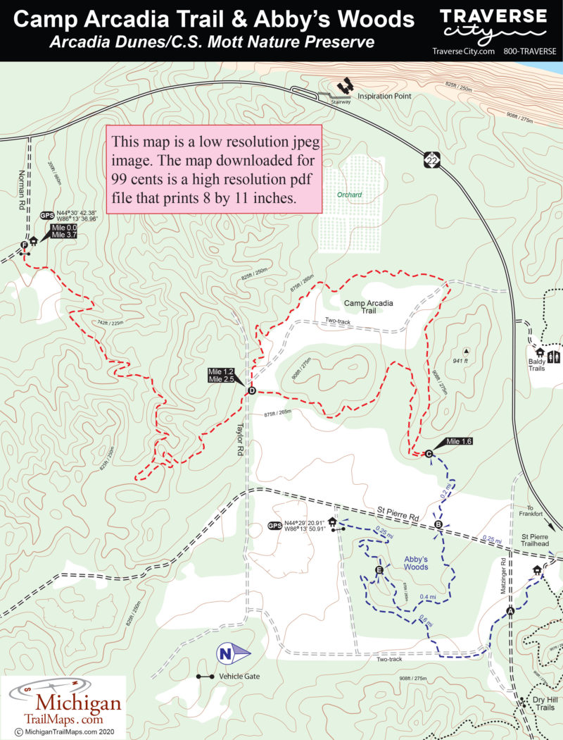
Distance:
1.5 to 10 miles
Type:
Multi-use trails
Terrain:
Sand dunes, forested ridges
Difficulty:
Easy to challenging
Nearest City or Town:
Frankfort

Arcadia Dunes: Camp Trails

Distance:
3.7 miles
Type:
Multi-use trail
Terrain:
Hardwood forests, meadows
Difficulty:
Easy to intermediate
Nearest City or Town:
Arcadia

Arcadia Dunes: Dry Hill Trails

Distance:
2- and 10.7-mile loops
Type:
Mountain bike single track
Terrain:
forested ridges
Difficulty:
Moderate
Nearest City or Town:
Arcadia

Arcadia Dunes: Pete's Woods

Distance:
1.5 miles
Type:
Foot path
Terrain:
Forested ridge
Difficulty:
Easy
Nearest City or Town:
Elberta

Arcadia Marsh Nature Preserve

Distance:
0.9 mile one-way
Type:
Foot path
Terrain:
Wetlands
Difficulty:
Easy
Nearest City or Town:
Arcadia

Aspen Park

Distance:
0.55 to 5.0 miles
Type:
Paved trails, single track
Terrain:
Flat to rolling woods, meadows, Elk pen
Difficulty:
Easy to moderate
Nearest City or Town:
Gaylord

Aspen Park: Aspen Single Track

Distance:
5.0 miles
Type:
Single track
Terrain:
Flat to rolling woods
Difficulty:
Easy to moderate
Nearest City or Town:
Gaylord

Aspen Park: Paved Trails

Distance:
1.65-mile loop
Type:
Paved trails
Terrain:
Woods, meadows, Elk Pen
Difficulty:
Easy
Nearest City or Town:
Gaylord

Aspen Park: Ski Trails

Distance:
1.7 miles
Type:
Groomed classic skiing
Terrain:
Flat to rolling woods
Difficulty:
Easy
Nearest City or Town:
Gaylord

Avalanche Preserve Recreation Area

Distance:
2 to 4.2 miles
Type:
Multi-use Trails
Terrain:
Forested ridge
Difficulty:
Moderate to challenging
Nearest City or Town:
Boyne City

Avalanche Preserve: Hiking Trail

Distance:
2.8-mile loop
Type:
Two-tracks and foot path
Terrain:
Forested ridge
Difficulty:
Moderate
Nearest City or Town:
Boyne City

Avalanche Preserve: Mountain Bike Trail

Distance:
1 to 8 miles
Type:
Single track
Terrain:
Forested ridge
Difficulty:
Easy to challenging
Nearest City or Town:
Boyne City

showing 1 through 20 of 356
Previous page Next page
Michigan TrailMaps.com Michigan's Premier Trail Resource Contact

Trail Mix News

by travel and outdoor writer Jim DuFresne!

Sign Up
Enews Signup
Find a Trail

Find Trails & Maps

Search for Trail
Search by Location