Trail Maps and Guides
Also visit Guidebooks
South Manitou Island – Sleeping Bear Dunes National Lakeshore
|
Classic Trails of Michigan Trail Map and Guide 11 by 17 inches, two-sided Price: $4.95
|
 MichiganTrailMaps.com, your trusted companion for trail information, presents the South Manitou Island trail map and guide. The large format map measures 11 by 17 inches, is printed on durable card stock and is coated to be water resistant. Includes all distance markers, contour lines, walk-in campgrounds, shipwrecks, historic buildings and ruins. Best of all, when folded it fits in your back pocket or the side pouch of your pack. MichiganTrailMaps.com, your trusted companion for trail information, presents the South Manitou Island trail map and guide. The large format map measures 11 by 17 inches, is printed on durable card stock and is coated to be water resistant. Includes all distance markers, contour lines, walk-in campgrounds, shipwrecks, historic buildings and ruins. Best of all, when folded it fits in your back pocket or the side pouch of your pack.
South Manitou’s most impressive features are the perched dunes along its west side that rise more than 400 feet above Lake Michigan… Read More |
North Manitou Island – Sleeping Bear Dunes National Lakeshore
|
Classic Trails of Michigan Trail Map and Guide 11 by 17 inches, two-sided Price: $4.95 |
 North Manitou Island is the newest map from MichiganTrailMaps.com, your trusted companion for trail information. The large format map measures 11 by 17 inches, is printed on durable card stock and coated to be water resistant. Includes all distance markers, contour lines, historic buildings and ruins. Best of all, when folded it fits in your back pocket or the side pouch of your pack. North Manitou Island is the newest map from MichiganTrailMaps.com, your trusted companion for trail information. The large format map measures 11 by 17 inches, is printed on durable card stock and coated to be water resistant. Includes all distance markers, contour lines, historic buildings and ruins. Best of all, when folded it fits in your back pocket or the side pouch of your pack.
Located in Lake Michigan, North Manitou is wild, isolated and remote, qualities that make it the premiere destination for backpackers in Michigan’s Lower Peninsula. The 14,753-acre island is 7.7 miles long, 4.2 miles wide and laced with 30 miles of… ..Read More |
Manistee River Trail & North Country Trail
|
Classic Trails of Michigan Trail Map and Guide 11 by 17 inches, two-sided Price: $4.95 |
 By combing the scenic Manistee River Trail with a portion of the North Country Trail, hikers can enjoy a 23-mile, multi-day trek with backcountry campsites, ridge-top views of the Manistee River and even a waterfall … or two! By combing the scenic Manistee River Trail with a portion of the North Country Trail, hikers can enjoy a 23-mile, multi-day trek with backcountry campsites, ridge-top views of the Manistee River and even a waterfall … or two!
One of Michigan’s newest trails, the 11-mile Manistee River Trail was completed in 1992 and linked to a rugged portion of the North Country by the largest wooden suspension bridge in the Lower Peninsula. The two trails now offer backpackers an ideal loop that begins and ends at Seaton Creek National Forest Campground west of Cadillac and in between skirts an undeveloped, remote stretch of….Read More |
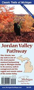
Jordan Valley Pathway Trail Map and Guide
|
Classic Trails of Trail Map and Guide 11 by 17 inches, two-sided Price: $4.95
|
 The Jordan Valley Pathway is the most popular weekend backpacking trips in Michigan’s Lower Peninsula, thanks to its scenery, walk-in campground and the rugged and remote nature of the Jordan Valley. Located north of Mancelona, the 18-mile, two-day pathway is a loop, thus eliminating the need for complicated transportation arrangements, and has enough climbs, especially on the second day, to give anybody a sense of accomplishment. The Jordan Valley Pathway is the most popular weekend backpacking trips in Michigan’s Lower Peninsula, thanks to its scenery, walk-in campground and the rugged and remote nature of the Jordan Valley. Located north of Mancelona, the 18-mile, two-day pathway is a loop, thus eliminating the need for complicated transportation arrangements, and has enough climbs, especially on the second day, to give anybody a sense of accomplishment.
Most of all, the Jordan Valley Pathway is a scenic walk where much f the day is spent either skirting …Read More
|
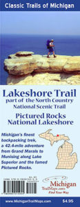
Pictured Rocks Lakeshore Trail – Part of North Country National Scenic Trail
|
Classic Trails of Michigan Trail Map and Guide 11 by 17 inches, two-sided Price: $4.95
|

In one of the most spectacular regions of the state, Pictured Rocks National Lakeshore, you have one of the most spectacular paths to hike and MichiganTrailMaps.com’s newest map, the Lakeshore Trail. For many, the only way to view and appreciate Pictured Rocks’ dramatic scenery is to strap on a pack and hike the 42.4-mile trail that doubles as part of the North Country National Scenic Trail. This is unquestionably one of Michigan’s classic hikes. The trek is a walk between two towns, Grand Marais and Munising, past lighthouses and shipwrecks, giant sand dunes and towering standstone cliffs, beaches both on Lake Superior and 200 feet above it…Read More |
Shingle Mill Pathway – Pigeon River Country
|
Classic Trails of Michigan Trail Map and Guide 11 by 17 inches, two-sided Price: $4.95
|

Created in 1973, the Pigeon River Country State Forest is a rugged 105,049-acre tract located 20 miles north of Gaylord and occupying the high central plateau of the Lower Peninsula. The forest is an outdoor playground crisscrossed with dirt roads, old two-tracks, and trails and dotted with lakes, trout streams and rustic campgrounds. It’s best known as the home of the Michigan elk herd that was reintroduced here in 1918. There are three major hiking trails in the state forest. The best known trail system, popular with mountain bikers and cross-country skiers as well as hikers, is Shingle Mill Pathway with loops of 11, 10, 6, 1.2 and 0.75 miles. Its 10-Mile Loop is ideal for weekend backpackers, a scenic … Read More
|
Fife Lake Loop Trail
|
Classic Trails of Michigan Trail Map and Guide 11 by 17 inches, two-sided Price: $4.95
|

Michigan’s newest backpacking adventure is the result of the Grand Traverse Hiking Club discovering a more scenic route for their segment of North Country Trail (NCT), America’s longest trail spanning 4,600 miles from North Dakota to New York. The original NCT swung north from the Manistee River west of US-131 but in 2010 club members began exploring, the east side of the highway. What they discovered were scenic vistas on river bluffs, crystal clear lakes, towering pines and a much more interesting terrain. The reroute required a year of planning with actual construction of the 12.8-mile trail beginning in 2012. Right from the start it was decided to maintain the original NCT and form a 21-mile loop like the popular Manistee River Trail to the south … Read More
|
Hoist Lakes & Reid Lake Foot Travel Areas
|
Classic Trails of Michigan Full Color Trail Map 11 by 17 inches, two-sided Price: $4.95
|

Hoist Lakes and Reid Lake are foot travel areas in the Huron National Forest west of Harrisville created to provide a quiet oasis from our motorized world. Hoist Lakes Foot Travel Area is a 10,600-acre tract, Reid Lake is 4,000 acres, both have a ban on mountain bikes, horses, vehicles and outboard motors. Between them they feature 30 miles of trails, a handful of walk-in campsites, a dozen lakes and backcountry fishing opportunities… Read More
|

