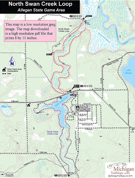
Allegan SGA: North Swan Creek Loop

Buy the $.99 downloadable map!
(This map is not geo-referenced)Trail Details

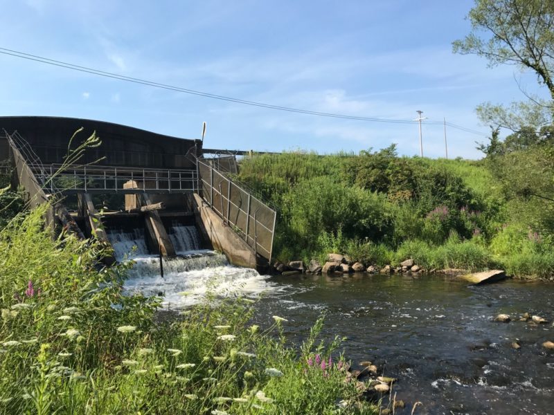
From late March to early May, North Swan Creek Loop is popular with anglers who explore the creek’s pools and runs for spawning steelhead entering from the Kalamazoo River and for brown trout, which are stocked in the creek. Both cold water species are stopped by the 118th Avenue dam. On the other side of the barrier, Swan Creek Pond is a warm-water fishery with good populations of bass, bluegill, crappies, and northern pike.
The Michigan DNR stocks more than 3,000 brown trout annually at the 118th Avenue Dam but also further upstream at the 116th Avenue and 112th Avenue. In the Kalamazoo River near Saugatuck more than 30,000 chinook salmon are planted and eventually they return to the river system, including Swan Creek, to spawn.
The following description follows North Swan Creek Loop in a counter clockwise direction. The east side trail stays closer to the creek and involves more climbing as it skirts the bluffs. The west side of the loop remains mostly on the edge of the bluff and is an easier hike. In places the west side trail parallels two-tracks that doubles as a ski trail in the winter and can be used as an alternative route back to 118th Avenue. Ski trails are marked with blue blazes, the hiking trail with yellow blazes.
| Difficulty - Moderate |
| Dog Friendly |
| Foot Path |
| Two-Track |
Geo-referenced maps from MichiganTrailMaps.com range from $1.99 to $2.99 each.
Download the Avenza app from the App Store or Google Play


