
Antrim Creek Natural Area
Buy the $.99 downloadable map!
(This map is not geo-referenced)Trail Details


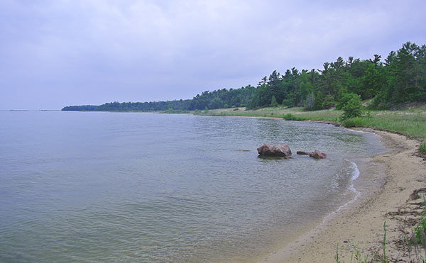
But for the historian and the naturalist the Antrim County park is an intriguing place to take a hike. Antrim Creek is home to an array of natural diversity including hardwood forest, forested wetland, conifer swamp, shrub thicket, meadow, wet meadow and coastal dunes. It supports a wide range of flora and fauna including tow endangered plants; Pitcher's Thistle and Lake Huron Tansy. In the spring wildflower enthusiasts to see Starflower, Indian Pipe, Yellow Trout Lily, Wood Lily, Columbine, Twin Flower, and Jack-In-The Pulpit blooming in all their glory.
The natural area also has a long history beginning with Native Americans using the spot as the closest embarkation point to cross Grand Traverse Bay to the Leelanau Peninsula. In the mid-1800s Antrim City was founded and peaked in 1873 with 200 residents, a school, post office and grist mill. You could catch a stage coach here south to Elk Rapids for $1.50 or north to Charlevoix for a $1. The lumber town was also a regular stop for steamships traveling between Traverse City and Petoskey.
When the timber was depleted in the mid-1880s, Antrim City quickly became a ghost town. In the 1930s the area was the site of Tyrrell’s Vacation Camp and in 1943 the tract purchased by Harry and Eleanor Jones. Over the duration of their 53-year stewardship , the Jones family kept the tract undeveloped and open to locals for swimming, hiking, hunting, fishing, cross country skiing, and snowshoeing. This northern Michigan gem was saved from residential development when Grand Traverse Regional Land Conservancy worked with the Jones family and local officials from Antrim County teamed to purchase the property in 1994 and permanently protect it as the Antrim Creek Natural Area.
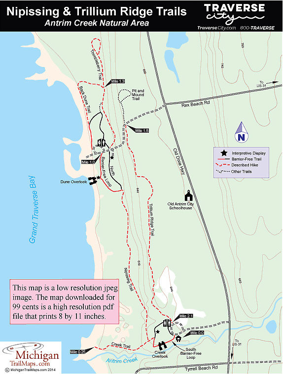
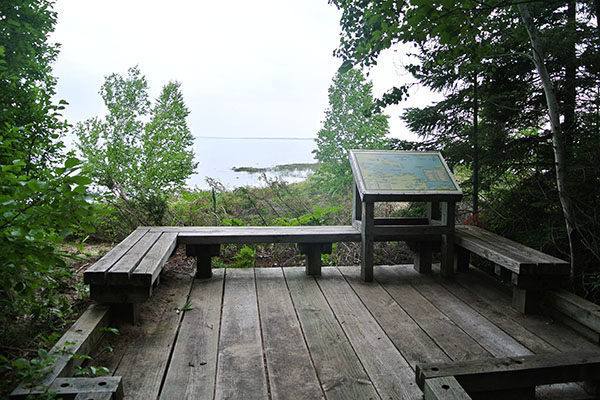
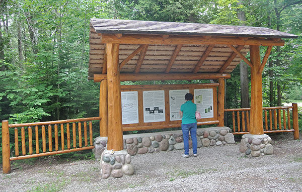
Extending across the park is a 2.5-mile network of trails including more than a half mile of handicap accessible paths and several interpretive stations. The hike described here is a 2.1-mile loop of most of the trail segments beginning at the South Entrance trailhead.
| Difficulty - Easy |
| Foot Path |
Geo-referenced maps from MichiganTrailMaps.com range from $1.99 to $2.99 each.
Download the Avenza app from the App Store or Google Play


