320

Trails Reviewed

Find Trails & Maps

Search for Trail
Search by Location
Search by

Back to listing

Arcadia Marsh Nature Preserve


Buy the Geo-referenced map
for use in the Avenza Maps App

Trail Details

County
Manistee
Regions
Northwest
Latitude
N 44° 29' 20.76"
Longitude
W 086° 13' 51.24"
Distance
0.9 mile one-way
Trail Type
Foot path
Terrain
Wetlands
Difficulty
Easy
Nearest City or Town
Arcadia
(map loads here)
view map
Avenza Maps
Geo-referenced maps from MichiganTrailMaps.com are available through Avenza Maps and range from $1.99 to $2.99 each.

Download the Avenza app from the App Store or Google Play

App Store Google Play

Located in Manistee County, the 400-acre Arcadia marsh borders Arcadia Lake and is fed by Bowens Creek. Restoration began in 2010 after Grand Traverse Regional Land Conservancy acquired 155 acres within the marsh. Teaming up with other conservation groups, GTRLC focused on restoring flows within the natural channel of Bowens Creek by plugging previous diversions. In 2019, the nearly mile-long foot trail was converted into a universally accessible path that includes 0.75 miles of boardwalk across the swamp, making for easy hiking and great birding.
Expand All
Photos
Description
Primarily because of their location along the shorelines, it’s estimated that more than 80 percent of the original Great Lakes marshes have been destroyed. Along Lake Michigan in the Lower Peninsula, about 15 remain today, which is the reason Grand Traverse Regional Land Conservancy put such a high priority on restoring and preserving Arcadia Marsh.

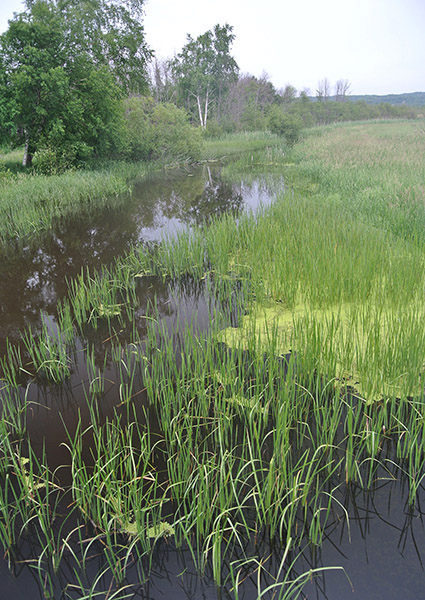
Located in Manistee County, the 400-acre marsh borders Arcadia Lake and is fed by Bowens Creek. In the late 1800s, a railroad grade was constructed through the marsh. Then, in the 1950s, the water level was lowered to improve agricultural potential and twice Bowens Creek has been diverted, resulting in a stream that is now very shallow and heavily sedimented. Finally, the marsh was permanently impacted when M-22 was constructed across Arcadia Lake as a quarter-mile causeway perforated only by a narrow bridge.

Restoration began in 2010 after GTRLC acquired 155 acres within the marsh. Teaming up with a handful of other conservation groups, work focused on restoring flows within the natural channel of Bowens Creek by plugging previous diversions. A prescribed burn was staged to counter the infestations of invasive species and 6 acres of shallow, open water was created within the marsh to benefit migrating birds and spawning northern pike.

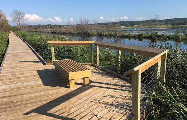
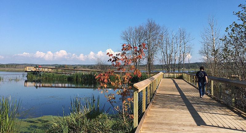
Today, Arcadia Marsh Nature Preserve extends over 273 acres on the doorstep of the village of Arcadia. Although the trail system is limited, the preserve has become a popular destination for birders due to the easy viewing of waterfowl and marsh-dependent migrants. In 2019, the nearly mile-long foot trail was converted into a universally accessible path that includes 0.75 miles of boardwalk across the swamp, making for easy hiking. Nearby a stretch of M-22 to the south of the trailhead can be used to scope nearly a mile of marsh by pulling off along the side of its elevated causeway.

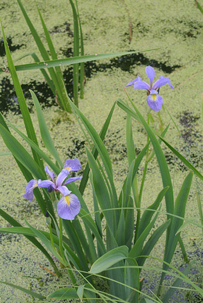
Arcadia Marsh is home to more than 180 species of birds, including 17 State endangered, threatened, or species of special concern. In spring and fall, birders concentrate on migrating waterfowl, cranes (including sandhill cranes), and great blue and green herons.  In low-water years the marsh is great for shorebirds and in high-water years it’s one of the easiest places in Michigan to spot American and Least Bittern. Rarities that frequent the marsh include Bewick’s Wren, Black-billed Magpie, Purple Gallinule and Nelson’s Sparrow, while in the winter birders often spot rough-legged hawks and snowy owls.
Amenities & Services
Difficulty - Easy
Foot Path
Trail Guide

The main trail at Arcadia Marsh is a long boardwalk that extends 0.75-mile across the heart of the preserve.

This mile-long, one-way hike begins by crossing the mouth of Bowens Creek along a former one-lane vehicle bridge. On the other side a boardwalk heads east for Saint Pierre Road trailhead through extensive wetlands while skirting the south side of the trail is a channel of open water, painted purple in June by clusters of blue flag irises. Other wildflowers that can be spotted include white water lilies, swamp roses, marsh skullcap, blue vervain and marsh vetchling.

Within 0.4 miles you reach a viewing deck in the middle of the marsh and as you near Saint Pierre Road trailhead pass a pair of short spurs that lead to fishing platforms.

Facilities

Other than an information kiosk and parking, there are no other facilities at the M-22 trailhead for Arcadia Marsh trailhead. There is a vault toilet at the Saint Pierre Road trailhead.

Hours & Fees

The nature preserve is open year round but dogs are not allowed from Feb. 1 to Sept. 1 and mountain bikes are banned from the trail. There are no fees for visiting the preserve.

Directions

Arcadia Nature Preserve is posted along M-22, a half mile south of the town of Arcadia with a trailhead and parking on the east side of the state highway.

Information

For more information, contact the Grand Traverse Regional Land Conservancy (231-929-7911; www.gtrlc.org).


Geo-referenced maps from MichiganTrailMaps.com range from $1.99 to $2.99 each.

Download the Avenza app from the App Store or Google Play

App Store Google Play

Michigan TrailMaps.com Michigan's Premier Trail Resource Contact

Trail Mix News

by travel and outdoor writer Jim DuFresne!

Sign Up
Enews Signup
Find a Trail

Find Trails & Maps

Search for Trail
Search by Location
Search by