
Aspen Park: Aspen Single Track

Buy the $.99 downloadable map!
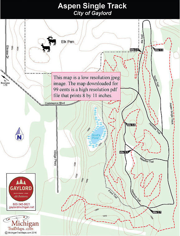
(This map is not geo-referenced)Trail Details
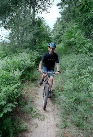
Built by the Northern Chapter of the Michigan Mountain Bike Association (MMBA), this 5-mile loop has become a favorite with locals looking for a quick workout and vacationing mountain bikers in need of a leg stretcher in the middle of a long drive up north.
Like everything else in Gaylord, Aspen Park is an easy-off-easy-on sidetrip from I-75. In less than five minutes after leaving the interstate, you're on a single track, riding through the woods past huge hemlocks.
Aspen Single Track dates back began in 2001 when the Northern Chapter received permission from city officials to cut the trail. Chapter president Eric Isaacsen and vice president Bill Snow then spent the winter exploring the area on snowshoes to get a feel for the topography and lay out the trail. In June of 2002, the new single track was completed.
The pair initially wanted to make the single track a beginner to intermediate ride but because of the topography the trail is more intermediate with some technical aspects to it. In the beginning much of it is still relatively flat, featuring fast sections through stands of red pine. In the second half of the ride you do encounter some twisty switchbacks and some surprisingly large hills for a municipal park.
Beginners need not to worry however. Five times the single track crosses the park's two-mile system of paved pathways where it’s easy to bail out. Although the trail is often labeled as a 6- or even 7-mile loop, it measured out to 5 miles when we mapped it with a GPS unit. Like most mountain bike trails in northern Michigan, you encounter an occasional sand pit along the Aspen Single Track but overall the surface is packed and easy to ride
| Difficulty - Easy |
| Difficulty - Moderate |
| Mountain Bike Single Track |
Geo-referenced maps from MichiganTrailMaps.com range from $1.99 to $2.99 each.
Download the Avenza app from the App Store or Google Play


