320

Trails Reviewed

Find Trails & Maps

Search for Trail
Search by Location
Search by

Back to listing

Avalanche Preserve: Hiking Trail

Trail Details

County
Charlevoix
Regions
Northwest
Latitude
N 45° 12' 3.24"
Longitude
W 085° 00' 52.20"
Distance
2.8-mile loop
Trail Type
Two-tracks and foot path
Terrain
Forested ridge
Difficulty
Moderate
Nearest City or Town
Boyne City
(map loads here)
view map
Separate from the mountain bike trail is the Avalanche Hiking Trail, a nearly 3-mile loop that climbs the ridge to the viewing decks and then descends it to return to the warming shelter and parking area. Much of the trail, but not all, is a former two-track that provides good footing and is well posted. The route described below is a 2.8-mile hike that follows the main loop in a clockwise direction and saves the best part – the panoramic views of Lake Charlevoix from the top – for the end.
Expand All
Photos
Description
Separate from the mountain bike trail is the Avalanche Hiking Trail, a nearly 3-mile loop that climbs the ridge to the viewing decks and then descends it to return to the warming shelter and parking area.

Much of the trail, but not all, is a former two-track that provides good footing and is well posted. Still Avalanche Peak is a maze of trails. The hiking trail is integrated into the mountain biking system and is constantly crossing the single track where you need to keep an eye out for cyclists. Almost half of trail is also utilized by participants playing the 18-hole disc golf course.

The route described below is a 2.8-mile hike that follows the main loop in a clockwise direction and saves the best part – the panoramic views of Lake Charlevoix from the top – for the end. Some signs list the walking loop as a 2.2-mile trek but trust us it’s 2.8 miles.

Keep in mind that the restrooms at the Avalanche Warming Shelter are open during the summer but not the rest of the facility.
Amenities & Services
Difficulty - Moderate
Dog Friendly
Multi-use Trail
Two-Track
Trail Guide

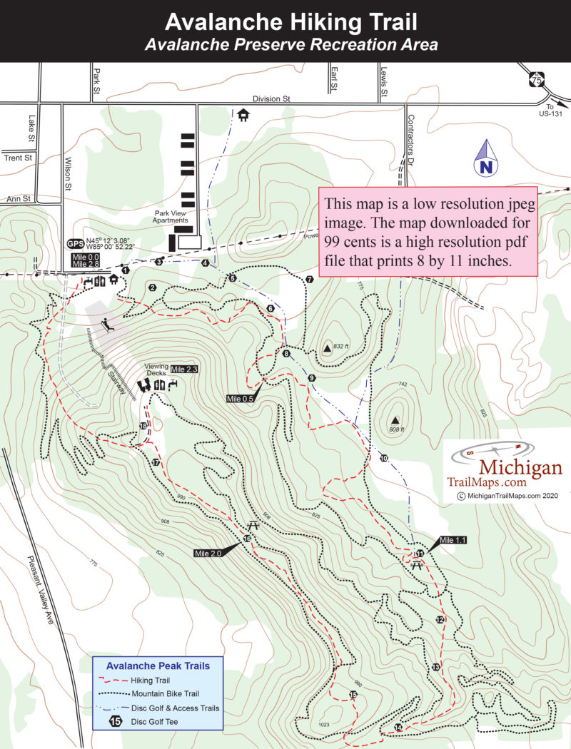
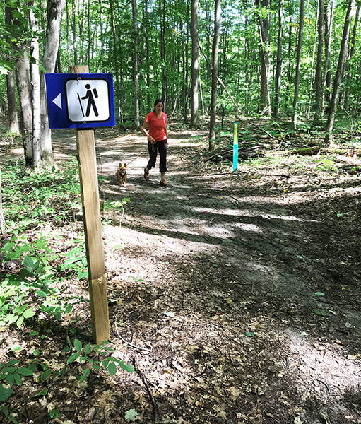
Begin at the warming shelter where to the east you can see a trailhead sign for the hiking trail just up the hill on the edge of the forest. Avoid the posted trail that follows the powerline as that is the start of the disc golf course.

You enter the woods and immediately begin crossing the mountain bike trail. You’ll cross the single track six times in the first half mile but trail signs and posted maps should keep you on course. Just beyond Mile 1, the trail begins climbing and then arrives at a major intersection. The hiking trail turns sharply right with the disc golf course merging into it. Nearby is the mountain bike trail. So many users. The spot features a picnic table, a bench and the tee for hole No. 11 of the disc golf course.

For the next half mile, you cross the mountain bike trail four times while passing disc golf holes No. 12 through No. 15. You’re also steadily climbing towards Avalanche Peak for a bit of a workout, topping above 1,000 feet at one point. At Mile 1.75 the trail levels out and begins its most interesting stretch, especially in the fall. You follow the narrow crest of a ridge for half mile where you can gaze down the side of this “mountain.” If there’s any wind, you’ll feel it up here and in late October or November the views will be nice.

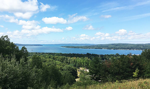
At Mile 2.3 you break out of the woods into an open area that features trails, two viewing decks, a toilet, picnic tables, drinking water and disc golf tees No. 17 and No. 18. Welcome to the top of Avalanche Peak. Also in the clearing is a cement tower that once was part of a downhill ski lift.

But it’s the viewing decks with built-in benches that draws the most interest. There isn’t a better place south of the Mackinac Bridge to sit back and gaze. At your feet is Boyne City while stretching out to the west is Lake Charlevoix, often dotted with sailboats. If it’s October, the ridges and hills surrounding the lake will be painted in shades of Halloween.

Near one deck is the stairway down the mountain, a descent of 462 steps and almost 300 feet. Taking the stairway will shave the final half mile in half, turning the trek into a 2.6-mile walk.

Otherwise backtrack the hiking trail 30 yards to a distinctive V junction and head right, avoiding the trail you arrive on. The walking trail uses an old two-track to descend the mountain and quickly crosses the mountain bike single track twice. You emerge at the parking lot just west of the warming shelter at Mile 2.8.

Facilities

At the base of the hill is the Avalanche Warming Shelter that includes restrooms, drinking water and loaner skates for the ice skating ring. At the observation area at the top is a pair of viewing decks with benches, a vault toilet and a drinking fountain.

Hours & Fees

There are no entry or vehicle fees for Avalanche Preserve Recreation Area.

Directions

From US-131, north of M-32, follow M-75 into Boyne City. Once in town head west on Division Street and then turn left on Lake Street. Signs at the south end of Lake Street direct you left to the entrance of Avalanche Preserve Recreation Area at 1129 Wilson Street.

Information

For more information Contact the Boyne City Parks Department (231-582-6597) or check the Boyne City web site.


Geo-referenced maps from MichiganTrailMaps.com range from $1.99 to $2.99 each.

Download the Avenza app from the App Store or Google Play

App Store Google Play

Michigan TrailMaps.com Michigan's Premier Trail Resource Contact

Trail Mix News

by travel and outdoor writer Jim DuFresne!

Sign Up
Enews Signup
Find a Trail

Find Trails & Maps

Search for Trail
Search by Location
Search by