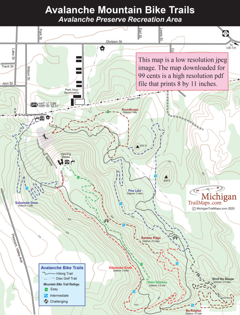
Roundhouse: This mile-long loop begins from the eastern side of the trailhead parking area and is signposted just up the slope along with the Hiking Trail. The trail is rated easy with a relatively smooth a natural surface with few roots, rocks or other protrusions. With little climbing involved, Roundhouse is ideal for children and newcomers to mountain biking. Its eastern half offers less elevation and within 0.6 miles arrives at a junction with Pine Lake Trail.
Pine Lake: Connecting to Roundhouse and returning to it is this 2-mile loop rated intermediate and featuring short but more substantial climbs that will initiate riders quickly to the preserve’s steeper topography. If following it in a clockwise direction, you reach a major junction with a mile that includes disc gold trail the Hiking Trail and the endpoint for Stroll the Steeps. In another 100 yards, you reach a junction with Sidewinder South that provides access to the more challenging trails in the southern portion of the preserve. At this point, Pine Lake swings north and returns to Roundhouse.
Sidewinder South: The southern half of Sidewinder is a 2-mile intermediate trail that wraps around the backside of the Avalanche ridge. One end of this two-way trail departs off Pine Lake, the other at the viewing decks. In between, if following it in a clockwise direction, you reach a junction with Rambler Ridge in 0.3 miles then another with Bo-Ridginal in 0.75 miles. Within a mile is the junction with Morel Dilemma that offers an easier route to the viewing decks.
Bo-Ridginal: This 0.8-mile intermediate trail is left over from the original 4.2-mile loop, thus its name. If picked up from Sidewinder South, Bo-Ridginal crosses the Hiking Trail within a couple of hundred yards and then descends into area occasionally referred to as Two-Track Valley. The trail weaves through this level stretch of forest and meadow before arriving at to the top of Stroll the Steeps. Keep in mind that the Steeps is a one-way, challenging trail. Bo-Ridginal is a two-way intermediate trail so you can backtrack to Sidewinder South.
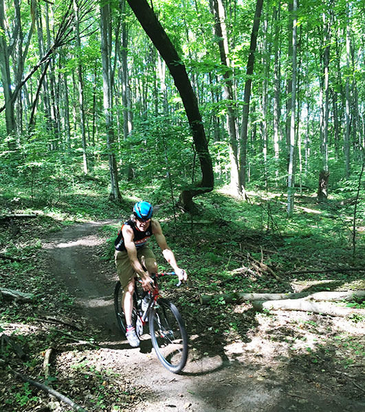
Stroll the Steeps: This is the system’s sole one-way, black diamond trail. The Steeps is an expert-level trail with steep side-slopes, berms, rocks, drops, and jumps. Some of the technical features have ride-arounds, but not all of them. Located in the southeast portion of the preserve, Steeps is aligned to take advantage of two narrowest ridges. The single track is perched on steep sideslopes and drops almost 120 feet in a half mile before flattening out for a cruise back to Pine Lake junction. As opposed to Bo-Ridginal’s speed and flow, Stroll the Steeps focuses on balance and rider control on narrow single track where riders will encounter “blind” fall-away corners.
Rambler Ridge: This intermediate trail is picked up a quarter mile from Sidewinder South’s east end and extends a half mile north to Morel Dilemma, just 0.16 miles from the viewing decks.
Morel Dilemma: One of the more scenic trails of the system is also rated easy, so you have time to look around. Morel Dilemma is picked up a mile from the east end of Sidewinder South and extends 0.8 miles north to the viewing decks. The first half of the trail closely parallels the Hiking Trail along a relatively level ridgeline where in late fall, the views through the trees are worth stopping for.
Sidewinder Down: The second half of Sidewinder is a mile-long descent for Avalanche overlook back to the parking area. Sidewinder Down was rerouted considerably from the original loop and is now a downhill flow-type run with lots of berms, a few rollers, and a couple of table-tops. It parallels much of the Hiking Trail and crosses it twice. The Sidewinder Down continues from Sidewinder South just 200 yards from the viewing decks.