
Big Bear Lake Pathway
Buy the $.99 downloadable map!
(This map is not geo-referenced)Trail Details

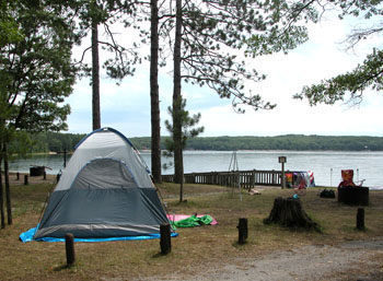
The main campground on Big Bear Lake lacks a boat ramp as well as the privacy usually associated with state forest campgrounds. But the Mackinaw State Forest campground does have one feature most other units would be hard pressed to match; a beautiful beach only a few steps from your site. The clear water of the lake combined with the sandy strip at its north shore is no doubt the reason for its popularity.
But escaping is easy, even in July, because the campground also serves as the trailhead to a state forest pathway. Big Bear Lake Pathway is a 2.5-mile trail system of two interconnected loops with most of the trail north of the Bear Lake Road. Departing from east end of main campground is the 1.8-mile Eagle Roost Loop, from the west end the 1-mile Beaver Lodge Loop. Combine them beginning from the campground’s day-use area and you have a pleasant 2.6-mile hike away from the bustle of campers, boaters and swimmers.
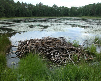
The trail is also referred to as the Big Bear Lake Nature Pathway due to the fact that it winds past three marshy ponds with two of them active with beavers. There are no interpretive signs or brochures to accompany hikers but in early morning or at dusk the pathway often rewards them with wildlife sightings.
Although there are no numbered posts at junctions as are displayed on older DNR maps, Big Bear Lake Pathway is well marked by blue blazes and pathway markers and easy to follow.
Big Bear Lake Pathway is open to mountain biking but due to its limited mileage most off-road cyclists prefer riding nearby Buttles Road Pathway. In the winter this would be an excellent trail for snowshoers.
| Camping |
| Difficulty - Easy |
| Dog Friendly |
Geo-referenced maps from MichiganTrailMaps.com range from $1.99 to $2.99 each.
Download the Avenza app from the App Store or Google Play


