320

Trails Reviewed

Find Trails & Maps

Search for Trail
Search by Location
Search by

Back to listing

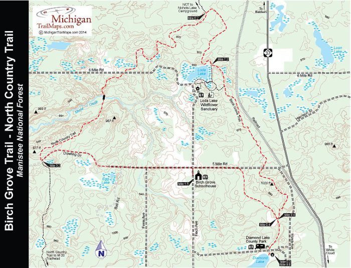
Birch Grove Trail/NCT Loop - Manistee National Forest

Trail Details

County
Newaygo
Regions
Heartland
Latitude
N 43° 36' 52.56"
Longitude
W 085° 48' 52.20"
Distance
9.8 miles
Trail Type
Foot path
Terrain
Loda Lake Wildflower Sanctuary, wooded ridges
Difficulty
Moderate
Nearest City or Town
White Lake
(map loads here)
view map
The Birch Grove Schoolhouse wasbuilt in the late 1870s for students buttodayserves as a pleasant place to stay for hikers and backpackers walking the Birch Grove Trail - North Country Trail (NCT) Loop.The 9.8-mileloop was completed in 2007 when the Birch Grove Trail was pieced together, a 6.4-mileroute of forest roads, old railroad grades and foot paths diverting from the NCT in Newaygo County. The new trail not only connected its namesake schoolhouse to the national trail but also Diamond Lake County Park and Loda Lake Wildflower Sanctuary, the only wildflower sanctuary in the national forest system.This description begins at Diamond Lake. Originally a company retreat for the Steelcase ...
Expand All
Photos
Description

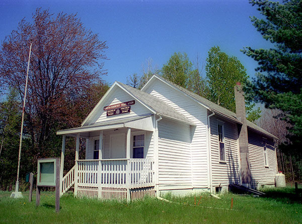
The Birch Grove Schoolhouse was built in the late 1870s for students but today serves as a pleasant place to stay for hikers and backpackers walking the Birch Grove Trail - North Country Trail (NCT) Loop.

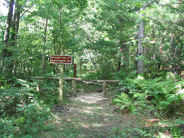
The 9.8-mile loop was completed in 2007 when the Birch Grove Trail was pieced together, a 6.4-mile route of forest roads, old railroad grades and foot paths diverting from the NCT in Newaygo County. The new trail not only connected its namesake schoolhouse to the national trail but also Diamond Lake County Park and Loda Lake Wildflower Sanctuary, the only wildflower sanctuary in the national forest system.

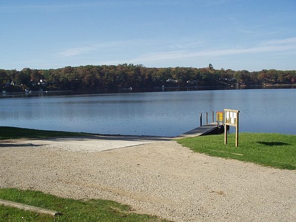
This description begins at Diamond Lake. Originally a company retreat for the Steelcase Corporation employees, the 156-acre Newaygo County park features a modern campground and a trailhead for the Birch Grove Trail. Both the Birch Grove Schoolhouse and Diamond Lake are best situated to be used as a base for hikers who can then undertake the loop as a day hike. Backpackers, however, can set up camp along the North Country Trail.

There are several ways to shorten the hike, including beginning at the schoolhouse and using 5 Mile Road to bypassing the segments south of it to Diamond Lake. This would be a 7.8-mile trek.  

Amenities & Services
Camping
Difficulty - Moderate
Dog Friendly
Foot Path
Trail Guide

In the Diamond Lake Campground, you head north along an old railroad grade and at Mile 0.4 reach a junction with the return segment from the NCT and Loda Lake Wildflower Sanctuary. Head northwest (left).

The trail winds pass an open area and then makes a gradual ascent before breaking out at 5 Mile Road, reached at Mile 1. Head west (left) and follow the paved road. At Mile 1.5 the pavement ends at the junction with Felch Avenue. Just to the south (left) is the Birch Grove Schoolhouse, less than a mile to the north (right) is the entrance to Loda Lake Wildflower Sanctuary.

The Birch Grove Trail continues west along 5 Mile Road, now a graded dirt road. The road begins ascending, topping off on a ridge where it swings north (right) to become Dowling Drive, a sandy, badly rutted two-track. You follow the two-track to arrive at the junction of the NCT crosses it at Mile 3.2.

The NCT swings northeast and follows a ridge through an area that is crisscrossed with ORV trails. Within a mile the trail begins a long descent off the ridge, bottoming out at Mena Creek that is crossed on a foot bridge. On the north side a sharp climb awaits you before you descend to reach 6 Mile Road at Mile 4.7.

  Follow 6 Mile Road briefly to the east (right) before picking up the NCT where it descends to a marsh and winds around it to the northeast, crossing Ferris Avenue within a half mile.  At Mile 6.2 you arrive at the posted junction with Birch Grove Trail. The NCT heads north (left) here, you head in an easterly direction (right) to follow an old railroad grade.

Birch Grove Trail swings to the south, skirts an old bog and then reaches the north end of Loda Lake and at Mile 7.2 a junction with the sanctuary’s trail system. Head left here to follow the premiere of the trail system for the most direct route back to Diamond Lake. Here right to enjoy the wildflowers or even a bench overlooking Loda Lake.

Without dipping into the sanctuary, you reach the junction with Birch Grove Trail within a quarter mile. Head south (left) and soon you’ll be following that old railroad grade again. At Mile 8.6 you cross paved 5 Mile Road and continue south to  arrive at the junction to Diamond Lake County Park at Mile 9.4

Facilities

Diamond Lake County Park features a 60-site modern campground along with a swimming beach, picnic area, and a boat launch with boat rentals.The trailhead for the Birch Grove Trail is located on the road that heads north to the service area. The trail is well posted and there is limited parking. 

Hours & Fees

Diamond Lake County Park is open from early May to late September. During the camping you can call the park at (231) 689-1190.

Directions

Diamond Lake County Park is 6 miles north of White Cloud and is reached from M-37 by turning west on 5 Mile Road. You immediate cross a set of railroad tracks and then turn left on Mundy Road. The park is entrance is a mile south  at 3351 Mundy Rd. To reach the Birch Grove Schoolhouse continue past Mundy Road for a mile on 5 Mile Road and then turn right on Felch Avenue.
  

Information

For more information on the Birch Grove Trail or to reserve a campsite at Diamond Lake County Park contact the Newaygo County Parks and Recreation (231-652-9298; www.countyofnewaygo.com/Parks). For accommodations at the Birch Grove Schoolhouse or a map of the loop see the West Michigan Chapter of the North Country Trail Association website (www.northcountrytrail.org/wmi).

For lodging and additional travel information contact the West Michigan Tourist Association (616-245-2217; www.WMTA.org).


Geo-referenced maps from MichiganTrailMaps.com range from $1.99 to $2.99 each.

Download the Avenza app from the App Store or Google Play

App Store Google Play

Michigan TrailMaps.com Michigan's Premier Trail Resource Contact

Trail Mix News

by travel and outdoor writer Jim DuFresne!

Sign Up
Enews Signup
Find a Trail

Find Trails & Maps

Search for Trail
Search by Location
Search by