320

Trails Reviewed

Find Trails & Maps

Search for Trail
Search by Location
Search by

Back to listing

Bishop’s Bog Preserve Trail

Trail Details

County
Kalamazoo
Regions
Heartland
Latitude
N 42° 09' 57.24"
Longitude
W 085° 35' 57.48"
Distance
4.6 miles round-trip
Trail Type
Foot path
Terrain
Extensive bogs and wetlands
Difficulty
Easy
Nearest City or Town
Portage
(map loads here)
view map
Bishops Bog Preserve Trail, a 1.2-mile, point-to-point trail with much of it a floating trail, is part of the Portage South-Central Greenway, a series of five parks that total 483 acres and are linked together by 6 miles of trail, a fourth of it floating on bogs and marshes. The parks included in this hike are West Lake Nature Preserve, South Westnedge Park, Bishops Bog Preserve, and Schrier Park and only once, while hiking from park to park, do you have to cross a road.The centerpiece of the greenway is Bishops Bog. The 152-acre relict bog is a holdover from the last Ice Age and harbors a number of climactically cool-region plants extremely rare for this part of the state. With its exte ...
Expand All
Photos
Description

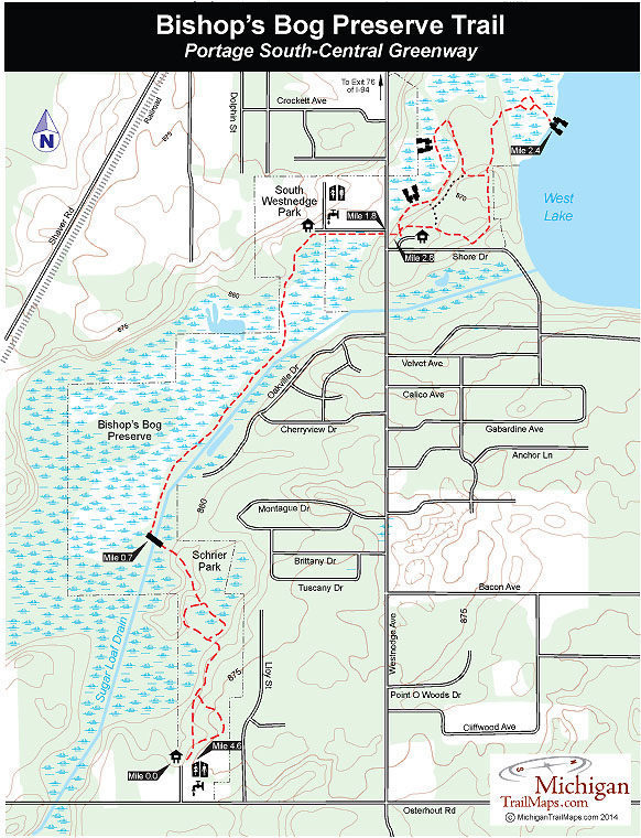
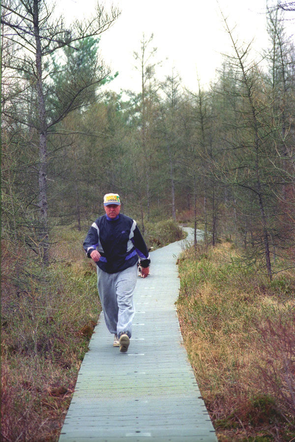
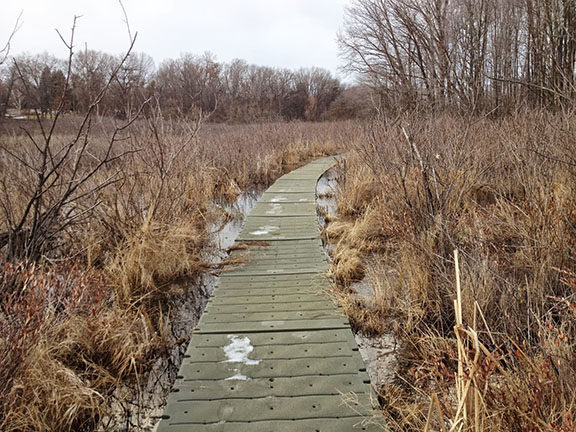
Bishop’s Bog Preserve Trail, a 1.2-mile, point-to-point trail with much of it a floating trail, is part of the Portage South-Central Greenway, a series of five parks that total 483 acres and are linked together by 6 miles of trail, a fourth of it floating on bogs and marshes. The parks included in this hike are West Lake Nature Preserve, South Westnedge Park, Bishop’s Bog Preserve, and Schrier Park and only once, while hiking from park to park, do you have to cross a road.

The centerpiece of the greenway is Bishop’s Bog. The 152-acre “relict bog” is a holdover from the last Ice Age and harbors a number of climactically cool-region plants extremely rare for this part of the state. With its extensive mat of sphagnum moss, tamarack trees, and blueberry bushes, the bog is something botanists would expect to find 300 miles to north. 

In 1987, the Michigan Nature Conservancy registered the area as the “largest remaining relict bog in southern Michigan,” and that year the Portage Parks and Recreation Department began piecing together the greenway. Bishop’s Bog Preserve Trail, the final link of the trail system, was completed in 1997.

The hike described here is a combination of trails in all the parks. It begins in Schrier Park and makes for an interesting walk of 4.6 miles. For a shorter day, you can just as easily turn around in South Westnedge Park and hike only Bishop’s Bog Preserve Trail for a return outing of 3 miles.

Amenities & Services
Difficulty - Easy
Dog Friendly
Foot Path
Trail Guide

Within Schrier Park a paved trail leads through the open day-use area and into the woods. By staying to the left at every intersection, you’ll quickly find yourself on a path in a hardwood forest of red maple, white oak, a few hickories and wild cherry and at Mile 0.7 use a foot bridge to cross Sugar Loaf Drain.

On the other side you enter Bishop’s Bog, a 152-acre preserve in which the ancient relict bog was left untouched. The trail through the bog becomes a bouncing boardwalk of plastic planking. This intriguing floating trail lasts for almost a mile as it passes through the middle of the sensitive wetland. 

At the north end of the bog the trail enters South Westnedge Park and becomes an asphalt path that swings sharply east and at Mile 1.8 reaches South Westnedge Avenue. On the other side you enter West Lake Nature Preserve, the north end of the greenway. The 110-acre park is an upland hardwood forest bordered on three sides by either an extensive bog or the marshy lakeshore of West Lake. Winding through the preserve are 2 miles of paths with the outside loop set up as a 1-mile-long interpretive trail. There are 18 stops that correspond to a pamphlet available at the trailhead.

The interpretive trail is numbered in a clockwise direction and includes a pair of short spurs in the first half mile that extend to observation decks floating on a bog. If it’s winter you can often see the prints of rabbits and pheasants in the snow that use the brushy marsh for cover. Eventually the trail swings into the woods and then at reaches a junction at Post No. 10.

Here a spur leads to almost a quarter mile of bouncing boardwalk through a rare stand of tamarack and across the open bog that borders the lake’s northwest corner. At the end of the spur is a third floating deck, reached at Mile 2.4, that allows you to scan the water for whatever wildlife there might be. 

From the spur the trail heads south, and signs will direct you back to the pavilion, where you pick up the asphalt path that heads west. You quickly cross South Westnedge Avenue and within a quarter mile reach the posted north end of Bishop’s Bog Trail in South Westnedge Park.

The remainer of the hike is a return through Bishop’s Bog Preserve. When you reach Sugar Loaf Drian at Mile 3.9, stay to the left at every intersection to enjoy the rest of Schrier’s interpretive loops. At Mile 4.6 you’ll return to the day-use area and parking lot where the outing began.

Facilities

Schrier Park is a 56-acre unit that anchors the south end of the Portage South-Central Greenway and features rest rooms, drinking water, picnic tables, and a pavilion.

Hours & Fees

The parks are open year round with Schrier Park open 8 a.m. to dusk daily.

Directions

To reach Schrier Park, depart I-94 at exit 76 and head south on Westnedge Avenue.  You’ll also pass the entrance to South Westnedge Park while West Lake Nature Preserve is reached by heading east on South Shore Drive. Within 5.3 miles turn west on Osterhout Road and to reach the entrance to Schrier Park within a half mile.

Information

Contact the Portage Department of Parks and Recreation (269-329-4522; www.portagemi.gov). For lodging and other travel information contact the West Michigan Tourist Association (616-245-2217; www.WMTA.org).


Geo-referenced maps from MichiganTrailMaps.com range from $1.99 to $2.99 each.

Download the Avenza app from the App Store or Google Play

App Store Google Play

Michigan TrailMaps.com Michigan's Premier Trail Resource Contact

Trail Mix News

by travel and outdoor writer Jim DuFresne!

Sign Up
Enews Signup
Find a Trail

Find Trails & Maps

Search for Trail
Search by Location
Search by