Brauer Preserve

Buy the $.99 downloadable map!
(This map is not geo-referenced)Trail Details

In 2003, the Washtenaw County Natural Areas Preservation Program purchased 187 acres west of Ann Arbor from the Brauer family and then seven years later obtained an adjoining 39 acres. The result was Brauer Preserve, a 226-acre tract that protects a diversity of habitat types, from sandy knolls and upland forests to wetlands, but also includes 85 acres of active farm land.
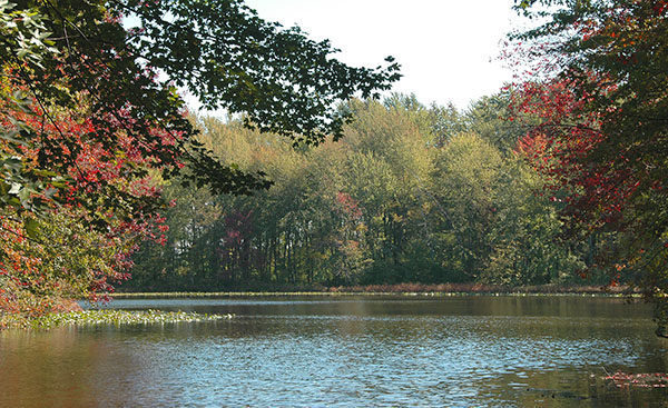
Thus the scenery on any visit to this rural preserve ranges from red barns and fields of soybeans to the mature trees and impressive fern communities that thrive in the hardwood swamp surrounding Lake Isabella, Brauer’s crowning jewel. There are parks and preserves with more impressive natural scenery in Washtenaw County but Brauer does offer an out-of-the-way destination that is quiet, uncrowded, if there is anybody there at all, and free from mountain bikers. Its diversity of habitats attracts birders who come to sight a variety of species including Indigo buntings, black-throated green warblers and belted kingfishers.
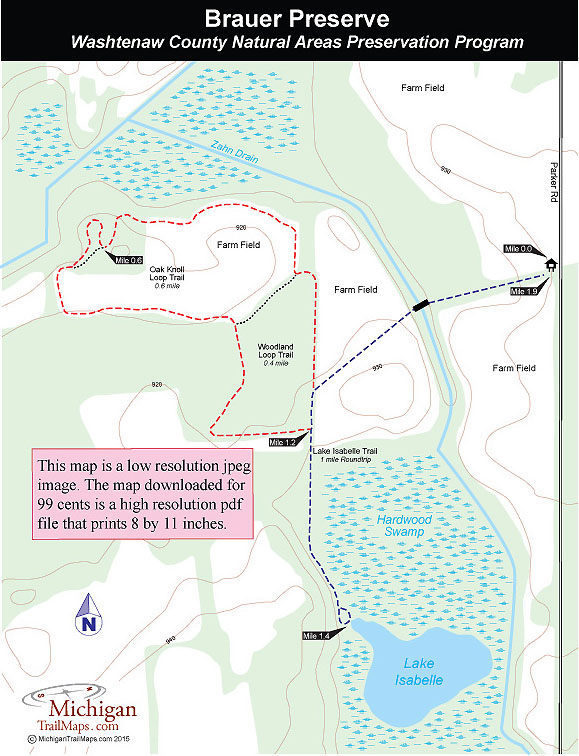
There is a 2-mile trail system in the preserved, composed of three interconnected loops; Lake Isabelle Trail, Woodland Loop Trail and Oak Knoll Loop Trail. The hike described here is a combination of all three for a walk of 1.9 miles. Following just the Lake Isabelle Trail to small lake is a round trip hike of a mile. Keep in mind that any of the trails can be wet and muddy in the spring but especially the route to Lake Isabelle.
| Difficulty - Easy |
| Foot Path |
Geo-referenced maps from MichiganTrailMaps.com range from $1.99 to $2.99 each.
Download the Avenza app from the App Store or Google Play


