Brighton Recreation Area: Kahchin Trail
Buy the $.99 downloadable map!
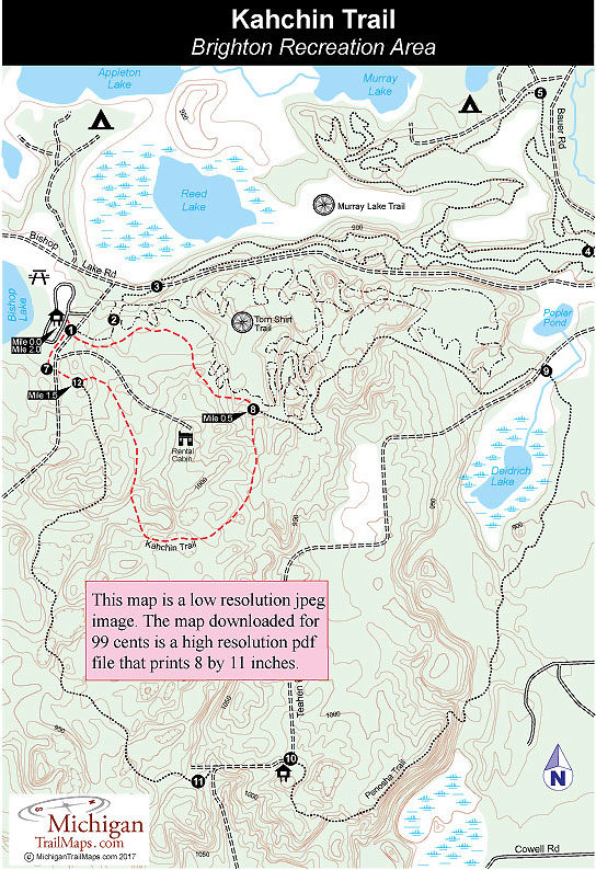
(This map is not geo-referenced)Trail Details
You begin on the Penosha Trail for the first half mile but then depart it at post No. 8. For the most part the next mile is a walk in the woods with few significant features. The best section is reached within a half mile of post No. 8 where you are treading along the crest of a rolling ridge with a dry kettle to the right of you and a marshy one to the left. The trail then descends before making its longest climb. You return to the Penosha Trail at post No. 12, 1.5 miles into the walk and less than a quarter mile from the trailhead.
| Camping |
| Difficulty - Easy |
| Dog Friendly |
| Foot Path |
Geo-referenced maps from MichiganTrailMaps.com range from $1.99 to $2.99 each.
Download the Avenza app from the App Store or Google Play


