Cheboygan State Park
Buy the $.99 downloadable map!
(This map is not geo-referenced)Trail Details


Acre for acre, Cheboygan State Park might be one of most underused units in the Lower Peninsula, a park that contains almost 5 miles of Great Lakes shoreline yet attracts less than 50,000 visitors annually. For hikers who take the time to visit this park and are willing to endure soggy socks, that means a scenic beach walk and a bit of solitude with few if any other people around.
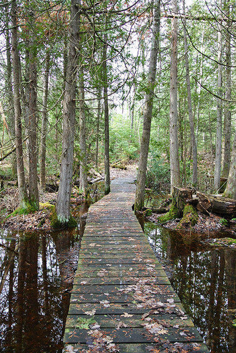
The 1,250-acre park features a day-use area and swimming beach in its southwest corner along Duncan Bay and a modern campground with 76 sites just north of it. Other than that Cheboygan for the most part is either low-lying forest and cedar swamps or Lake Huron beach and windswept dunes. It’s a place where soggy trails often lead to spectacular sand.
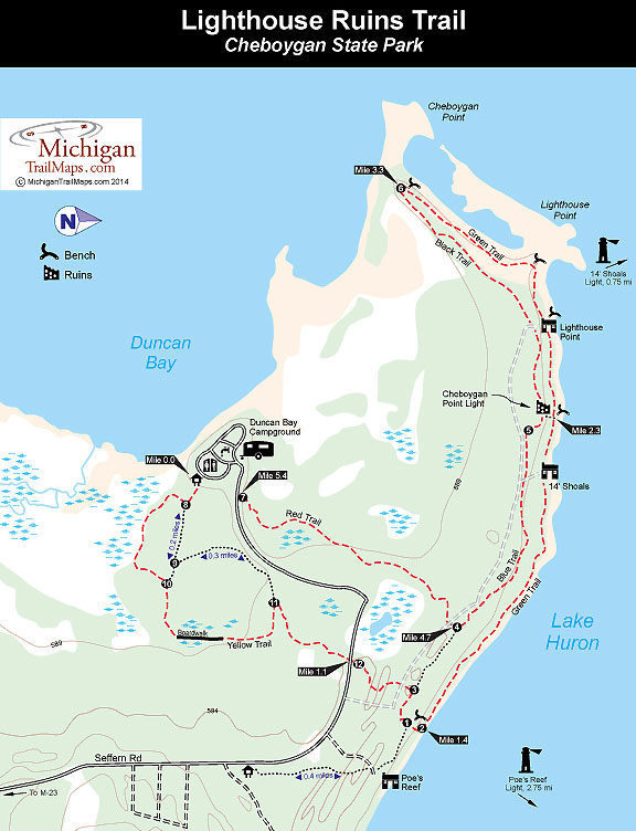
The park has 6 miles of trails and this hike is the perimeter of the system, a 5.5-mile trek that begins and ends at the campground and includes what was once known as the Lighthouse Ruins Trail. Today the various trails are color-coded and labeled on park maps by their colors but Lighthouse Ruins Trail remains a much more descriptive name for this walk.
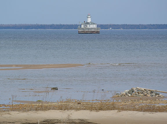
The highlight of any hike in the park is the excellent coastal scenery that includes several offshore lighthouses, miles of beachcombing, and the ruins of an 1859 lighthouse. The Red and Yellow Trails through the interior of the park are the wettest. If you begin at a trailhead along the park road, you can bypass these sections and combine the rest of the trails for a relatively dry 4-mile hike to Cheboygan Point.
| Camping |
| Difficulty - Easy |
| Dog Friendly |
| Foot Path |
| Mountain Bike Single Track |
| Multi-use Trail |
Geo-referenced maps from MichiganTrailMaps.com range from $1.99 to $2.99 each.
Download the Avenza app from the App Store or Google Play


