Dowagiac Woods Nature Sanctuary

Buy the $.99 downloadable map!
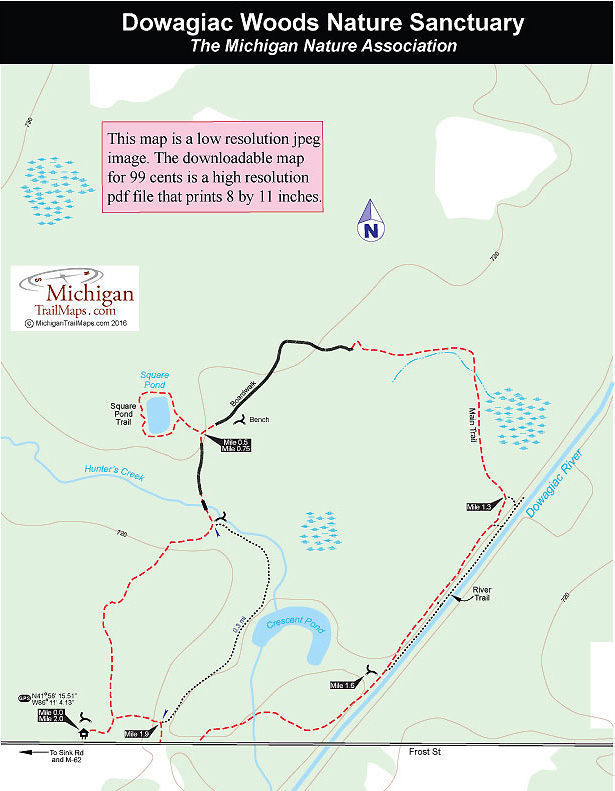
(This map is not geo-referenced)Trail Details


Often referred to by the Michigan Nature Association as its “jewel in the crown,” Dowagiac Woods is the largest MNA sanctuary in the Lower Peninsula. The 384-acre wooded preserve is located just west of the city of Dowagiac in the northwest corner of Cass County.
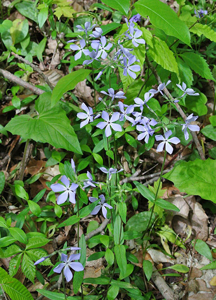
Bordered on the east by the Dowagiac River, the sanctuary’s dominant natural communities are floodplain forest, southern hardwood swamps and mesic southern forests. But Dowagiac Woods is best known for its diverse and profuse display of wildflowers from mid-April to mid-May when more than 50 species of plants will be in bloom.
It was a wildflower that lead to preservation of the area when a MNA member reported in 1975 that the Blue-Eyed Mary (Collinsia verna), a stunning flower with blue and white petals, grew there. In 1981, the MNA, with the help of $20,000 grant from the Kresge Foundation, raised the $110,000 to purchase 235 acres of the woods. In 2008, an additional 149 acres were added on the north side of the original sanctuary.
Because the majority of the property has never been plowed or clear-cut, Dowagiac Woods boasts an incredible diversity in plant species. Nearly 50 kinds of trees have been found in the sanctuary, including blue beech, black ash, chinkapin oak, cork elm, black walnut and hackberry. The Ohio buckeye tree thrives in the preserve and is the first tree to leaf out in the spring, blooming in late April.
Dowagiac Woods is a haven for four animals in danger of becoming extinct in Michigan; the black rat snake, Greek valerian, box turtle and spotted turtle, while hikers often spot or hear yellow warblers, northern yellowthroat, Acadian flycatcher and ruffed grouse.
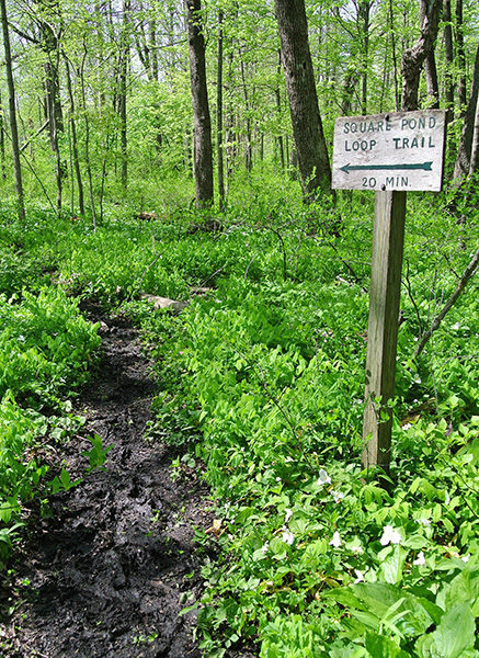
The sanctuary’s trail system totals 2.5 miles. The hike described here is a 2-mile walk combining the Main Trail and the Square Pond Loop Trail. The trails are level, easy to follow and – thanks to extensive boardwalks and bridges – relatively dry though the footing can get a little muddy in the spring. Mountain bikes and dogs are banned from Dowagiac Woods.
| Difficulty - Easy |
| Foot Path |
Geo-referenced maps from MichiganTrailMaps.com range from $1.99 to $2.99 each.
Download the Avenza app from the App Store or Google Play


