Hardy Dam Rustic Nature Trail
Buy the $.99 downloadable map!
(This map is not geo-referenced)Trail Details


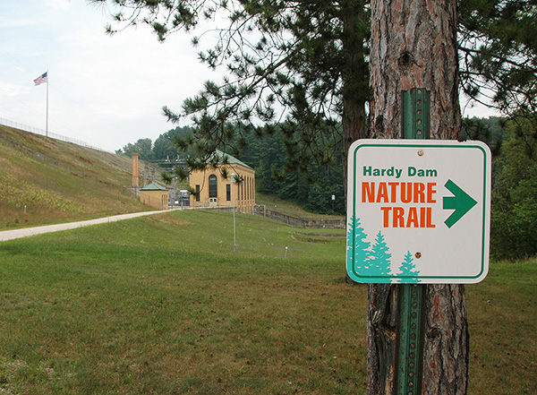
Hardy Dam is an interesting contrast. Built in 1931, this huge man-made structure is the largest hydroelectric plant in the Lower Peninsula and produces enough electricity for a city of 24,000 people.
Yet upstream the Muskegon River has been turned into Hardy Dam Pond, 4,000-acre body of water with 50 miles of almost undeveloped shoreline including no private cottages or homes on it. Downstream Consumers Energy and local Boy Scout troops have teamed up to build Hardy Dam Rustic Nature Trail where at times it’s so quiet in the woods it’s hard to believe there are generators, power lines and spillways just upstream.
Together seeing the dam, even driving across it, and hiking this interpretive path makes for an interesting stop in eastern Newaygo County near the Mecosta county line. This is especially true for any family heading home on US-131 and is in need of a break to stretch the legs or burn off some excessive energy in the back of the mini-van.
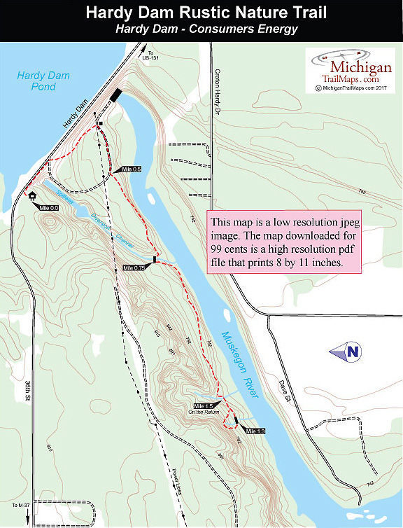
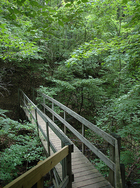
Hardy Dam Rustic Nature Trail is a point-to-point path with a small loop at the end. The entire hike, including the return, is an easy 2.75-mile outing. There are 26 numbered posts along it, though a few seem to be missing, that correspond to an interpretive brochure focusing on tree and plant identification. You get glimpses of the Muskegon River here and there but most of the time you’re hiking in a climax maple-beech forest that is stunning in the fall.
| Difficulty - Easy |
| Foot Path |
Geo-referenced maps from MichiganTrailMaps.com range from $1.99 to $2.99 each.
Download the Avenza app from the App Store or Google Play


