Highland Recreation Area: Goose Meadow Trail

Buy the $.99 downloadable map!
(This map is not geo-referenced)Trail Details
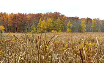
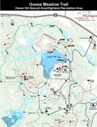
This hike begins in the Goose Meadow Picnic Area where the trailhead is marked by a large stone and plaque commentating the National Park Service designation of Haven Hill as a National Natural Landmark in 1976.
The picnic area also includes picnic tables, drinking water, a pavilion and toilets while crossing the entrance drive nearby is the Blue Trail.
| Camping |
| Difficulty - Easy |
| Dog Friendly |
| Foot Path |
Geo-referenced maps from MichiganTrailMaps.com range from $1.99 to $2.99 each.
Download the Avenza app from the App Store or Google Play


