320

Trails Reviewed

Find Trails & Maps

Search for Trail
Search by Location
Search by

Back to listing

Isle Royale NP: Greenstone Ridge Trail-Map 1


Buy the Geo-referenced map
for use in the Avenza Maps App

Trail Details

County
Houghton
Regions
Western Upper Peninsula
Latitude
N 48° 09' 9.00"
Longitude
W 088° 29' 54.96"
Distance
42.2 miles
Trail Type
Backpacking
Terrain
Forested ridge
Difficulty
Moderate
Nearest City or Town
Houghton
(map loads here)
view map
Avenza Maps
Geo-referenced maps from MichiganTrailMaps.com are available through Avenza Maps and range from $1.99 to $2.99 each.

Download the Avenza app from the App Store or Google Play

App Store Google Play

The Greenstone Ridge, the backbone to Michigan’s unique island national park, is also responsible for the state’s best long distance hike; the 42.5-mile Greenstone Ridge Trail. This is the trail where many hikers first break-in their shoulders hauling their gear and become backpackers for the rest of their lives.
Expand All
Photos
Description
The Greenstone Ridge, the backbone to Michigan’s unique island national park, is also responsible for the state’s best long distance hike; the Greenstone Ridge Trail. This is the trail where many hikers first break-in their shoulders hauling their gear and become backpackers for the rest of their lives. This is where many people forgo their cell phones, MP3 players, their cars, and their emails for five days and from then on embrace the wilderness concept. This is where children and their parents head into the woods and discover they can not only live without Coke-Cola and potato chips, but not even miss them.

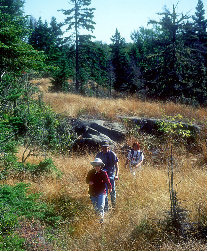
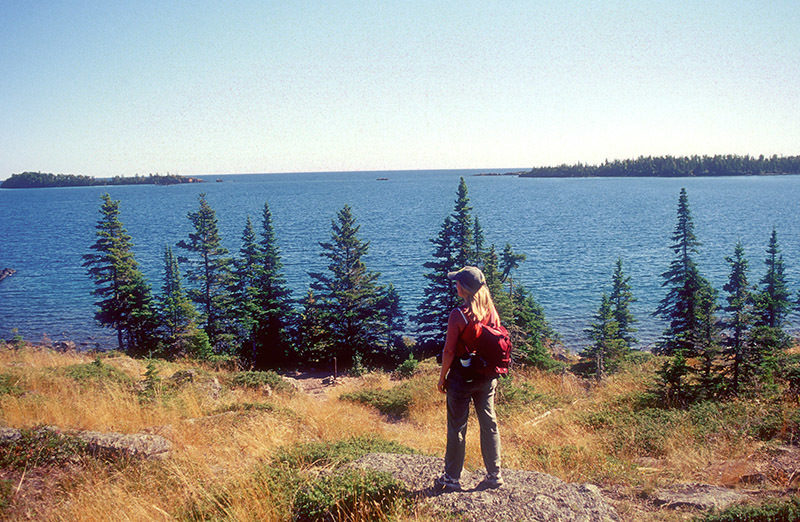
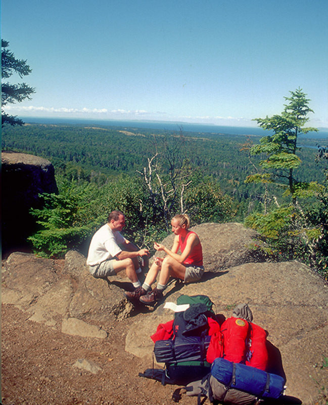
This trail is a Michigan classic, a beautiful and personally fulfilling hike from one end of our largest island to the other. Every backpacker should hike the Greenstone at least once. Lucky you if you get to experience it twice.

Although the trail is rated moderate and is easy to follow, there are eight high points that exceed of 1,300 feet and often knee-bending climbs between them. Experienced hikers in good shape can cover the 40-plus miles in 3 days, but the Greenstone can also be a good trail for beginners if they come with light packs and have 4 or 5 days to walk it.

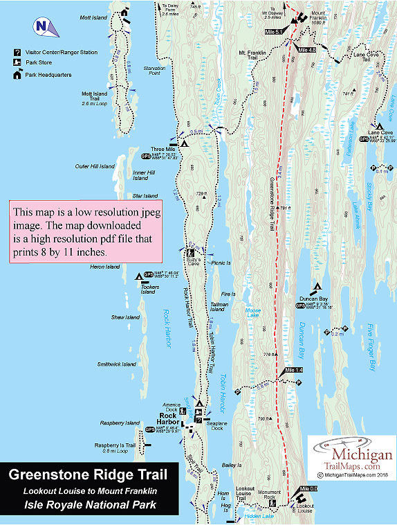
The Greenstone is technically a 40-mile trail that extends from Lookout Louise near the east end of Isle Royale to Windigo on the west end. Few hikers take the time to arrange boat transportation from Rock Harbor across Tobin Harbor to Hidden Lake, the start of the Lookout Louise Trail. Instead most hikers begin with the Rock Harbor Trail and spend their first night at Three-Mile Campground. The following day they take the Mount Franklin Trail to the Greenstone.

Ironically one of the most scenic stretches of the Greenstone – from Lookout Louise to Mount Franklin – is the portion most often skipped. Greenstone Ridge Trail Map 1 covers this stretch, a 5.1-mile trek. For the night you can leave the Greenstone to camp at Three Mile (2.5 miles away), Lane Cove (2.7 miles) or  Daisy Farm (4.2 miles).
Amenities & Services
Camping
Difficulty - Moderate
Foot Path
Trail Guide

The Greenstone Ridge Trail is covered in detailed with maps in Isle Royale National Park: Foot Trails & Water Routes by Jim DuFresne. To order the 184-page guide to the Greenstone Ridge Trail and the rest of the wilderness island, Click Here.

Facilities

Shower tokens, clean towel, and bar of soap can be purchased at the camp store at Rock Harbor or Windigo. Some backpackers like to book a room for their final night at Rock Harbor, either at the lodge or in one of the housekeeping units that can be shared by six people and feature small kitchenettes. For reservations, contact the park concessionaire, Forever Resorts (866-644-2003 or 906-337-4993 in summer; www.isleroyaleresort.com).

In the Upper Peninsula, on the way to Isle Royale National Park, the best place to pick up equipment is Downwind Sports which has two stores at 514 N Third St. in Marquette (906-226-7112) and 308 Shelden Ave. in Houghton (906-482-2500). Once on the island, information, maps and backcountry permits can be obtained from the Rock Harbor or Windigo Visitor Centers at the foot of the ferry wharf. There are also small stores at each entry port with limited and very expensive supplies.

Hours & Fees

Isle Royale National Park opens April 16 and closes on Nov. 1 to all visitors for the winter.  The park has a entrance fee of $7 per person per day or an annual pass for $60. You can pay the entrance fee once you arrive at the park or in advance at at pay.gov  and avoid congestion and long waits on the island. All park visitors who plan to camp overnight at campgrounds or cross-country sites are required to obtain a camping permit. This permit can be obtained free of charge at the visitor center at Windigo or Rock Harbor when you arrive or on board Ranger III on the way to the Island.

The cost of intra-island passage on the Voyageur II depends on where you are picked up and dropped off. Reservation for the ferry are strongly recommended in July and August.

Directions

The Rock Harbor Lodge runs a water taxi that can drop backpackers and campers off at the start of the Lookout Louis Trail. Contact the Rock Harbor Resort (866-644-2003 or 906-337-4993 in summer; www.isleroyaleresort.com) to find out current schedule and costs of its water taxi service.

To return to Rock Harbor from Windigo after hiking the Greenstone most backpackers book passage on the Voyageur II. After arriving at Windigo from Minnestoa, the ferry circumnavigates the island clockwise and overnights at Rock Harbor Lodge. The following day, it continues with possible stops at Daisy Farm, Chippewa Harbor Campground, Malone Bay Campground, and Windigo before returning to Grand Portage. The trip not only gets you back to Rock Harbor but provides a view of Isle Royale not seen from the crest of the Greenstone Ridge.

Information

For more information on the Voyageur II contact the Grand Portage – Isle Royale Transportation Line (651-653-5872, 888-746-2305; www.isleroyaleboats.com).


Geo-referenced maps from MichiganTrailMaps.com range from $1.99 to $2.99 each.

Download the Avenza app from the App Store or Google Play

App Store Google Play

Michigan TrailMaps.com Michigan's Premier Trail Resource Contact

Trail Mix News

by travel and outdoor writer Jim DuFresne!

Sign Up
Enews Signup
Find a Trail

Find Trails & Maps

Search for Trail
Search by Location
Search by