320

Trails Reviewed

Find Trails & Maps

Search for Trail
Search by Location
Search by

Back to listing

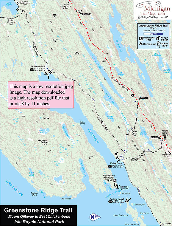
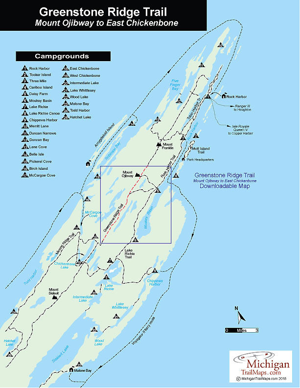
Isle Royale NP: Greenstone Ridge Trail-Map 3


Buy the Geo-referenced map
for use in the Avenza Maps App

Trail Details

County
Houghton
Regions
Western Upper Peninsula
Latitude
N 48° 05' 0.24"
Longitude
W 088° 39' 40.32"
Distance
5.7 miles
Trail Type
Foot path
Terrain
Greenstone Ridge
Difficulty
Moderate
Nearest City or Town
Hougton
(map loads here)
view map
Avenza Maps
Geo-referenced maps from MichiganTrailMaps.com are available through Avenza Maps and range from $1.99 to $2.99 each.

Download the Avenza app from the App Store or Google Play

App Store Google Play

The Greenstone Ridge Trail from Mount Ojibway to the junction with East Chickenbone Lake Campground is a 5.7-mile trek of moderate difficulty along the crest of the ridge. Parts are scenic as the trees thin and views pop up in the first half mile past the Ojibway Tower and again across a series of small knobs just past the junction with Daisy Farm Trail. 
Expand All
Photos
Description
The Greenstone Ridge Trail from Mount Ojibway to the junction with East Chickenbone Lake Campground is a 5.7-mile trek along the crest of the ridge. Parts are scenic as the trees thin and views pop up in the first half mile past the Ojibway Tower and again across a series of small knobs just past the junction with Daisy Farm Trail. Overall this section of the Greenstone Ridge Trail is moderate in difficulty without too many major climbs or descents.

Although there are no trails to Angleworm Lake, at one point the Greenstone Ridge Trail is only 250 yards from the shoreline of the long, narrow inland lake, providing anglers an excellent opportunity to reach it for an opportunity to fish it.

At the East Chickenbone Lake junction the campground is less than a quarter mile to the north on East Chickenbone Trail. Heading west you will reach West Chickenbone Lake Campground in 1.8 miles. A common day for many backpackers is to trek from Daisy Farm to West Chichkenbone, a 7.9-mile trek via the Daisy Farm Trail or a 9.2-mile outing if starting out with the Mount Ojibway Trail.
Amenities & Services
Camping
Difficulty - Moderate
Foot Path
Trail Guide

The Greenstone Ridge Trail is covered in detailed with maps in Isle Royale National Park: Foot Trails & Water Routes by Jim DuFresne. To order the 192-page guide to the Greenstone Ridge Trail and the rest of the wilderness island, Click Here.

Facilities

Shower tokens, clean towel, and bar of soap can be purchased at the camp store at Rock Harbor or Windigo. Some backpackers like to book a room for their final night at Rock Harbor, either at the lodge or in one of the housekeeping units that can be shared by six people and feature small kitchenettes. For reservations, contact the park concessionaire, Forever Resorts (866-644-2003 or 906-337-4993 in summer; www.isleroyaleresort.com).

In the Upper Peninsula, on the way to Isle Royale National Park, the best place to pick up equipment is Downwind Sports which has two stores at 514 N Third St. in Marquette (906-226-7112) and 308 Shelden Ave. in Houghton (906-482-2500). Once on the island, information, maps and backcountry permits can be obtained from the Rock Harbor or Windigo Visitor Centers at the foot of the ferry wharf. There are also small stores at each entry port with limited and very expensive supplies.

Hours & Fees

Isle Royale National Park opens April 16 and closes on Nov. 1 to all visitors for the winter.  The park has a entrance fee of $7 per person per day or an annual pass for $60. You can pay the entrance fee once you arrive at the park or in advance at at pay.gov  and avoid congestion and long waits on the island. All park visitors who plan to camp overnight at campgrounds or cross-country sites are required to obtain a camping permit. This permit can be obtained free of charge at the visitor center at Windigo or Rock Harbor when you arrive or on board Ranger III on the way to the Island.

Directions

To return to Rock Harbor from Windigo after hiking the Greenstone Ridge Trail many backpackers book passage on the Voyageur II. After arriving at Windigo from Minnestoa, the ferry circumnavigates the island clockwise and overnights at Rock Harbor Lodge. The following day, it continues with possible stops at Daisy Farm, Chippewa Harbor Campground, Malone Bay Campground, and Windigo before returning to Grand Portage. The trip not only gets you back to Rock Harbor but provides a view of Isle Royale not seen from the crest of the Greenstone Ridge.

Information

For more information on the Voyageur II contact the Grand Portage – Isle Royale Transportation Line (651-653-5872, 888-746-2305; www.isleroyaleboats.com).


Geo-referenced maps from MichiganTrailMaps.com range from $1.99 to $2.99 each.

Download the Avenza app from the App Store or Google Play

App Store Google Play

Michigan TrailMaps.com Michigan's Premier Trail Resource Contact

Trail Mix News

by travel and outdoor writer Jim DuFresne!

Sign Up
Enews Signup
Find a Trail

Find Trails & Maps

Search for Trail
Search by Location
Search by