320

Trails Reviewed

Find Trails & Maps

Search for Trail
Search by Location
Search by

Back to listing

Isle Royale NP: Lake Richie Trail

Trail Details

County
Houghton
Regions
Western Upper Peninsula
Latitude
N 48° 03' 35.64"
Longitude
W 088° 39' 45.72"
Distance
1.9 miles
Trail Type
Backpacking and portage
Terrain
Forest and open rock
Difficulty
Easy to moderate
Nearest City or Town
Houghton
(map loads here)
view map
Lake Richie is best known as the longest portage on Isle Royale, up to a 2.2-mile trek with a boat over your head to go from Moskey Basin to Lake Richie. Thankfully the trail is somewhat level and easy. But Lake Richie Trail is also an important link for backpackers who want to depart the Greenstone Ridge Trail to spend a night as scenic Moskey Basin Campground before continuing on to Daisy Farm or Rock Harbor. 
Expand All
Photos
Description
Lake Richie is best known as the longest portage on Isle Royale, up to a 2.2-mile trek with a boat over your head to go from Moskey Basin to Lake Richie. Even worse, it's often the first portage for many paddlers, who often just arrived from Rock Harbor with food bags still full of gorp, instant oatmeal and Ramen noodles. Thankfully the trail is somewhat level and easy.

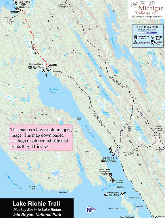
But it is also an important link for backpackers who want to depart the Greenstone Ridge Trail to spend a night as scenic Moskey Basin Campground before continuing on to Daisy Farm or Rock Harbor.

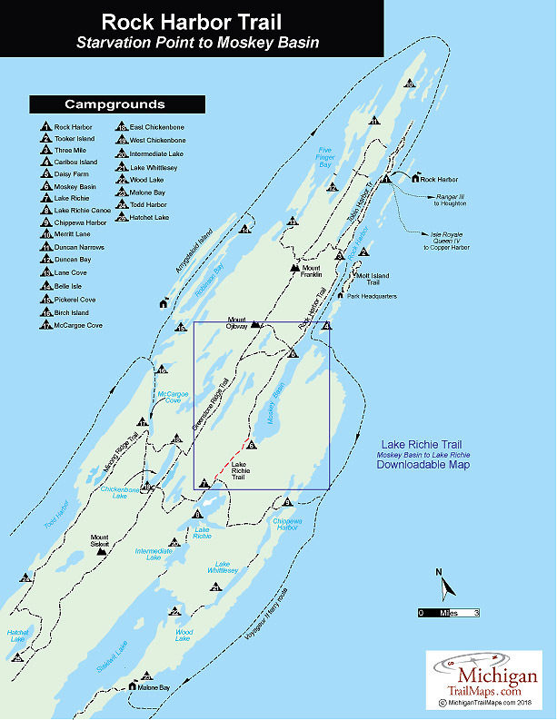
The east end of the 1.9-mile trail begins at a junction with the Rock Harbor Trail, 0.2-mile from the Moskey Basin dock. It officially ends at the junction with the Indian Portage Trail, which heads south for 4.1 miles to Chippewa Harbor Campground. From the junction, you can wander west on the Indian Portage Trail for another 0.2 mile to the shoreline of Lake Richie. The Lake Richie Campground is another 0.1 mile farther on.

 
Amenities & Services
Camping
Difficulty - Easy
Foot Path
Trail Guide

Rock Harbor Trail is covered with maps in Isle Royale National Park: Foot Trails & Water Routes by Jim DuFresne. To order the 192-page guide to the wilderness island, Click Here.

Facilities

Lake Richie Trail is anchored at each end by a campground. It begins near Moskey Basin and then ends just 0.2 mile from Lake Richie Campground. Moskey Basin has shelters, Lake Richie Campground does not.

Shower tokens, clean towel, and bar of soap can be purchased at the camp store at Rock Harbor or Windigo. Some backpackers like to book a room for their final night at Rock Harbor, either at the lodge or in one of the housekeeping units that can be shared by six people and feature small kitchenettes. For reservations, contact the park concessionaire, Forever Resorts (866-644-2003 or 906-337-4993 in summer; www.isleroyaleresort.com).

Hours & Fees

Isle Royale National Park opens April 16 and closes on Nov. 1 to all visitors for the winter.  The park has a entrance fee of $7 per person per day or an annual pass for $60. You can pay the entrance fee once you arrive at the park or in advance at at pay.gov  and avoid congestion and long waits on the island. All park visitors who plan to camp overnight at campgrounds or cross-country sites are required to obtain a camping permit. This permit can be obtained free of charge at the visitor center at Windigo or Rock Harbor when you arrive or on board Ranger III on the way to the Island.

Directions

The east end of Lake Richie Trail is a 10.9-mile hike from Rock Harbor via the Rock Harbor Trail or a 3.7-mile trek from Daisy Farm. The Rock Harbor Lodge runs a water taxi that can drop backpackers and campers at Moskey Basin Campground.

Contact the Rock Harbor Resort (866-644-2003 or 906-337-4993 in summer; www.isleroyaleresort.com) to find out current schedule and costs of its watwer taxi service.

Information

Call the Isle Royale National Park headquarters in Houghton (906-482-0984) or check the Isle Royale National Park website (www.nps.gov/isro).


Geo-referenced maps from MichiganTrailMaps.com range from $1.99 to $2.99 each.

Download the Avenza app from the App Store or Google Play

App Store Google Play

Michigan TrailMaps.com Michigan's Premier Trail Resource Contact

Trail Mix News

by travel and outdoor writer Jim DuFresne!

Sign Up
Enews Signup
Find a Trail

Find Trails & Maps

Search for Trail
Search by Location
Search by