320

Trails Reviewed

Find Trails & Maps

Search for Trail
Search by Location
Search by

Back to listing

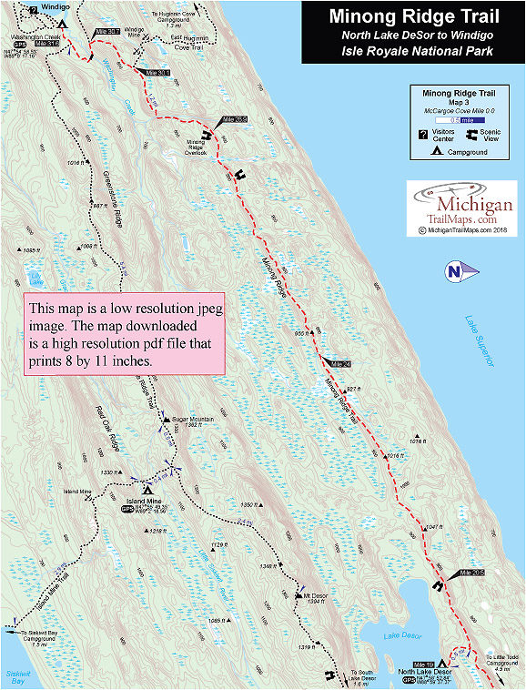
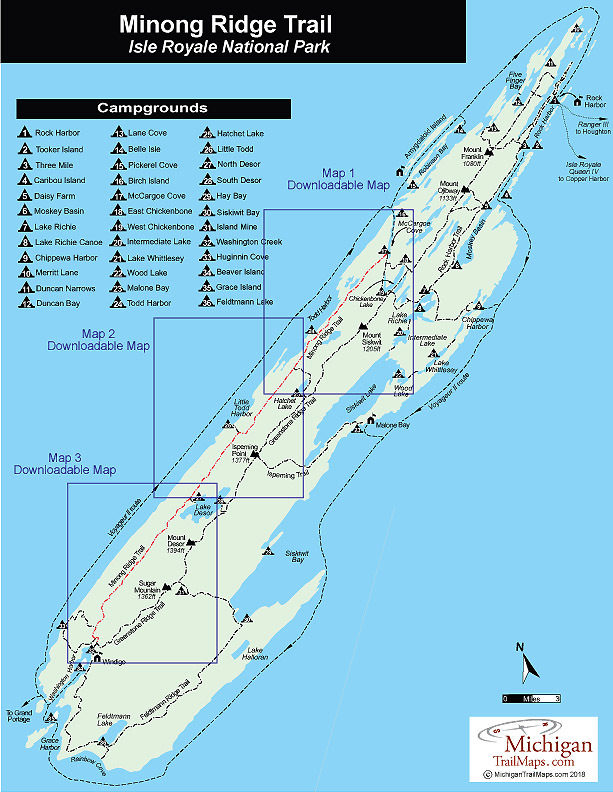
Isle Royale NP: Minong Ridge Trail-Map 3


Buy the Geo-referenced map
for use in the Avenza Maps App

Trail Details

County
Houghton
Regions
Western Upper Peninsula
Latitude
N 47° 57' 2.16"
Longitude
W 089° 06' 0.36"
Distance
12.6 miles
Trail Type
Foot path
Terrain
Minong Ridge
Difficulty
Challenging
Nearest City or Town
Houghton
(map loads here)
view map
Avenza Maps
Geo-referenced maps from MichiganTrailMaps.com are available through Avenza Maps and range from $1.99 to $2.99 each.

Download the Avenza app from the App Store or Google Play

App Store Google Play

Although the Minong Ridge Trail from North Lake Desor to Washinton Creek Campground is not as difficult as the previous segments along the Minong Ridge, it is the longest one at 12.6 miles and requires a full day with a backpack on. Despite a natural eagerness to reach Windigo, take your time, and keep your eye on the trail to pick up the occasional rock cairns. This stretch can get confusing when it crosses a couple of beaver ponds.
Expand All
Photos
Description
Although the Minong Ridge Trail from North Lake Desor to Washinton Creek Campground is not as difficult as the previous segments along the Minong Ridge, it is the longest one at 12.6 miles and requires a full day with a backpack on. Despite a natural eagerness to reach Windigo, take your time, and keep your eye on the trail to pick up the occasional rock cairns. This stretch can get confusing when it crosses a couple of beaver ponds.

The best view of the day is reached within 1.5 miles of leaving the junction to North Lake Desor Camp­ground. Four ridge-top openings with views are reached in a 2-mile stretch just before you arrive at the first beaver dam. After the second beaver dam, you climb to Minong Ridge Overlook, a popular destination for dayhikers from Windigo. At this point you're less than 3 miles from Washington Creek Campground.
Amenities & Services
Camping
Difficulty - Challenging
Foot Path
Trail Guide

The Minong Ridge Trail is covered in detailed with maps in Isle Royale National Park: Foot Trails & Water Routes by Jim DuFresne. To order the 192-page guide to the Greenstone Ridge Trail and the rest of the wilderness island, Click Here.

Facilities

This segment of the Minong Ridge Trail connects two campgrounds; Todd North Lake Desor and Washington Creek.

North Lake Desor has a pit toilet and individual campsites but no group site or, for that matter, much level ground. Along the shoreline just east of the campground is a small sandy cove ideal for a cool dip in the lake.

Washington Creek Campground has 10 shelters along the creek, toilets, tables, and piped-in water, along with individual and group campsites. There is often a camp moose-– if not a couple – visiting the stream at dusk. Keep in mind that Washington Creek is an extremely popular place for backpackers to spend a night or two. If there is an open shelter, stake it out before heading to the showers or camp store in Windigo.

Shower tokens, a clean towel, and a bar of soap can be purchased at the camp store in Windigo. Some backpackers like to book a rustic cabin in Windigo that offers basic accommodations. For reservations, contact the park concessionaire, Forever Resorts (866-644-2003 or 906-337-4993 in summer; www.isleroyaleresort.com).


Hours & Fees

Isle Royale National Park opens April 16 and closes on Nov. 1 to all visitors for the winter.  The park has an entrance fee of $7 per person per day or an annual pass for $60. You can pay the entrance fee once you arrive at the park or in advance at pay.gov  and avoid congestion and long waits on the island. All park visitors who plan to camp overnight at campgrounds or cross-country sites are required to obtain a camping permit. This permit can be obtained free of charge at the visitor center at Windigo or Rock Harbor when you arrive or onboard Ranger III on the way to the Island.

Directions

To reach the start of the Minong Ridge Trail on foot follow the first two days of the Greenstone Ridge Trail and then continue on the East Chickenbone Trail to McCargoe Cove, a 2.1 mile hike. Many hikers will hike to Daisy Farm the first day and then to McCargoe Cove via the East Chickenbone Trail the second day.

A far easier way to reach the start of the Minong and to save time is to book passage on the M.V. Sandy, the tour boat operated by Rock Harbor Lodge and Marina. Once a week the vessel makes a day-trip to McCargoe Cove from Rock Harbor and can be used by backpackers as one-way transportation. To return to Rock Harbor from Windigo after hiking the Minong book passage on the Voyageur II.

Contact the Rock Harbor Resort (866-644-2003 or 906-337-4993 in summer; www.isleroyaleresort.com) to find out the current schedule and costs for the M.V.Sandy.

Information

Call the Isle Royale National Park headquarters in Houghton (906-482-0984) or check the Isle Royale National Park website (www.nps.gov/isro).

For more information on the Voyageur II for transport back to Rock Harbor contact the Grand Portage – Isle Royale Transportation Line (651-653-5872, 888-746-2305; www.isleroyaleboats.com).


Geo-referenced maps from MichiganTrailMaps.com range from $1.99 to $2.99 each.

Download the Avenza app from the App Store or Google Play

App Store Google Play

Michigan TrailMaps.com Michigan's Premier Trail Resource Contact

Trail Mix News

by travel and outdoor writer Jim DuFresne!

Sign Up
Enews Signup
Find a Trail

Find Trails & Maps

Search for Trail
Search by Location
Search by