Isle Royale NP: Rock Harbor Trail - Map 1
Buy the $.99 downloadable map!
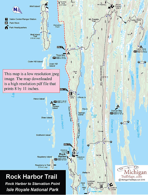
(This map is not geo-referenced)Trail Details
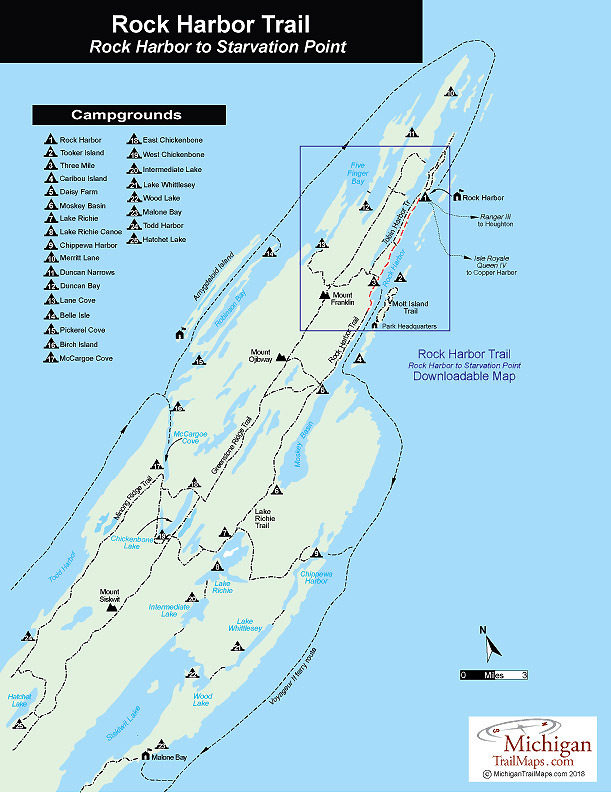

The first portion of the Rock Harbor Trail, the 7.2-mile trek to Daisy Farm, is an incredibly scenic walk along the bluffs of the shoreline, with constant views of the water. The 3.9-mile segment to Moskey Basin is not as scenic as it swings inland and is more difficult. Rock Harbor Trail Map 1 covers the 4.6-mile stretch from Rock Harbor to just pass Starvation Point. Rcok Harbor Trail Map 2 covers the western half of the trail to Moskey Basin.
Rock Harbor connects three backcountry campgrounds, two in the first half. Three Mile (2.8 miles) is the first reached from Rock Harbor and is pleasant, situated right off the shoreline. But being so close to where the Ranger III unloads its passengers, it can fill up fast during the summer, the reason for its 1-night limit. Three Mile Campground has eight shelters, group and individual campsites, pit toilets, and, most unusual, two docks. From either you can listen to the water lap onshore in the evening or watch the waves rush through the gaps between Inner Hill Island and Mott Island across Rock Harbor.
the second campground reached is Daisy Farm (7.2 miles) that falls in the same category as those at Rock Harbor and Windigo. It's a very popular spot to spend a night or even a couple of days and, consequently, has a lot of traffic. The campground has 16 shelters (often taken by early afternoon) and group and individual campsites. A ranger stationed here gives evening talks twice a week for most of the summer. There is also a large dock, from the end of which you can see Moskey Basin to the west, Mott Island to the east, and the restored Edisen Fishery straight across.
You can utilize the water taxi service offer by Rock Harbor Lodge to be dropped off at Three Mile or Daisey Farm if you are short on time.
| Camping |
| Difficulty - Moderate |
| Foot Path |
Geo-referenced maps from MichiganTrailMaps.com range from $1.99 to $2.99 each.
Download the Avenza app from the App Store or Google Play


