Lake Michigan Trail provides the shortest avenue to the beach and begins as a level walk through a pine/hardwood stand that keeps you well shaded from the sun. In less than a half mile, you pass the first of several benches and hike through a series of forested dunes. The ridges actually rise above you on both sides of the trail, but the trek remains surprisingly level. At Mile 0.7, you arrive at the junction with Cathead Spur, the beach access trail.
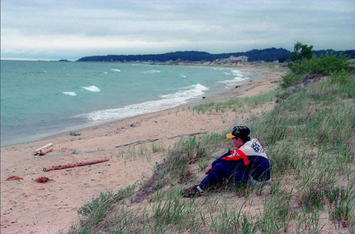
It's a 0.3 mile out to the bay, along a path that begins in the forest but suddenly breaks out of the trees into open dunes. If it's summer, you'll make the transition from cool forest to the brilliant sunlight and hot sand of the dunes in three steps or less. Yellow posts lead you across the low, rolling dunes to Cathead Bay, a spectacular spot to unroll a beach blanket. Only a few cottages are visible to the east; to the west is Cathead Point, and out on the horizon of Lake Michigan lie the Fox Islands.
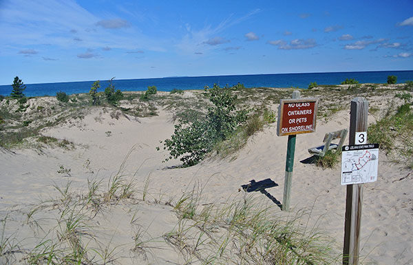
Backtrack on the spur trail and turn left to continue on Lake Michigan Trail. The trail climbs over a low dune and at Mile 1.4 reaches the next junction, Manitou Overlook Spur. This side trail to the left is an uphill walk, including a long staircase at the end, to a wooden observation platform and bench from where you can view the edge of the forest, open dunes, and the shoreline. Although it's called Manitou Overlook, the most prominent landmark you see in Lake Michigan is the Fox Islands, and in the still of a quiet morning, they often appear to be floating on a layer of mist and fog.
Backtrack to post No. 4 and continued straight to reach post No. 6 at Mile 1.9 that marks the junction with Mud Lake Trail. Marked by orange boot prints, Mud Lake Trail heads left and within a quarter mile reaches post No. 7 and the Maple Ridge Cutoff, a crossover spur that allows you to reach the parking area in a half mile south. There, near the posted map, is a bench overlooking several impressive paper birch trees. The Mud Lake Trail continues in a northerly direction as a wide and level path, reaching post No. 8 and the junction to Tamarack Cutoff at Mile 2.4.
Most of the trails are wide tracks to accommodate both hikers and skiers, but the northern half of Mud Lake suddenly changes to a true footpath as it winds among several forested dunes. There’s no views of the water here, but the terrain is interesting and at Mile 3.3 you begin a steady climb, topping off at a well-placed bench where you can rest and gaze down into a pothole, a natural amphitheater forested in hardwoods. You descend to a marsh, skirt it, and then follow a boardwalk to cut across the middle of it to arrive at post No. 9 at Mile 3.7.
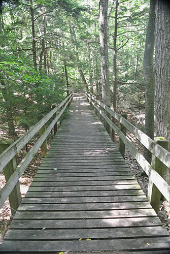
This post marks the junction to Pothole Ridge Spur. Mud Lake Trail heads south (left) and is a shorter and more level route. Pothole ridge begins with the steepest climb of the day and despite what common sense tells you, start climbing. This segment of trail is a scenic walk along the crest of a dune that includes a pair of boardwalks built to prevent excessive erosion to the delicate sides, the second features a pair of built–in benches. You pass post No. 10 and then descend to post No. 11 and the marshy north end of Mud Lake, reaches at Mile 4.2.
Returning to Mud Lake Trail, you head southeast along what was an old two-track that parallels a towering dune on one side while providing glimpses of the marshy shoreline of the lake on the other. Keep an eye on Mud Lake; a variety of birds and wildflowers, including wild irises, can often be spotted. At Mile 4.5, you arrive at post No. 12, marking the junction with Tamarack Cutoff and one end of a handicapped accessible segment of trail. There are also picnic tables among the trees. From here, it’s a half mile until Mud Lake Trail emerges into the open field and then enters the east end of the parking lot.