
Maplehurst Natural Area
Buy the $.99 downloadable map!
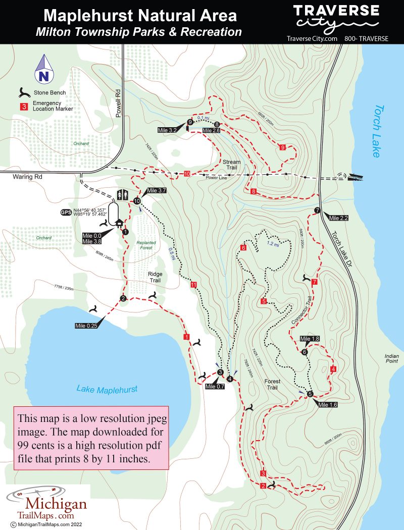
(This map is not geo-referenced)Trail Details


You’re driving through rural Antrim County, passing the perfect rows of cherry and apple orchards, faded red barns and farm stands overloaded with just-picked produce when a sign beckons you to leave the pavement and enter a forest.
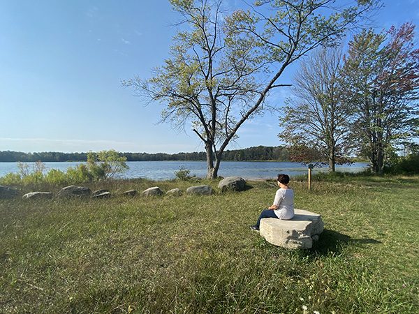
The short entrance road climbs to the highest point in the preserve, where you can see parts of Elk Lake, East Grand Traverse Bay, and even a slice of Mission Peninsula from a parking area. A grassy meadow, where sleeping cabins once stood, gently descends to even more water; the tract’s 60-acre spring-fed gem, Lake Maplehurst.
For more than 50 years, this 389-acre mix of woods and watery views was Camp Maplehurst, founded by psychology professor Thomas Cohn in 1955 as a retreat where gifted students could experience nature. By 2011, when Cohn's son closed the summer camp due to declining enrollment, Maplehurst had hosted more than 10,000 campers.
Milton Township officials viewed the shuttered camp, one of the largest remaining undeveloped parcels near Torch Lake, as something worth saving from future development. They turned to the Grand Traverse Regional Land Conservancy, who helped the township secure a Michigan Natural Resources Trust Fund grant and then fundraised the grant’s required match.
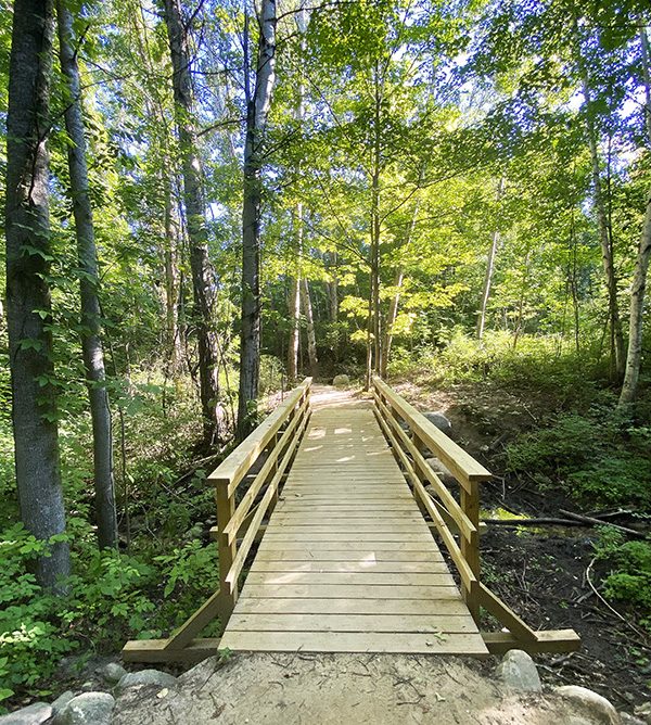
Maplehurst Natural Area opened in 2019 featuring a 5.6-mile, multi-loop trail system that makes the most of its unusually rugged terrain. All four loops at Maplehurst were designed with a focus on hiking and mountain biking. In the winter, portions of them are suitable for cross-country skiing and snowshoeing.
Lake Maplehurst meanwhile is once again a destination for canoers, kayakers and other non-motorized boaters.
| Difficulty - Moderate |
| Dog Friendly |
| Mountain Bike Single Track |
| Foot Path |
Geo-referenced maps from MichiganTrailMaps.com range from $1.99 to $2.99 each.
Download the Avenza app from the App Store or Google Play


