Maybury State Park: History Trail

Trail Details
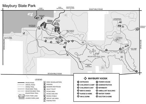
The Friends of Maybury State Park spearheaded the development of the History Trail, a self-guided history tour to commemorate Maybury Sanatorium.
To help combat the spread of tuberculosis, often referred to as the “white plague” in the early 20th century, the city of Detroit purchased eight farms in Northville that totaled of 850 acres and in 1921 opened the sanatorium. At its peak the institution was a self-contained community of more than 40 buildings and included Maybury Farm that contributed fresh milk and produce to the facility. Maybury Sanatorium gave Detroit a reputation as one of the leading cities in the world in the fight against tuberculosis before it closed in 1969.
| Difficulty - Easy |
| Foot Path |
Geo-referenced maps from MichiganTrailMaps.com range from $1.99 to $2.99 each.
Download the Avenza app from the App Store or Google Play


