
Palmer Woods: Hiking Trails
Buy the $.99 downloadable map!
(This map is not geo-referenced)Buy the Geo-referenced map
for use in the Avenza Maps App
Trail Details
Geo-referenced maps from MichiganTrailMaps.com are available through Avenza Maps and range from $1.99 to $2.99 each.
Download the Avenza app from the App Store or Google Play


Preserve namesake Dr. Dan Palmer was responsible for the tract. A dermatologist by trade and a botanist on the weekends with a passion for ferns, Dr. Palmer began purchasing small, undeveloped plots in the early 1970s and accomplished what couldn't possibly be done today. He managed to string together 20 adjoining lots that totaled 750 acres of northern hardwoods in the heart of Leelanau County. In 2013, he offered to sell his woods to the Leelanau Conservancy, which undertook its largest fundraiser, a $3 million campaign.
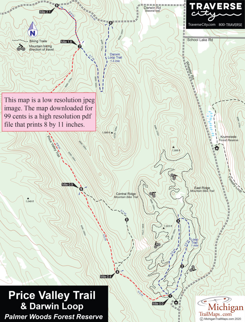
Palmer Woods is one of the conservancy's two Forest Reserves, the other being Krumwiede located just across Wheeler Road. Both are managed to maintain, even improve, the biological diversity of the trees through periodic selective harvesting. Dr. Palmer was already managing his woods as a sustainable working forest, so the tract is laced by old logging roads with a handful quickly turned into hiking trails. The 2.1-mile Price Valley Trail was the first posted and was followed by the Darwin Loop Trail in 2017. Today there are 3.8 miles of footpaths, and eventually, the forest reserve will feature 9 miles of hiking and skiing trails and more than 15 miles of mountain biking trails.
The conservancy has teamed up with the Friends of Sleeping Bear Dunes to groom a ski trail for both skate and classic skiers when there is sufficient snow. At the same time, snowshoers have also discovered the tract, turning Palmer Woods into a four-season destination for trail users.
| Difficulty - Easy |
| Groomed Classic Skiing |
| Groomed Skate Skiing |
| Dog Friendly |
Geo-referenced maps from MichiganTrailMaps.com range from $1.99 to $2.99 each.
Download the Avenza app from the App Store or Google Play
