Petoskey State Park: Portage Trail
Buy the $.99 downloadable map!
(This map is not geo-referenced)Trail Details

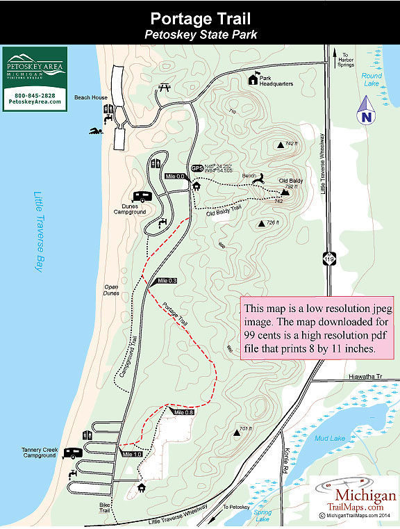
Portage Trail is the longest path in Petoskey at a mile from one end to the other. Older park maps show it as a partial loop but the actual marked trail extends from Dunes Campground to Tannery Creek Campground, crossing the park road to a forested area of some surprisingly steep hills.
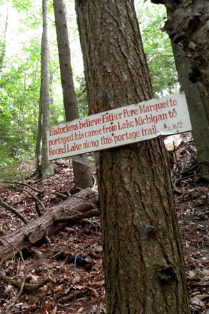
The trail picks up its name from the fact that historians believe in 1672 Father Jacques Marquette, the famous Jesuit priest and explorer, portaged his canoe through the park traveling from Lake Michigan to Round Lake. Father Marquette founded Sault Ste. Marie in 1668, St Ignace in 1671 and then went on with Louis Jolliet to become the first Europeans to see and map the northern portion of the Mississippi River.
Portage Trail has trailheads along the park road near the Tannery Creek restroom and the firewood bin at Dunes Campground. You can also pick it up from a parking area across from Tannery Creek Campground at the south end of the park. This description begins at the Old Baldy Trailhead where there is parking for day visitors.
| Camping |
| Difficulty - Easy |
| Dog Friendly |
| Foot Path |
Geo-referenced maps from MichiganTrailMaps.com range from $1.99 to $2.99 each.
Download the Avenza app from the App Store or Google Play


