Pinckney Recreation Area: Crooked Lake Trail - Hiking

Buy the $.99 downloadable map!
(This map is not geo-referenced)Trail Details

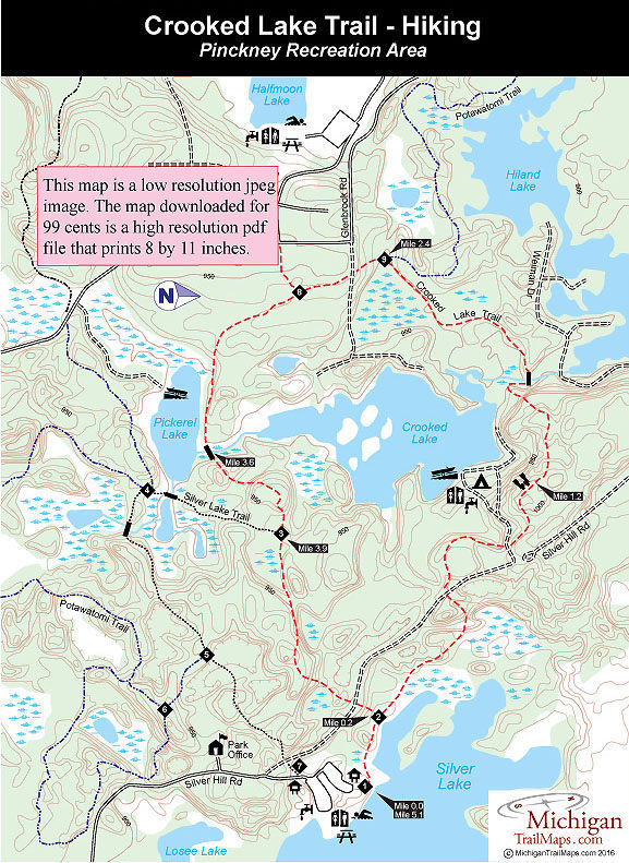
The best hiking in southeastern Michigan is in Pinckney Recreation Area, and the Crooked Lake Trail is another reason why. This 5.1-mile loop is a pleasant walk that traverses hardwood forests, marshes, and grassy hillsides. Along the way, you pass three inland lakes, climb to 1,008 feet for a view of Crooked Lake, and plunge down a ridge forested in hardwoods that makes this path an especially scenic one in October.
But the nicest feature of this trail is its proximity to several urban areas, including Jackson, Ann Arbor, and western Detroit. Because of Pinckney Recreation Area, hikers from here don't have to drive all day just to find a scenic trail on state land.
This location also draws a large number of mountain bikers looking for suitable terrain to pursue their activity. In 1990 the park staff instituted regulations that required bikers to follow Crooked Lake in a clockwise direction and hikers walk in a counter-clockwise direction.
By following these regulations, at least you have time to react to bikers speeding towards you. If encounters with even conscientious cyclists who pull over to allow hikers to pass disturb your walk, find another trail. Crooked Lake and the park's Potawatomi Trail draw more mountain bike activity than any other routes in southeastern Michigan and maybe any other trail in the state.
Along with October, when fall colors peak, mid-May is a pleasant time to walk this trail, when the ponds and marshes are ringed by wildflowers and waterfowl can often be sighted on the lakes. These same low-lying areas make the area a little buggy in late June through July, although not excessively bad.
| Camping |
| Difficulty - Moderate |
| Dog Friendly |
| Multi-use Trail |
Geo-referenced maps from MichiganTrailMaps.com range from $1.99 to $2.99 each.
Download the Avenza app from the App Store or Google Play


