For a map or complete description to all the trails order Porcupine Mountains Wilderness State Park: A Backcountry Guide for Hikers, Backpackers, Campers & Winter Visitors by Jim DuFresne from the eshop:
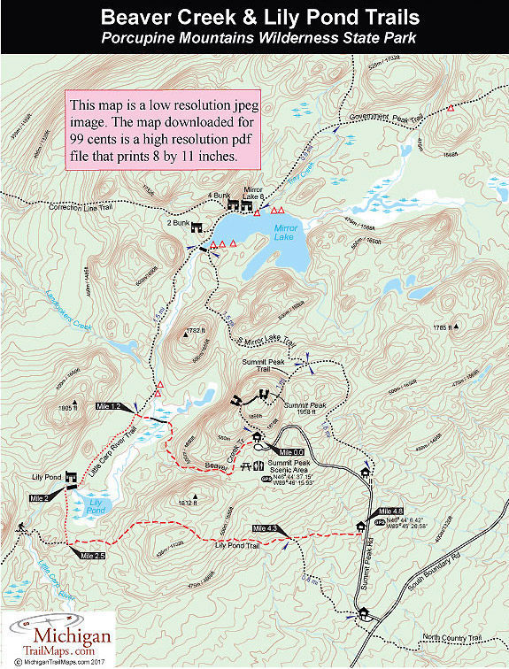
Beaver Creek Trail
Distance: 2 miles to Lily Pond
Beaver Creek Trail begins near the toilet building, wanders into the maple forest and immediately arrives at a second trailhead where the foot path swings away from an old logging road that is Summit Peak Trail. Beaver Creek is clearly mark and from here crosses a small stream and then makes rapid descent from the Summit Peak area into a gorge formed by the so called Beaver Creek, though it is not labeled on maps. At Mile 0.4 you reach a bench overlooking a beaver pond. From here the downhill walk is even more impressive as you follow the stream through the steep-sided and boulder-strewn gorge.
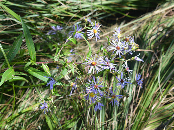
Eventually you bottom out and swing north away from the creek and arrive at the extensive marsh area surrounding Little Carp River at Mile 1.1. A bridge and then planking with a small knob of dry ground in the middle provides dry footing across the marsh to the junction of Little Carp River Trail on the other side. But take your time crossing for the opportunities to sight wildlife, including beavers, are very good here while the wetlands are often filled with wildflowers in the summer.
The posted junction is reached at Mile 1.2 and from here Mirror Lake is 1.5 miles north (right) along Little Carp River Trail while Lily Pond is 0.8 mile to the south (left). Heading south, the trail is a level walk through a mix of hardwoods and pines with an occasional wet area to step through before you break out at the impressive bridge across Little Carp River. The huge wooden structure features a bench in the middle that features a view of Lily Pond and the surrounding ridges. The bench and the view make the bridge a great place for an extended break or lunch.
Lily Pond Trail
Distance: 2.8 miles
Little Carp River Trail departs into an impressive stand of white pine and in less than a half mile, or Mile 2.5, reaches the posted junction with Lily Pond Trail. Continue west on the Little Carp River Trail and you will reach Lake Superior in 9 miles.
Head east on Lily Pond Trail to return to Summit Peak Road in 2.3 miles. You immediately pass a pair of old tree stump chairs that have been cleverly carved with a chainsaw and now are padded with green moss. Who says park rangers aren’t creative? You pass through an impressive stand of old growth hemlocks and then the trail begins its ascent out of Little Carp River valley.
The climb is gentle at first and along the way you move from pines into a virgin stand of maple and beech and pass some impressively large trunks. Thimbleberry patches will also begin appearing, the openings the result of a massive wind storm known as the Great Blowdown of 1953, and if your timing is right you will be stopping at every splash of red along the trail.
At Mile 2.8 the climb steepens as you gain 165 feet in the next half mile before a steep but short pitch leads to the high point of the trail at 1,735 feet. A bench here allows you to plop down and admire, not a panoramic view, but old growth maples and other hardwoods.
Once over the top, the trail makes a steady descent for a half mile to cross a stream at 1,500 feet and then at Mile 4.3 arrives at a junction. Heading to the south (right) is the North Country Trail which in 0.8 miles reaches a trailhead in a large, paved parking area near the junction of Summit Peak Road and South Boundary Road.
Heading to the east (left) is Lily Pond Trail. In the final half mile, you gently descend back to the lower elevation of Summit Park Road at 1,400 feet and then cross one last stream just before breaking out in a small parking lot at Mile 4.8. From here you’re 0.7 miles north of South Boundary Road and 1.5 miles south of the Beaver Creek/Summi Peak trailhead.