For a map or complete description to all the trails order Porcupine Mountains Wilderness State Park: A Backcountry Guide for Hikers, Backpackers, Campers & Winter Visitors by Jim DuFresne from the eshop:
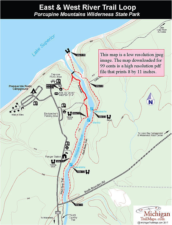
Beginning in the park’s Presque Isle Day-use Area, you waste no time in getting to the river. The trail immediately turns into a long stairway that descends into the gorge, past a junction with the West River Trail boardwalk to an impressive swing bridge that crosses the rushing water that is the Presque Isle here. From the middle of the bridge, it is an incredible view up stream. Presque Isle is by far the largest river to flow through the Porkies and its current is so strong that the whirlpool swirl of the water has carved perfect half-circles in the bedrock below you.
On the other side of the bridge is another junction andw hat appears on maps as a peninsula. In realty it's an island in the mouth of the river with a dry channel on one side that becomes flooded during high water. The left-handed fork heads north across the island to Lake Superior and its shoreline of jumbled driftwood.
The right-handed fork is marked by a North Country Trail symbol and leads you south to the dry channel on the east side, an intriguing spot. Crossing the channel you climb across layers of shale with a small waterfall in the background before reaching the other side of the gorge. The East River Trail begins with a steep climb, topping off at the posted junction with the 17-mile long Lake Superior Trail at Mile 0.5. The NCT stays with the Lake Superior Trail that heads east to reach the Little Carp River in 6.3 miles.
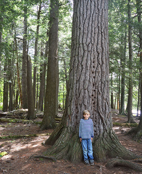
The East River Trail continues south, climbing along the edge of the gorge and over masses of roots from the towering stand of virgin hemlock, white pine and cedar. The trees are impressive here, but the walk can be challenging at times. Even when you can’t see the river, the thunder of whitewater is a constant reminder of what lies below.
At Mile 0.8 the trail descends to a bench overlooking Manabezho and Manido falls, a pair thundering cascades just down river from each other. The first is Manabezho Falls, the most impressive cascade along the river. The falls make a 20 to 25-foot thundering drop over a rock ledge and create a heavy mist and a blanket of form. Another 100 yards upstream is Manido Falls, which descend 25 feet over a gradually declining set of rock ledges.
The climbing and descending along the gorge continues, allowing you to view a series of cascades for the next half mile until you arrive at Nawadaha Falls where the river tumbles 15 feet over a series of rock steps. The trail swings away from the river to pass beneath the most impressive stand of old-growth pine along the loop and at Mile 1.6 breaks out at South Boundary Road. On the other side of the bridge, trails are marked on both sides of South Boundary Road. To the south (left) is the North Country Trail. To the north (right) the West River Trail quickly leaves the pavement and as a needle-carpeted path winds through another impressive stand of towering hemlock.
The west side is a much easier hike. You stay near the river and weave through the trees to reach a viewing deck overlooking Nawadaha Falls at Mile 2. Just beyond the deck is the spur that heads west (left) to the trailhead near the ranger station. Within a quarter mile the West River Trail climbs out of the gorge only to descend steeply back into it a short distance downstream to reach the viewing deck overlooking Manido Falls at Mile 2.3.
A boardwalk and massive stairs replace the foot path for the reminder of the hike, leading you to a viewing area above Manabezho and then past more turbulent waters that follow it. You are so close you can feel their cooling mist on a hot afternoon. It is so impressive; you’re disappointed when you soon return to the stairway that leads back to the day-use area.