Porcupine Mountains: Nonesuch Mine Trail

Buy the $.99 downloadable map!
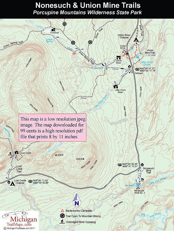
(This map is not geo-referenced)Trail Details
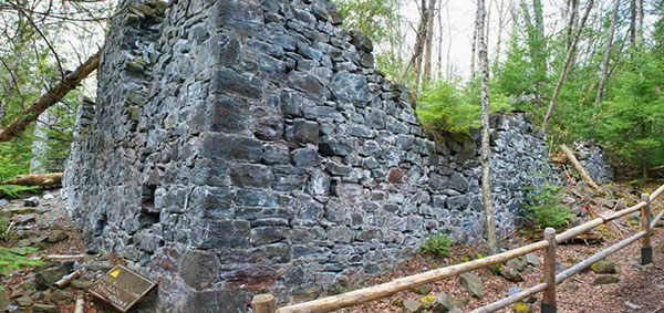
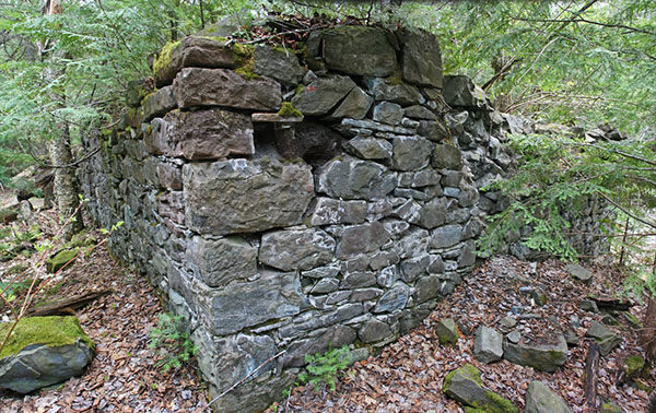
Ed Less is given credit for discovering the Nonesuch on the Little Iron River in 1865 and within two years the Nonesuch Mining Company was extracting copper from a pair of shafts. But as a mining operation the Nonesuch sputtered at best over the next 45 years, opening and closing five different times, each under different ownership.
The only time the Nonesuch vein produced a profit was from 1879 to 1881 after a tram road was completed to Union Bay on Lake Superior. By the early 1880s 150 men were employed at Nonesuch mine which resulted in a company town of more than a dozen homes, warehouses, a store, boarding houses and a hotel. During the summer the town had a population more than 300, featured a uniformed baseball team and was connected to Ontonagon with weekly stage coach service. When the mine ceased operations for good in 1912 the total recorded production of the mine was 390,000 pounds of copper.
Today what's left of the Nonesuch Mine provides an easy outing to explore the ruins of an abandoned copper mine, the adjoining company town and even a scenic waterfall when there is enough flow in the Little Iron River, not always the case in July and August. It’s a half mile trek to the waterfall along a two-track and then a foot path at the end. This can be a quick hike to stretch the legs or an outing that lasts several hours exploring the area.
| Difficulty - Easy |
| Dog Friendly |
| Foot Path |
| Two-Track |

Geo-referenced maps from MichiganTrailMaps.com range from $1.99 to $2.99 each.
Download the Avenza app from the App Store or Google Play


