For a map or complete description to all the trails order Porcupine Mountains Wilderness State Park: A Backcountry Guide for Hikers, Backpackers, Campers & Winter Visitors by Jim DuFresne from the eshop:
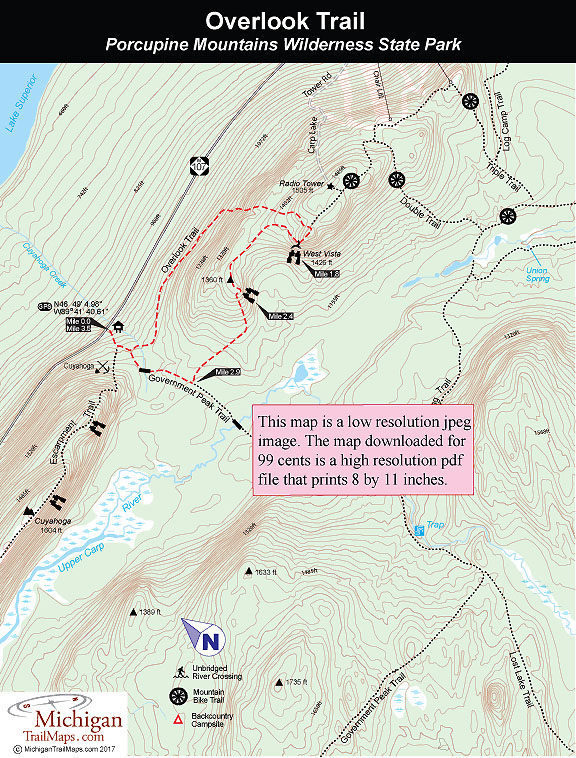
Most hikers begin the Overlook Trail at the Government Peak Trailhead along M-107. You actually begin and end on Government Peak Trail but only briefly. The wide trail quickly climbs to its junction with the Escarpment Trail, then intersects with the north end of the Overlook, a signposted junction that is less than a quarter mile from the trailhead on M-107.
The Overlook begins by descending to Cuyahoga Creek, climbing out of the gully, and then passing through a wet area for the next 0.3 mile. This ends when the trail enters a stand of stately virgin hemlock. The trees are stunning, especially when most people have to lean back to see the tops. At this point keep a sharp eye out for blue blazes on the trunks as the trail is not well defined in places.
At Mile 1.1 the Overlook swings to the southeast and begins a steady climb, levels out briefly among the towering pines and climbs again. The second ascent is a steep one for more than a quarter mile before you top out in a forest of hardwoods at 1,494 feet at Mile 1.7. Here the foot path merges with a two-track that is a ski trail during the winter and open to mountain bikers the rest of the year. To the east (left) the ski/bike trail passes a radio tower within a quarter mile and then heads for park’s downhill ski area.
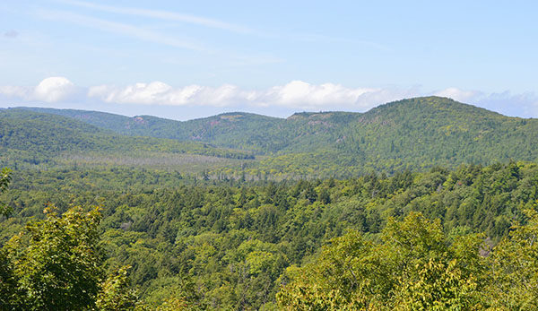
To the west (right) the ski/bike trail makes a short descent and at Mile 1.8 arrives at the West Vista, where somebody has thoughtfully placed a bench. The 1,426-foot high point is a far better view in September, when leaves have fallen and the rest are changing color. In the winter, it is the stunning highlight for cross country skiers as they can look down the Carp River Valley, past Lake of the Clouds and the Escarpment all the way to Lake Superior. But even in the summer the view is worth an extended break.
The second leg of the Overlook Trail is well posted at the West Vista and begins by descending into a forest of mature hemlocks and maples and climbing in and out of a small creek. Within a half mile the trail swings to the southwest and arrives at a second viewing point at Mile 2.4. The view includes the Union Spring area to the southeast with the Trap Hills on the horizon, though in mid-summer you might have to stand on your toes to get a glimpse.
The trail continues with another sharp descent of more than 150 feet in less than a quarter mile before leveling out and swinging to the west in a forest of mature hemlocks and maples. You reach a well-posted junction with Government Peak Trail just shy of Mile 3 and head north (right). Within a quarter mile the trail crosses a wet area that is Cuyahoga Creek but is well planked. The wide, unmistakable path climbs a bit and then you finish off the day with a descent to M-107, passing the earlier junctions to the Escarpment and Overlook.