Porcupine Mountains: Pinkerton Trail

Buy the $.99 downloadable map!
(This map is not geo-referenced)Trail Details
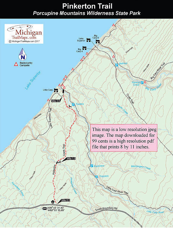

But Pinkerton is also a scenic walk, passing through impressive stands of virgin hemlock and crossing several bridged streams and creeks along the way.
| Camping |
| Difficulty - Easy |
| Difficulty - Moderate |
| Foot Path |
Geo-referenced maps from MichiganTrailMaps.com range from $1.99 to $2.99 each.
Download the Avenza app from the App Store or Google Play


