322

Trails Reviewed

Find Trails & Maps

Search for Trail
Search by Location
Search by

Back to listing

Porcupine Mountains: Pinkerton Trail

Trail Details

County
Gogebic
Regions
Western Upper Peninsula
Latitude
N 46° 43' 27.12"
Longitude
W 089° 53' 33.72"
Distance
2.6 mile one-way
Trail Type
Foot path
Terrain
Old growth forests, Little Carp River
Difficulty
Easy to moderate
Nearest City or Town
Wakefield
(map loads here)
view map
Pinkerton Trail is the shortest route to the cabins and campsites near the mouth of the Big Carp River, a popular destination for many hikers. Others choose Pinkerton Trail to bypass the rugged west end of the Lake Superior Trail. The trail itself is 2.6 miles, making the journey to the mouth of the Big Carp River a one-way trek of roughly 4 miles. But Pinkerton is also a scenic walk, passing through impressive stands of virgin hemlock and crossing several bridged streams and creeks along the way.
Expand All
Photos
Description
Pinkerton Trail is the shortest route to the cabins and campsites near the mouth of the Big Carp River, a popular destination for many hikers. Others choose Pinkerton Trail to bypass the rugged west end of the Lake Superior Trail. The trail itself is 2.6 miles, making the journey to the mouth of the Big Carp River a one-way trek of roughly 4 miles.

But Pinkerton is also a scenic walk, passing through impressive stands of virgin hemlock and crossing several bridged streams and creeks along the way.
Amenities & Services
Camping
Difficulty - Easy
Difficulty - Moderate
Foot Path
Trail Guide

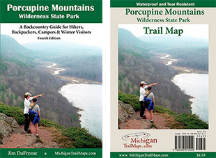
For a map or complete description to all the trails order Porcupine Mountains Wilderness State Park: A Backcountry Guide for Hikers, Backpackers, Campers & Winter Visitors by Jim DuFresne from the eshop:

The highest point of the trail - 861 feet - is at the trailhead. From there you quickly enter an old growth forest, a stand of impressive hemlocks and later northern hardwoods such as maple and yellow birch and begin a mild descent. At Mile 1 the trail arrives at the Pinkerton Creek bridge where on the other side you climb the bank to a bench. The trail levels out briefly, then descends to cross a feeder creek on a slab bridge.

The trail levels out again, angling towards Little Carp River through the impressive forest and at one point passes a lighting-struck tree posted with “1988”, the year of the storm. At Mile 2.2 you emerge on the edge of the Little Carp River Gorge to see the rushing stream below. From here it is a gradual half mile descent to the Lake Superior Trail junction.

To the west Presque Isle River is a 6.3-mile trek while Little Carp River Cabin is just up the trail to the east. The mouth of the Big Carp River is still 1.3 miles to the east but reached along a very scenic stretch of the Lake Superior Trail that hugs the shoreline.

Facilities

There is limited parking at the trailhead and no source of drinking water or other facilities.

Hours & Fees

A state park Recreation Passport or daily vehicle permit is required to enter the park and leave a car at the trailhead. Passes can be purchased from the park's Wilderness Visitor Center.

Directions

The trailhead is posted along South Boundary Road, 5 miles east of Presque Isle and 20 miles west from the Visitor’s Center.

Information

For more information call the park headquarters at (906) 885-5275.


Geo-referenced maps from MichiganTrailMaps.com range from $1.99 to $2.99 each.

Download the Avenza app from the App Store or Google Play

App Store Google Play

Michigan TrailMaps.com Michigan's Premier Trail Resource Contact

Trail Mix News

by travel and outdoor writer Jim DuFresne!

Sign Up
Enews Signup
Find a Trail

Find Trails & Maps

Search for Trail
Search by Location
Search by