324

Trails Reviewed

Find Trails & Maps

Search for Trail
Search by Location
Search by

Back to listing

Power Island

Trail Details

County
Grand Traverse
Regions
Northwest
Latitude
N 44° 51' 54.36"
Longitude
W 085° 34' 38.28"
Distance
Loops of 3.1 miles and 2.2 miles
Trail Type
Foot path
Terrain
Forested ridges and 3 miles of shoreline
Difficulty
Moderate to challenging
Nearest City or Town
Traverse City
(map loads here)
view map
Within sight of downtown Traverse City, roadless, vehicle-less Power Island is one of the most unusual county parks in Michigan. Best of all it features 6.5 miles foot trails and 15 rustic campsites with watery views of West Grand Traverse Bay.
Expand All
Photos
Description
One of Michigan's most unusual county parks is Power Island. The 204-acre preserve of forests, bluffs, and beaches is 3.5 miles south of Bowers Harbor in West Grand Traverse Bay and in sight of downtown Traverse City. The park actually contains two islands, but during periods of low water levels, adjoining Bassett Island is connected to the much larger Power Island by a narrow isthmus of sandy beaches and wetlands.

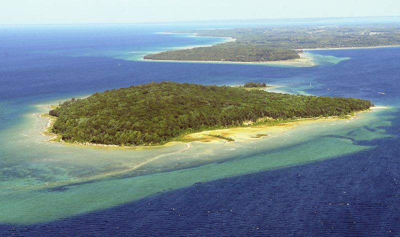
Originally known as Marion Island, the island was purchased by automotive pioneer Henry Ford in 1917, who used it as a rustic retreat where he entertained friends like Thomas Edison, Harvey Firestone, and possibly three U.S. presidents: Woodrow Wilson, Warren G. Harding, and Theodore Roosevelt. Ford sold his retreat in 1944, and after several owners, the island was acquired with the help of the Nature Conservancy and turned over to the Grand Traverse County Parks and Recreation in 1975.

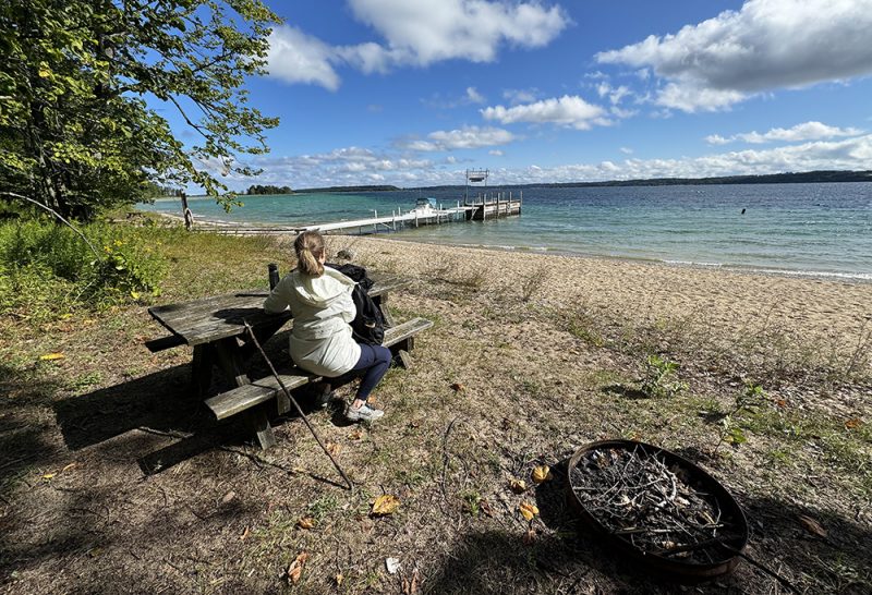
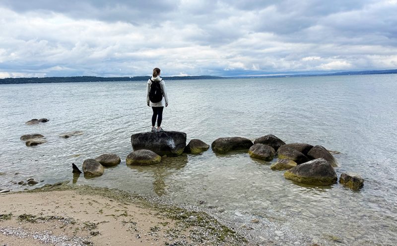
There are no roads or vehicles on Power Island. The park features 10 rustic campsites on Power Island and five on Bassett Island – no RVers here -that often are reserved in advance. The park’s facilities include outhouses, drinking water, and a small picnic area overlooking a beautiful swimming beach.

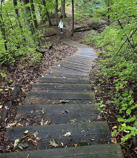
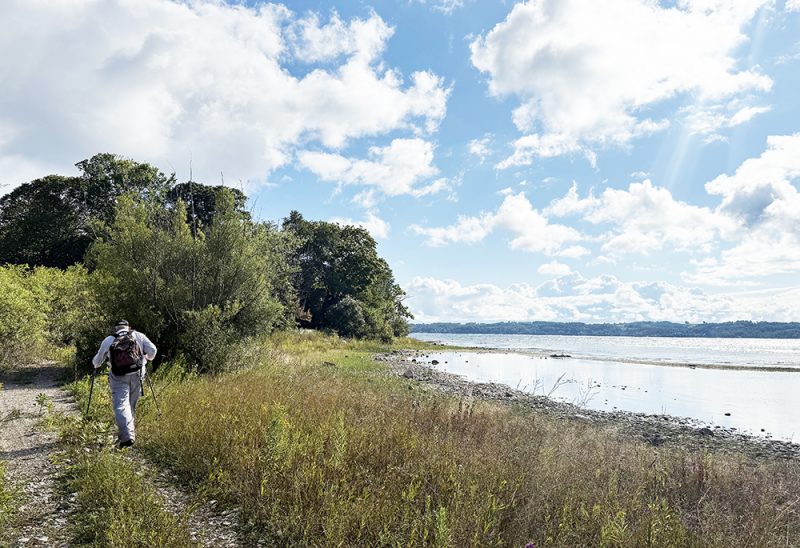
The island features a 6.5-mile network of well-marked trails. The park designates almost half of the system as ATV trails that allow access by a ranger on a motorized rescue vehicle. These paths  - Center, West Beach, Bassett Island and Short Loop Trails – are wider and easier to follow.

The network's perimeter creates a 3.1-mile loop that is often in view of Grand Traverse Bay and the many beaches along the shoreline. The rest of the trail system winds along the interior bluffs and offers considerably more elevation and climbs.

Thanks to its sheltered location just outside of Bowers Harbor, Power Island is one of the most popular boating and kayaking destinations on the bay. On summer weekends, its tiny harbor regularly fills with boats and frolicking boaters who congregate around the dock and swimming beach, or cluster in the shallows off the island’s southern edge to enjoy Caribbean-clear waters and picnic on the tree-shaded beaches.

But even on the busiest days, you can escape into the well-forested ridges of the interior or the west shore beaches, as most visitors never venture more than a few yards from the water’s edge or even leave their boat.
Amenities & Services
Camping
Difficulty - Challenging
Difficulty - Moderate
Difficulty - Easy
Dog Friendly
Foot Path
Trail Guide

The 6.5 miles of trails on Power Island are composed of short segments that can be combined for a nearly endless variety of loops from the park’s dock. But for all practical purposes, the trail network is composed of a perimeter loop that follows the shoreline and has very little climbing, and the trails that climb up and over the ridge that dominates the island’s interior.

Perimeter Loop

This 3.1-mile route follows the shoreline, provides plenty of views and access to beaches on West Grand Traverse Bay, and includes historic Bassett Island. From the park dock, you begin at Post 1 and follow the trail in a clockwise direction. At Mile 0.6, you arrive at Post 6, marking the junction to scenic South Point Loop. A long series of steps descends towards the shoreline along this loop, and another set allows you to reach the water itself and the sweeping views at the southeast corner of the island. South Point continues to skirt the shoreline just above the bay and at Mile 1 merges into the West Beach Trail.

Parts of this wide trail follow a 1903 logging road, providing for scenic and easy hiking. Post 10 at Mile 1.3 is where you head west to reach beautiful West Beach. North Shore Trail continues from here as a foot path that remains close to the shore, weaving in and out of the forest to views of the bay until reaching Post 13 at Mile 2.

A side trip to Bassett Island is highly recommended, even if you’re not planning to camp there. When water levels are high, Bassett is a true island, but in recent years, a narrow isthmus has allowed hikers to reach it and still keep their boots dry.  It’s a quarter mile to the island, and the views along this narrow strip of sand are excellent, with wetlands on one side and a beach on the other.

At the turn of the century, Bassett Island was the site of a two-story dance pavilion that revelers from Traverse City reached by steamships. They flocked up the bay for raucous dances that went late into the night as well as movie screenings, picnics, and social gatherings. And legend has it that Henry Ford kicked baseball slugger Babe Ruth off the island following a drunken escapade one night. Today, the island is a quiet spot with five campsites, a vault toilet, and nice views, but no dance hall.

Bassett Island Trail heads south from Post 13 to the park dock that is reached within a mile. At Post 14, you can add a half-mile side trip to climb North Bluff to Eagle Nest Lookout, passing some nice views along the way. Ironically, there are now views at Eagle Nest as the foliage has long since filled in.

Ridge Loop

There are four bluff trails that skirt the island\'s interior ridge, and this 2.2-mile loop from the park dock includes three of them. You pick up the first, South Bluff Trail at Post 5 and follow the foot path to the south end of the West Bluff Trail at Post 9, a walk of less than a mile. To many hikers, the rugged West Bluff Trail is the most interesting route in the park. The trail is a series of climbs and descents over undulating terrain, often the steep edge of a bluff, with views of the bay. It ends at Post 22.  You can bypass this challenging section by following Center Trail instead to the post.

Continue north for Eagle Nest Lookout at Post 20, where, to the dismay of many, there is neither breathtaking scenery nor a nest in sight. But the post marks the junction to the North Bluff Trail, which quickly passes sweeping views of the island’s north end and Bowers Harbor in the distance. The loop is completed by descending to the Short Loop, a wide path that was once part of an interpretive trail.

Facilities

There are 10 campsites on Power Island in South Beach Campground and five in Bassett Island Campground. Sites feature a fire pit area, picnic table, cooking grill, and access to an outhouse. There is drinking water near the end of the dock.

Reservations are strongly reccommended for Power Island campsites during the summer and can be made starting on the first business day in January of the year of the reservation. Campsites are $35 a night for Grand Traverse County residents and $55 a night for non-residents. Campsites are reserved online through Grand Traverse County Parks and Recreation or by calling 231-922-4818.

The dock at Power Island is available only for temporary mooring, primarily to unload visitors or camping gear. There are no designated boat slips for public use on the island. Boats generally anchor just offshore on the southeast side of the island, while kayakers are allowed to pull their boats on the beach.

Hours & Fees

Power Island is open year round from 8 a.m. until 11 p.m. and some people do visit the park in the winter. The camping season is from the last weekend in May through to the first weekend in October.

Directions

There was a short-lived ferry service to Power Island in 2014, but today you have to reach it in your own vessel. Kayakers generally put in at the DNR access site in Bowers Harbor, where the island is a 3.5-mile paddle, much of it in protected waters, depending on the wind direction. From Clinch Park Marina in Traverse City, the park is a 6.5-mile boat ride or paddle.

Information

For more information contact the Grand Traverse County Parks & Recreation at (231) 922-4818 or online.

For lodging or travel information contact Traverse City Tourism (800-872-8377; www.traversecity.com).


Geo-referenced maps from MichiganTrailMaps.com range from $1.99 to $2.99 each.

Download the Avenza app from the App Store or Google Play

App Store Google Play

Michigan TrailMaps.com Michigan's Premier Trail Resource Contact

Trail Mix News

by travel and outdoor writer Jim DuFresne!

Sign Up
Enews Signup
Find a Trail

Find Trails & Maps

Search for Trail
Search by Location
Search by