Proud Lake Recreation Area: Marsh Trail

Buy the $.99 downloadable map!
(This map is not geo-referenced)Trail Details
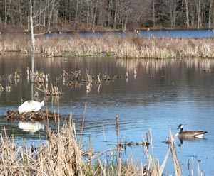

This short and easy walk is ideal for children, even those as young as three or four years old. The small lake, technically an impoundment, provides them with something to constantly to look at while the eight interpretive panels along the trail, whose subjects range from dragonflies and turtles to herons, allow you to pass along a bit of wetland education. If it’s spring or fall, carry a pair of binoculars to search for wildlife and look at birds.
| Camping |
| Difficulty - Easy |
| Foot Path |
Geo-referenced maps from MichiganTrailMaps.com range from $1.99 to $2.99 each.
Download the Avenza app from the App Store or Google Play


