
Sleeping Bear Dunes: Empire Bluff Trail

Buy the $.99 downloadable map!
(This map is not geo-referenced)Buy the Geo-referenced map
for use in the Avenza Maps App
Trail Details
Geo-referenced maps from MichiganTrailMaps.com are available through Avenza Maps and range from $1.99 to $2.99 each.
Download the Avenza app from the App Store or Google Play


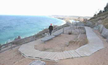
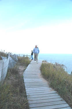
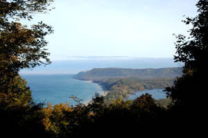
Add six interpretive posts and an accompanying brochure that explains the natural and geological history of the area, and you have one of the best short hikes in the state.
The round trip is only 1.5 miles and in 2022, the park staff re-routed a small portion of the trail to soften the final slope at the end. But Empire Bluff is still rated moderate due to the amount of climbing involved. You also have to keep an eye out for poison ivy, commonly seen in the open areas along the way, and should definitely refrain from descending the sandy bluffs at the end since it will hasten erosion.
The trail is open year-round and makes for a far better snowshoe trek than it does for Nordic skiing, even with backcountry skis. Mountain biking is not allowed on the trail.
As a hike, Empire Bluff is an excellent choice for families and can be done by most people in under an hour. Pack along a lunch and enjoy it with a view that would rival any tableside view at Michigan’s finest restaurants. Better yet, bring a flashlight and arrive at near dusk on a clear evening for a sunset second to none.
| Difficulty - Moderate |
| Foot Path |
Geo-referenced maps from MichiganTrailMaps.com range from $1.99 to $2.99 each.
Download the Avenza app from the App Store or Google Play
