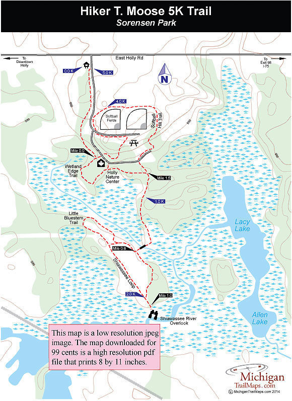
Sorensen Park

Buy the $.99 downloadable map!
(This map is not geo-referenced)Trail Details

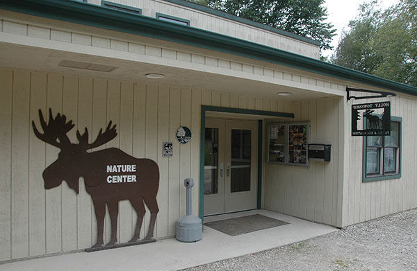
At the front of Sorensen Park are the usual park amenities; softball fields, a tot lot and a picnic area. In the back is one of the best examples of a warm-water river eco-system in Michigan and a rare fen. Separating the two is the Holly Nature Center.
All this is literally on the edge of Holly, a small town in the northwest corner of Oakland County. An amazing place if you know about it. But most people driving past the park entrance on East Holly Road don’t have a clue of what lies beyond the ball fields, including the Hiker T. Moose 5K Trail.
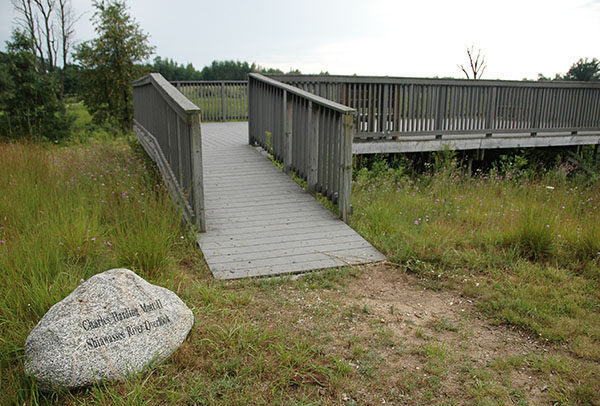
After establishing the park, the small nature center was added in the late 1990s and a trail system was developed. The crowning jewel of the park, however, arrived in 2003 when park officials use a grant to build the Charles Harding Mott II Shiawassee River Overlook. The massive observation deck now anchors the south end of the park’s trail system and allows hikers to view the amazing fen that surrounds the Shiawassee River.
From start to finish, the Shiawassee River is a watershed that covers 742,400 acres and supports more than 40 species of fish, including darters, minnows, and channel catfish. The river also plays an integral role in the travels of migratory waterfowl while the swamps and fens adjacent to the river's headwaters support several globally rare species, including the massasauga rattlesnake, Blanding's turtle, and insects such as the powesheik skipperling.
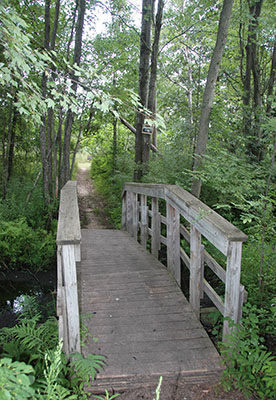
The wetlands, fen and the headwaters of the Shiawassee are prominent features of the Sorensen trail system. The Hiker T. Moose is a 5-kilometer trail covers the entire trail system but includes 2 kilometers that wraps around the softball fields and picnic areas at the developed north end of the park and walking what is referred to as the Shiawassee Loop twice. It’s the only way to get a 5-kilometer route in a 93-acre park.
For those more interested in the vast wetlands and fen than piling up mileage, a more interesting hike is to combine the Wetland Edge Trail with Shiawassee Loop and Little Bluestem Trail for a walk of 1.6 miles.
| Difficulty - Easy |
| Dog Friendly |
| Foot Path |
Geo-referenced maps from MichiganTrailMaps.com range from $1.99 to $2.99 each.
Download the Avenza app from the App Store or Google Play


