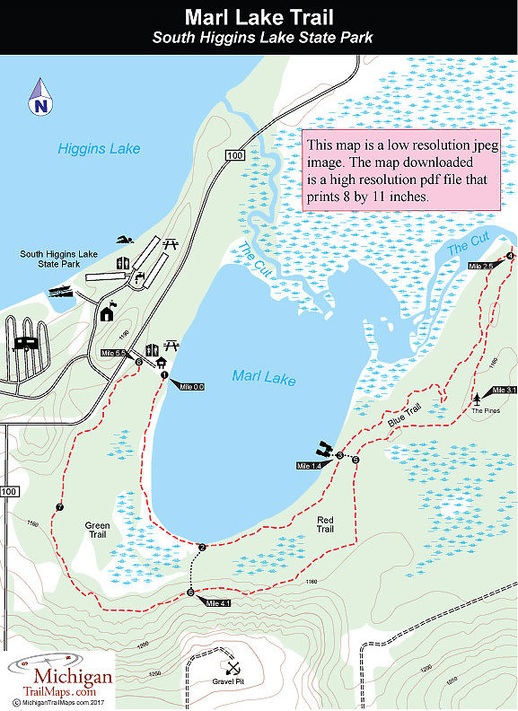
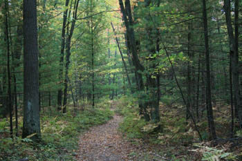
From the parking area the Green Trail begins at a bridge and from there heads south as a wooded path, hugging the lake for 0.75 mile and providing delightful views of the water through the fringe of pine trees. Right before the first cutoff, you cross two long bridges that provide dry access between the lake to the east and an interesting swamp to the west.
The cutoff is posted with green dots that swing south (right) to reach the return trail; the red and blue dots continue along the lakeshore. The Red Trail stays close to the lake at first then swings away from it slightly. You can still catch slivers of blue between the green pines and the white trunks of the paper birch trees, as well as any wind off the lake.
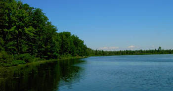
At Mile 1.4 you reach the second cutoff spur, where a short path leads left down to the shoreline. At the bench here, you can sit and look across the weedy lake to watch others just starting out at the parking area. Marl Lake lies totally in the park allowing its shoreline to be free from cottages and resorts. Its deepest section is only three feet, limiting anglers to canoes or small motorboats. The lake does hold populations of perch, bass, and northern pike and has an unimproved boat launch, but angling activity is light and shore fishing is usually unproductive due to the shallow depth.
At this point, the vast majority of hikers begin their return, which is too bad. The longer Blue Trail takes you past the oldest and most impressive trees of the forest, and it is from this section of the trail that hikers have their best chance of sighting whitetail deer, especially in the early morning or at dusk. Even if you don't see the animals themselves, their tracks often cover the path.
The Blue Trail immediately moves out of view of the water into a mixed forest of pine, maple, oak, and beech. It can get wet and muddy in places, but manageable for anybody wearing hiking boots, even a low-cut pair. The blue diamonds embedded in the trees are mostly six to seven feet off the ground. In the winter, skiers might have trouble following the route after a fresh snowfall, but hikers encounter few problems.
At Mile 2.5 you arrive at a spot where the trail merges into an old two-track road and begins its return journey. But to the north (left) is a short trail that leads down to the Cut, the channel that flows between Higgins Lake and Houghton Lake, passing through the north end of Marl Lake along the way. The waterway is a popular canoe route, and you might hear or see a few rental canoes banging their way down the channel.
The return trip on the loop follows an old vehicle track and is considerably wider, and drier, than the first half. It winds through mostly hardwoods, but at Mile 3.1 reaches a stand of pine with one particularly impressive white pine towering right above you. In another 0.3 mile, you come to the junction with the second cutover spur. The main trail continues southwest along the old two-track road and in Mile 4.1, you arrive at the first cutover spur.
The remaining of the return loop swings near a gravel pit, winds through some clearings, and ends up paralleling County Road 100, where on a summer weekend the traffic roars by. The alternative is to follow the first crossover spur and re-hike the most scenic stretch of the trail. For most hikers, that's no choice at all.