Susan Creek Nature Preserve

Buy the $.99 downloadable map!
(This map is not geo-referenced)Trail Details
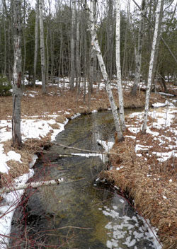

Lying adjacent to US-31, one of the busiest roads in Charlevoix County, yet relatively obscured is Susan Creek Nature Preserve, the perfect escape. The 223-acre preserve consists of three separate tracts and features a 1.5-mile loop that winds through hardwood forests, meadows, black ash swamp and cedar thickets, making it an outstanding area to sight wildlife. The trail also include a pair foot bridges that span across scenic Susan Creek.
The Little Traverse Conservancy preserve provides trail access to the adjacent 55-acre Taimi Hoag Nature Preserve owned by Little Traverse Bay Bands of Odawa Indians. Together the two tracts contain 278 acres, 0.75 miles of Susan Creek and more than 1.5 miles of US-31 frontage.
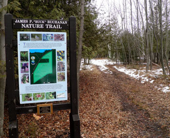
It was Little Traverse Conservancy’s desire to protect the scenic corridor of US-31 between Petoskey and Charlevoix that lead to acquiring the area. In 2007 the trail system was completed thanks to funding provided in part by the Buchanan Family and today is known as the James P. Buck Buchanan Nature Trail.
On maps the Susan Creek path is also referred to as the Blue Trail and listed as 1.3 miles. The Taimi Hoag path is labeled as the Red Trail, is listed as 0.8 miles and is currently being developed as an interpretive path with numbered posts already installed. When combined the two trails make for a 2.7-mile outing, the one described below, that requires backtracking only a half-mile segment of the Red Trail. The most popular use of the area is for hiking but mountain biking is also allowed in Susan Creek Nature Preserve and the trail system is easy to reach from the Little Traverse Wheelway which located only a few hundred yards northwest of the entrance and parking area on US-31. Mountain biking is not allowed in Taimi Hoag.
Winter Activities
In the winter the preserves are an excellent destination for an easy cross-country ski or snowshoe outing as much of the trail system is either old two-tracks or former railroad grade. The trails are not groomed.
| Difficulty - Easy |
| Dog Friendly |
| Foot Path |
Geo-referenced maps from MichiganTrailMaps.com range from $1.99 to $2.99 each.
Download the Avenza app from the App Store or Google Play


