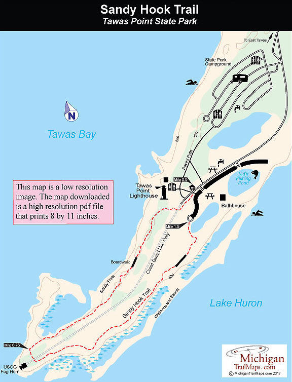
Tawas Point State Park: Sandy Hook Trail
Buy the $.99 downloadable map!
(This map is not geo-referenced)Trail Details
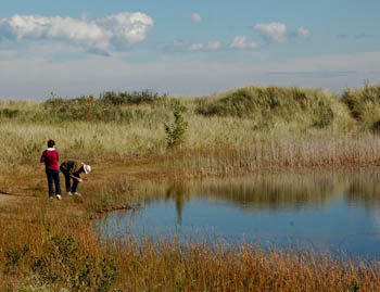
The park preserves the end of Tawas Point, a two-mile spit that separates Tawas Bay from Lake Huron. The tip of the point is a jagged hook of sandy beaches, wetlands and small dunes and it is this unique sand dune ecosystem and its location as a major landfall for birds migrating across Saginaw Bay that make Sandy Hook Nature Trail a popular destination for birders every fall and spring. Birding peaks in mid-May when for three days the park becomes the site of the Tawas Point Birding Festival (tawasbirdfest.com).
During the migrations, the point is said to be "alive with birds." Often spotted along beaches or the small inland ponds are terns and gulls, including Bonaparte's gulls and Caspian terns, along with shorebirds such as red knots, whimbrels, and even the rare piping plover. The ponds also attract loons, flocks of mergansers, and a variety of other waterfowl species. The end of the spit is practically treeless, but warblers, flycatchers, and hummingbirds feed among the willow thickets and shrubs such as sand cherry.
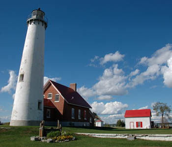
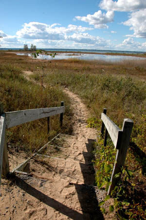
The trail is mainly a sandy path that connects a few stretches of boardwalk along the Tawas Bay and Lake Huron sides of the spit. Its most obvious feature is neither birds nor beaches but the historic Tawas Point Lighthouse that can be seen from different angles throughout much of the walk. Its 19 posts and interpretive brochure have long since been replaced by a dozen plaques along the trail covering topics such as rare terns, looking for tracks and the lighthouse.
The trail is closed to mountain bikes and dogs are prohibited. You can ski it in the winter but its limited mileage and sandy conditions make it unappealing to most Nordic skiers who would much rather head inland to the Corsair Trails.
| Camping |
| Difficulty - Easy |
| Foot Path |
Geo-referenced maps from MichiganTrailMaps.com range from $1.99 to $2.99 each.
Download the Avenza app from the App Store or Google Play


