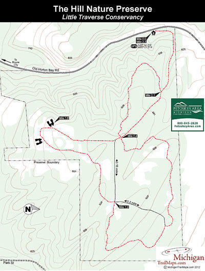
The Hill Nature Preserve
Buy the $.99 downloadable map!
(This map is not geo-referenced)Trail Details
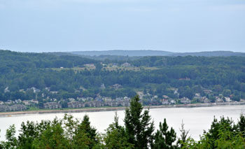


Lucky Boyne City. It lies at the east end of beautiful Lake Charlevoix and is guarded on by scenic high hills. On the south side of town is Avalanche Peak, a nearly 1,000-foot high point that provides some of the most panoramic views in the Lower Peninsula.
On the north side of Boyne City is The Hill. While not quite as high, The Hill still provides views of Lake Charlevoix and the ridges that make it such an incredible body of water and is accessed by a 2.5-mile trail system that, despite the preserve being relatively new, is well marked and easy to follow.
Originally part of the Grunow Farm, the tract was purchased by the Herzog brothers — Gene and John — and their friend and fellow orthopedic surgeon, Dr. Lou Mrstik in 1966 after the men fell in love with Northern Michigan during ski trips to Boyne Mountain. Their families began a 50-year tradition of enjoying the high ridge during trips up north. In 1996, the families donated a conservation easement on 106 acres of the property adjacent to the vineyard and garden and in 2011 the land was donated to Little Traverse Conservancy to become a permanent nature preserve.
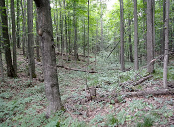
In addition to its interesting topography including its 924 foot evaluation, The Hill features a nice diversity of both pines and hardwoods within its boundaries. Hikers will also encounter apple trees that grew from the seeds of the old farm orchard.
The trail system, a mix of old two-tracks, mowed lanes and new foot paths, basically forms a loop from the trailhead parking lot with two cross-over spurs. The perimeter of the system, the hike described below, is only a 2.3-mile outing and if followed in a clockwise direction saves the views of Lake Charlevoix as a highpoint towards the end.
| Difficulty - Easy |
| Dog Friendly |
| Foot Path |
Geo-referenced maps from MichiganTrailMaps.com range from $1.99 to $2.99 each.
Download the Avenza app from the App Store or Google Play


